Starting point: Žiri (478 m)
| Lat/Lon: | 46,0461°N 14,1095°E |
| |
Time of walking: 50 min
Difficulty: easy marked way
Altitude difference: 264 m
Altitude difference po putu: 270 m
Map: Škofjeloško in Cerkljansko hribovje 1:50.000
Recommended equipment (summer):
Recommended equipment (winter):
Views: 2.270
 | 1 person likes this post |
Access to the starting point:
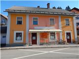
a) Drive to Škofja Loka, then continue in the direction of Poljanska dolina. When you arrive in Žiri, continue through the village on the main road, and drive somewhere to the Žiri primary school, or Obuti Maček oštarije. Park somewhere nearby and the trail starts near the Obuti Maček oštarije.
b) Take the Vrhnika, then follow the signs for Smrečje and Žiri. When you arrive at Žiri, join the main road through the Poljanska valley, and follow it to the left, going some way to the Žiri primary school, or the Obuti Maček oštarije. Park in a suitable parking lot nearby, and the start of the route described above is near the Obuti Maček oštarije.
c) From Logatec, drive towards Rovty and then Žire. Pass the parish church of St Martin and then you will arrive at the Obuti Maček oštarije, near which the trail begins. Park in a suitable place nearby.
d) From the road Idrija - Spodnja Idrija, just after the end of Idrija, turn right (if coming from Spodnja Idrija, turn left before Idrija) over the bridge over the Idrijca river towards the Eurospin shop. On the other side of the bridge you will reach the village of Mokraška vas, and we stick to the main road leading to Ledinsko Razpotje and Žire. Higher up, the road leads us through some serpentines, and then we arrive at the Ledine crossroads, where the road gradually becomes a dirt track. After the neighbouring settlement Govejk, the road starts to descend towards Žire, and after a few kilometres of descent we arrive in Žiri and a little further on to a crossroads where we reach the main road Žiri - Logatec. Continue left in the direction of Škofja Loka and continue through Žiri. Shortly after the parish church of St Martin, you will reach the Obuti Maček oštarije, near which the route described above begins. Park in a suitable place nearby.
Path description:
A few 10 steps north (direction towards Škofja Loka) of the Obuti Maček oštarije, we will notice markings that direct us from the main road to the south-east, to the road that leads us past a few more houses. The road soon ends, and then we continue on the marked path that climbs above Žiri. At first we get some views towards Žire, then the path turns into a forest, through which we climb for a while, following the markings at the crossroads. Higher up, we emerge from the forest onto the meadows, and a little further on, at the end of a small forest island, we see a bench on the right, with a registration box at the Goropečki hill beside it.
The path ahead leads along the gently sloping cart track, which will take you in a few minutes to the edge of the Goropeke settlement, where you will first pass the Žakelj company on the bottom right (sofas, furniture, beds, etc. ), and then reach an asphalt road, which you will follow to the right along the lower right-hand side. Continue through the village and quickly reach the Church of St John the Baptist.
Go around the church on the left and quickly leave the central part of the village above it. Higher up, the path leads you past a signpost, after which you continue along a road slightly to the left from a small crossroads. The path continues past the abandoned ski slope Goropeke, and then into the forest where Dom na Goropekah is located, but which has been closed for several years.
Žiri - Goropeški grič 0:30, Goropeški grič - St. John the Baptist 0:10, St. John the Baptist - Dom na Goropekah 0:10.
Description and pictures refer to the situation in 2019 (January).

Pictures:
 1
1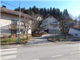 2
2 3
3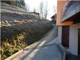 4
4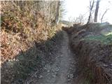 5
5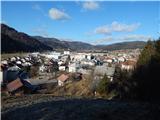 6
6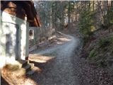 7
7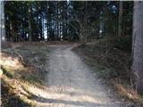 8
8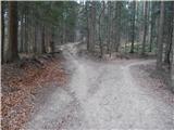 9
9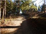 10
10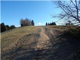 11
11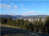 12
12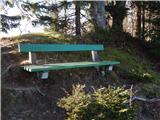 13
13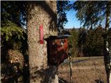 14
14 15
15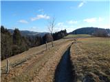 16
16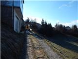 17
17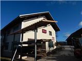 18
18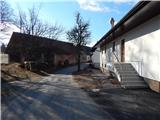 19
19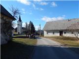 20
20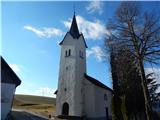 21
21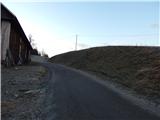 22
22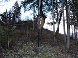 23
23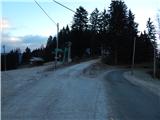 24
24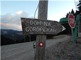 25
25 26
26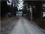 27
27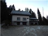 28
28
Discussion about the trail Žiri - Dom na Goropekah