Zidani Most - Kum (through Škratova dolina (new path))
Starting point: Zidani Most (201 m)
| Lat/Lon: | 46,0902°N 15,1576°E |
| |
Name of path: through Škratova dolina (new path)
Time of walking: 3 h 5 min
Difficulty: easy marked way
Altitude difference: 1019 m
Altitude difference po putu: 1050 m
Map:
Recommended equipment (summer):
Recommended equipment (winter): ice axe, crampons
Views: 24.770
 | 4 people like this post |
Access to the starting point:
a) From Litija or Zagorje ob Savi, drive to Hrastnik and from there continue in the direction of Zidanega Mosta. After Suhadol, the road passes to the right side of the railway, and when it crosses the railway again a little further on, a dirt road branches off after the ramp, but before crossing the railway to the right, along which the route described above begins.
b) From Rimske Toplice or Radeče, take the road to Zidani Most, from where you continue towards Hrastnik. When the road crosses the railway line for the first time, just after the turnoff for Širje, a dirt road branches off to the left, along which the described route begins.
Path description:
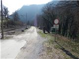
Near the railway crossing, you will see signs for Kum, which will direct you to Cicka (Cicka is a hand-cranked cable car that will take you to the other side of the Sava River). When you get to the other side of the Sava, first get off at Cicka and then continue in the direction of the Kum signs. Just after Cicko, the path leads past the Trbežnik farm, which you pass on the right. Cross the stream Suhi graben over a small bridge above the farm, and then cross the stream again, this time without a small bridge, just a little further on. When you cross the stream again a little higher up, you will come across one of Slovenia's larger islets, because higher up the stream splits into two parts and runs along both sides of the islet (on dry days, one part of the stream dries up, so there is no island then). Walk along the islet for a few minutes, then get off and continue left of the stream for a while. There is a steep climb up a steep slope which leads steeply above the stream. After crossing the slope, where greater care is needed, especially in wet conditions, to avoid slipping, we enter the less steep valley of the Goblin. The path continues past the old mill, and then crosses the stream a few more times. A little further on, the path leads us past several more small springs, and above them we soon reach a worse macadam road. The road then climbs up through the valley of the Škrat, most of the time through the forest. Higher up, the forest ends and a moderately steep path leads past an abandoned farm to an asphalt road where we join the road from Radeče.
Follow the road to the right, and soon the path to Nebeško hora branches off to the left. After a further short climb, when you reach a crossroads, take a sharp right (straight on the old path leading under the roof of the nearby farmhouse) in the direction Kuma. From the crossroads, walk along the road for a few more minutes, and then the signs for Kum direct you left onto a footpath, along which you continue your ascent. There are a couple of forks where you follow the signs and then you come out on a dirt road which you follow to the left. After a short climb along the road, you will reach a sort of levelling, where you continue left in the direction of Kuma (to the right Mežnarija and the Church of St. Mary on Ključavica). The way forward takes us past the chapel, and then just beyond it we continue right on the worse road, and from there a few steps further left on cart track. Overlooking the Ključavice escarpment, climb up a grassy slope, then the path flattens out and crosses lane of bushes. On the other side of the scrub, descend to the vicinity of a nearby house, which is passed on the right, and then continue along a minor road which leads to the left of another house. After the house the road widens and you quickly arrive in the woods, where there is a marked crossroads.
Continue straight on (left Little Kum and Podkum) in the direction of Kuma, along a path that climbs first gently and then steeply. Higher up, the forest ends and the path leads us just below the summit of Kuma, where we join the road leading to the mountain home. Follow the road a few steps to the mountain lodge and a few metres further to the church of St Neže at the top of Kuma.
Description and pictures refer to the situation in 2016 (March).

Pictures:
 1
1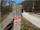 2
2 3
3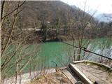 4
4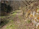 5
5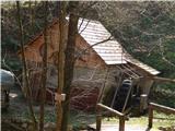 6
6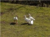 7
7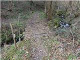 8
8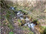 9
9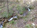 10
10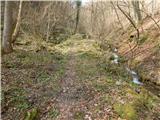 11
11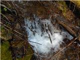 12
12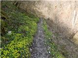 13
13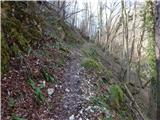 14
14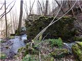 15
15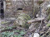 16
16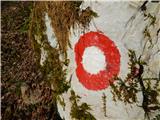 17
17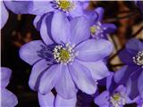 18
18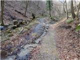 19
19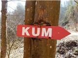 20
20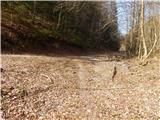 21
21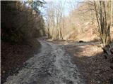 22
22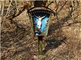 23
23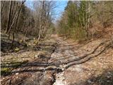 24
24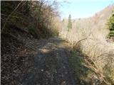 25
25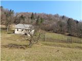 26
26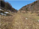 27
27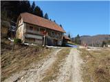 28
28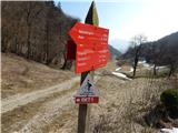 29
29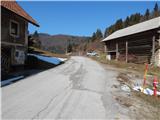 30
30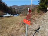 31
31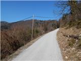 32
32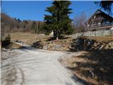 33
33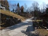 34
34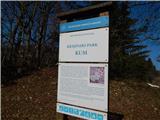 35
35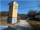 36
36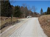 37
37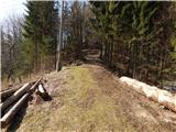 38
38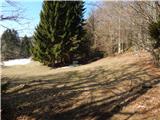 39
39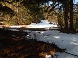 40
40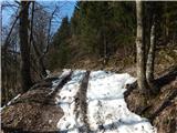 41
41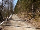 42
42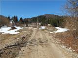 43
43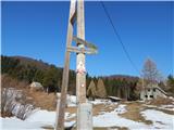 44
44 45
45 46
46 47
47 48
48 49
49 50
50 51
51 52
52 53
53 54
54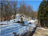 55
55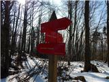 56
56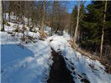 57
57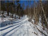 58
58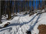 59
59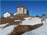 60
60 61
61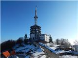 62
62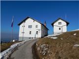 63
63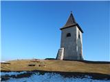 64
64 65
65
Discussion about the trail Zidani Most - Kum (through Škratova dolina (new path))
|
| PlaRinka19. 03. 2017 |
Zelo lepa pot. Na začetku zelo strma, a se nato zelo položi. Celo goske se da še kar srečati na poti. 
|
|
|
|
| geppo19. 03. 2017 |
http://www.hribi.net/trenutnerazmere.asp?slo=1&gorovjeid=25&id=851 Midva sva se pripeljala z avtomobilom do Zidanega Mostu. Potem po cesti proti Hrastniku, cck. 1km ali pa nekaj manj. Tik ob cesti je potem ta "cicka" s katero se popelješ čez Savo. Naprej je pa itak lepo markirano in nimaš kaj zgrešit. poglej si na linku, ki sem ti ga prilimal lp
|
|
|
|
| garmont19. 03. 2017 |
Ker si postavila svoje vprašanje pod opis poti iz Zidanega Mosta, moraš seveda izstopiti iz vlaka v Zidanem Mostu.  Lahko pa greš seveda na Kum tudi,če izstopiš iz vlaka v Zagorju, Trbovljah , Hrastniku ali Radečah. 
|
|
|
|
| docepe220. 03. 2017 |
Ni nov, le nekoliko se je spremenila smer, da se ne gre čez dvorišča hiš.
|
|
|
|
| N3bULA23. 08. 2017 |
Pohod opravil danes. Casi v naslovu drzijo, za gor malo manj kot 3 urce, navzdol pa 1.5 ure (Navzdol sem malo bolj hitel). Pot je odlicna za vroce poletne dni, jaz sem sel danes popoldan ko je bilo zelo vroce, vendar pot vecinoma tece v gozdu, dobrsen del pa se ob potoku, tako da je lepo hladna. Markacije so na samem zacetku OK, potem pa kar nekam poniknejo, v kriziscu kjer gre ta nova smer desno, stara pa levo, markaciji za novo pot sploh ni, tako da sem sledil kar stari poti, tudi za navzdol sem ko sem sledil markacijam prisel na staro in ne na novo pot  , ce se stara pot ukinja, naj se markacije pobrisejo in naredijo za tanovo. No najlepsa stvar na poti pa je vas Ključevica, tik pod vrhom kuma, prava idilicna gorska vasica z izjemnim razgledom. lp
|
|
|
|
| piotr11. 03. 2019 |
Sam sem pred 11 tedni tukaj sestopal in tudi pri prevozu s cicko ni nobenih posebnosti. Res pa se sedaj sam laže povlečeš, v primerjavi z nekdanjo.
|
|
|
|
| modrook125. 01. 2020 |
A se lahko avto parkira na drugi strani save,da bi se izognil cicki?
|
|
|
|
| docepe26. 01. 2020 |
Da, iz Hrastniške in Radeške smeri, je pa cesta zelo ozka.
|
|
|
|
| Enka6. 01. 2020 |
Jaz sem parkirala kar pri starem mostu v Radečah, pa potem po tisti ozki cesti rajši cca 2,5 km peš do izhodišča. V tem primeru se lahko vračaš krožno po poti za Radeče (priporočam spotoma še skok na Nebeško goro) in imaš do avta na koncu le minutko hoje.
|
|
|
|
| Skala7712. 03. 2020 |
Zanima me kakšno je stanje z "cicko" Marec 2020
|
|
|
|
| ejti13. 02. 2021 |
Ima mogoče kdo sveže informacije, ali cicka funkcionira?
|
|
|
|
| lencad15. 03. 2021 |
Cicka deluje. Sva jo uporabila danes.
|
|
|
|
| ejti16. 03. 2021 |
Fino, hvala za obvestilo.
|
|
|
|
| Mara6625. 06. 2021 21:05:21 |
Danes "cicka" ni delovala. Na drugi strani smo videli, da je cicka ovita v manjšo verigo in zaklenjena z ključavnico. Je pa cicka malce v slabem stanju. Vandalizem na delu.
|
|
|
|
| navdušena11. 01. 2022 08:53:26 |
Kdo ve, kako je zdaj s "cicko"?
|
|
|
|
| Marusaorel24. 10. 2022 19:15:36 |
Danes sem prečkala Savo s cicko, deluje. Noro doživetje!
|
|
|
|
| marepn95525. 10. 2022 12:57:52 |
Se strinjam, da je super zadeva tale Cicka in upam, da bo turistično društvo Radeče (najlepša hvala T. Društvo Radeče) uspelo vzdrževati Cicko še v bodoče, ker jaz običajno pridem z vlakom do Z. Mosta in potem preko Kuma v Zagorju zopet na vlak, če imam pa dober dan pa iz Kuma nadaljujem do Podkuma, Rodeža in v Renkah preko mostu (zaprtega mostu, adrenalinski prehod ) do Zasavske gore in Vač na Zgornjo Slivno in od tu pa do Kresnic, potem pa običajno že zmanjka dneva, energije pa že prej.
|
|
|
|
| Resevna17. 02. 2024 11:02:13 |
Sem spraševal na Trenutnih razmerah; morda bo tu več sreče: se je v zadnjem mesecu kdo peljal s cicko? V kakšnem stanju je? Znam plavati, a vseeno ... Hvala za info.
|
|
|
|
| babica 517. 02. 2024 15:58:09 |
Na strani Planinske zveze - stanje poti sem prebrala, da je cicka zaradi dotrajanosti zaprta.
|
|
|
|
| Brave6617. 02. 2024 16:16:19 |
Jaz sem bil čez z cicko lani novembra in ni problema...
|
|
|
|
| rok.si21. 04. 2024 18:38:06 |
Cicka je bila danes, 21.4.2024, operativna.
|
|
|
|
| Tbs11. 05. 2024 17:51:03 |
Kaksno je danes stanje cicke in kako se sploh dela z njo?
|
|
|
|
| ločanka12. 05. 2024 13:27:24 |
Glej pod trenutne razmere za Kum
|
|
|
|
| bongo13. 05. 2024 16:39:35 |
Cicka "dela". Ce sta dva, gre najprej en not in ga drugi s pomocjo vitla potegne prek Save in obrneta vlogi, da pa se tudi s pomocjo jeklenice potegniti do izstopne tocke, a je nalo težje.
|
|
|
|
| andi213. 05. 2024 18:01:49 |
Če sta dva, je res enostavno. Moraš v bistvu proti koncu nehat poganjat, sicer kar s hitrostjo prileti tisti v cicki do konca. Je brat bentil, ko sem ga nalašč hecal pa za njo ne velja tisti znani hec - a se kdaj žica strga? Ja, redko, a tu in tam se. Ja, kdaj jo pa potem zamenjate? Jah, ko se strga 
|
|
|