Zagrad - Medvižica (via Ostrič)
Starting point: Zagrad (780 m)
| Lat/Lon: | 45,5043°N 14,0599°E |
| |
Name of path: via Ostrič
Time of walking: 1 h 45 min
Difficulty: easy marked way
Altitude difference: 301 m
Altitude difference po putu: 350 m
Map: Slovenska Istra - Čičarija, Brkini in Kras 1:50.000
Recommended equipment (summer):
Recommended equipment (winter):
Views: 9.644
 | 1 person likes this post |
Access to the starting point:
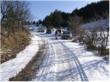
From the Ljubljana - Koper motorway, take the Kozina exit and follow the road towards Rijeka. In the village Obrov turn right in the direction of the village Golac from where you continue driving towards the hamlet Zagrad. In Zagrad, turn left and follow the road, which becomes macadam, until you see a sign for no further driving (use forest road at your own risk). Park here in a small parking lot on the side of the road.
Path description:
Just a few metres before the traffic sign, you will see cart track, which turns right off the road and starts to climb gently at first (the start is not marked). Soon we see the first marking, which tells us that we are on the right track. Continue moderately up the cart track, which at a higher level passes out of the forest onto grassy slopes surrounded by individual trees (mostly pine). The path lays down here and turns slightly to the right a little further on, where you also come to a marked crossroads.
Continue in the direction of Ostrič, Slavnik and Razsušica (pond on the left for 30 minutes) along the path which begins to climb towards an undistinguished saddle between Ostrič on the left and the lesser known Griža on the right. Follow this path to where you will see a larger sinkhole ahead. Here, cart track continues straight on, and the marked footpath turns left and starts to climb steeply up the uncultivated slope of Ostrič. Follow this briefly steeper path all the way to the top of Ostrič, which offers a fine view.
From the top, continue along the marked path, which descends in a few minutes of moderate descent to the other side of the aforementioned sinkhole. Here, retrace your steps to cart track and follow it to the left. The marked trail then turns right into the forest, where it circles Griža in a semicircle, then turns slightly to the left, where after a few minutes of gentle ascent we reach a clearing in the middle of which a marked trail branches off to the right to the top of Medvižica (slightly to the left Razsušica). The path immediately returns to the forest, where after a few steps of further walking you reach a rocky part. Here the path turns left and climbs steeply over the rocky slope. Follow this steep path, which is surrounded by numerous crevasses, to the summit.
The path between Ostrič and Medvižica is occasionally a little less well marked.

Pictures:
 1
1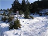 2
2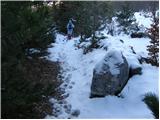 3
3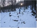 4
4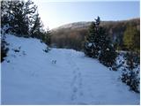 5
5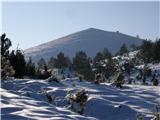 6
6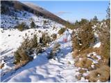 7
7 8
8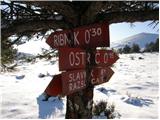 9
9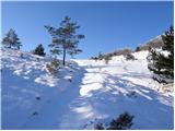 10
10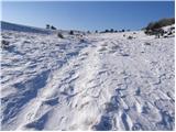 11
11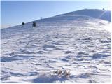 12
12 13
13 14
14 15
15 16
16 17
17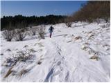 18
18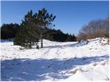 19
19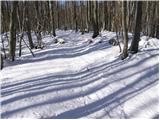 20
20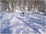 21
21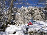 22
22 23
23 24
24
Discussion about the trail Zagrad - Medvižica (via Ostrič)
|
| repa&zelje2. 01. 2020 |
Izredno lep januarski izlet. Priporočam krožno turo, čez Ostrič mimo Medvižice, čez Razsušico nazaj do Zagrada. Fantastični razgledi: Triglav, Dolomiti, Snežnik, Učka, z Medvežice tudi tržaški zaliv... Skupaj s postanki (malico) 3 ure. 
|
|
|
|
| Fulcrum18. 01. 2026 13:57:49 |
S parkirišča (slika 1) nadaljujemo po makadamski cesti še 100 metrov naprej, do mesta, kjer nas smerokaz usmeri desno na dobro označeno pot proti Ostriču, oziroma Žabniku, kot mu rečejo domačini. Pot je dobro označena, na več mestih so nam v pomoč nove smerne table.
|
|
|