Weissensee - Almspitz (via Techendorfer Alm)
Starting point: Weissensee (940 m)
| Lat/Lon: | 46,6989°N 13,4148°E |
| |
Name of path: via Techendorfer Alm
Time of walking: 4 h
Difficulty: easy marked way
Altitude difference: 1240 m
Altitude difference po putu: 1240 m
Map:
Recommended equipment (summer):
Recommended equipment (winter): ice axe, crampons
Views: 4.265
 | 1 person likes this post |
Access to the starting point:
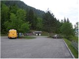
Shortly before Spittal, from the route of Villach (along the old road), the road to Ziebel branches off to the left. At the village, continue driving towards Lake Weissense, which is about 15km from Ziebel. Park in the large parking lot near the lake.
Path description:
From the large parking lot, walk a few metres down to the main road, where you will see signs on the left. Take the wide path that leads along the lake behind the "Techendorf" sign. The path first leads over a small bridge and leads to the bivouac on the eastern side of Lake Weissensee. Here, turn right onto the tarmac road that runs alongside the bivouac and leads to a crossroads where you turn left and, after a few metres' walk, you come to a set of signs. Bear left after the "Techendorfer Alm steil" signs. After a few metres, regain the signs and bear right on the steep path towards mountain pasture Techendorfer Alm. The left-hand path follows a more gradual path, which is mostly on the road.
The path climbs quite steeply through the forest and leads to a clearing where you cross cart track and start climbing along the edge of the forest. Here the first views of the nearby peaks of the Latschur group open up. The path climbs through the forest again and then crosses the mountain road several times. At all the junctions, which are very well marked, continue in the direction of Techendorfer Alm steil (steep path). Finally, when the path to the left forks towards the Stosia saddle, continue along the road which, after about 15 minutes' walk, leads to the mountain pasture Techendorfer Alm, where there is also a small mountain hut.
From mountain pasture continue northwards following the signs Stosia, Latschur. The trail first crosses a sparse forest and then ascends grassy slopes towards the Stosia saddle. This part of the trail is marked with white and blue markers.
At the saddle, turn right and follow the grassy ridge. When you reach a crossroads, continue straight on along the ridge, and a direct path to Eckwand branches off to the right. When you reach the crossroads again, take the path to the right, which continues along the ridge and leads to Almspitz (2180m). The path to the left leads to Latschur. The trail then continues to climb along the grassy ridge and soon leads to the Almspitz peak, which offers a beautiful view of the surrounding peaks.

Pictures:
 1
1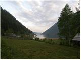 2
2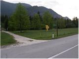 3
3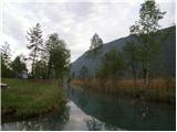 4
4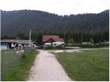 5
5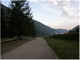 6
6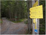 7
7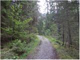 8
8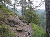 9
9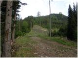 10
10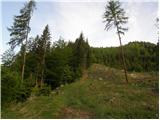 11
11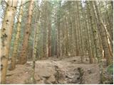 12
12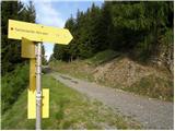 13
13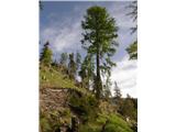 14
14 15
15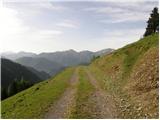 16
16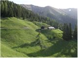 17
17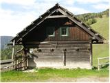 18
18 19
19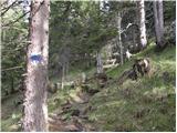 20
20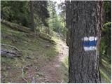 21
21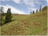 22
22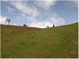 23
23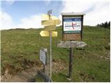 24
24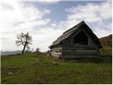 25
25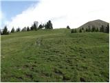 26
26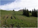 27
27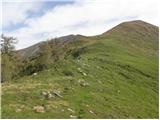 28
28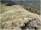 29
29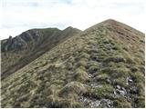 30
30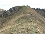 31
31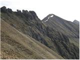 32
32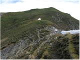 33
33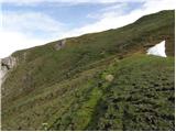 34
34 35
35
Discussion about the trail Weissensee - Almspitz (via Techendorfer Alm)
|
| dusanw12. 12. 2010 |
Zelo lep izlet vendar kako to zgleda pozimi.
|
|
|
|
| 2061alessio14. 12. 2010 |
jaz sem naredil krožno turo z prijatelico 6.6.2010 , parkirali avto v bližini slike št.7 in po poti št.265 gor do planino Stosia (kota 1.811, h:1.30), naprej do vrha Latschur(kota 2.236, h:2.45), potem po poti št.20 do vrha Eckwand (kota 2.221, h:3.30),sestop do sedlo Eckwand (h:3.40), vzpon do vrha Kopasnock (h:4.00) in potem sestop do sedlo Mitte Staff po poti št. 21 (h:4.10), naprej po ne oznaceni poti in strmi travnik do ene planine kota 1.652 (h:5.15), sedaj po markirani poti in gozdarsko cesto do planine Mosslacher (kota 1447)in naprej po isti cesti cez slapovov v Silbergraben (h:6.15) do avta (h: 6.50); vsaj se bi dalo tudi iz smucamj samo orientacija med sedlo Mitte Staff in planina Mosslacher je že poleti malo težavna, vseeno pa kar razgledna krožna poletna tura.
|
|
|