Weißenbach - Schoberstein
Starting point: Weißenbach (470 m)
| Lat/Lon: | 47,8001°N 13,5401°E |
| |
Time of walking: 1 h 30 min
Difficulty: partly demanding marked way
Altitude difference: 567 m
Altitude difference po putu: 567 m
Map:
Recommended equipment (summer):
Recommended equipment (winter): ice axe, crampons
Views: 673
 | 1 person likes this post |
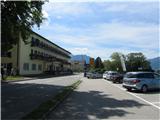
Access to the starting point:
Drive through the Karavanke Tunnel into Austria and continue along the Turkish Autobahn past Salzburg. Leave the motorway at the exit for Mondsee, which is bypassed along the east coast. Continue towards Attersee, where you immediately turn right and follow the road along the southern and then the eastern shore of the lake to Weißenbach am Attersee. Park in one of the car parks along the main road or the road that branches off towards Bad Ischl.
Path description:
There are several well-marked trailheads in Weißenbach to Schoberstein - find the nearest one and get on your way. The paths join at the Chapel of St. Nicholas, where the climb begins. The path climbs serpentinely through the woods, and just before leaving the woods the path briefly dips. Then the serpentine ascent continues, with a section of the path aided by steel cables. Just below the summit, turn left and climb to the top. The whole route is very well marked.
Pictures:
 1
1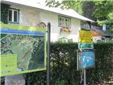 2
2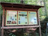 3
3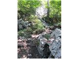 4
4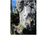 5
5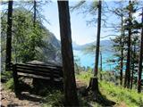 6
6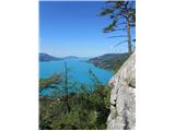 7
7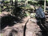 8
8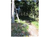 9
9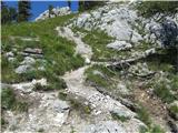 10
10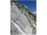 11
11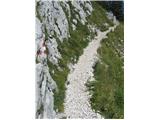 12
12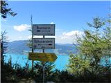 13
13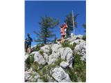 14
14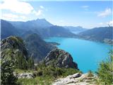 15
15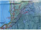 16
16
Discussion about the trail Weißenbach - Schoberstein
|
| J.P.7. 05. 2025 21:00:22 |
Tura je prekratka v kolikor se napotimo le do Schobersteina. Odlična krožna se naredi v kolikor podaljšamo naprej čez Mahdlgupt in Dachsteinblick na kar na sedlu takoj za Dachsteinblickom sestopimo in vrnemo nazaj na izhodišče. Se splača ker so razgledi veličastni. Parking je na voljo takoj zraven izhodišča ali nekoliko dlje, na glavni cesti preden zavijemo v vas (v kolikor prihajamo iz smeri Berghofa). Cena za 6 ur je 4€.
|
|
|