Waldheimhütte - Köhlerhütte (via Türkenkreuz)
Starting point: Waldheimhütte (1614 m)
| Lat/Lon: | 47,0562°N 14,6305°E |
| |
Name of path: via Türkenkreuz
Time of walking: 1 h
Difficulty: easy marked way
Altitude difference: 241 m
Altitude difference po putu: 275 m
Map: WK 212 (Seetaler & Seckauer Alpen 1:50.000)
Recommended equipment (summer):
Recommended equipment (winter): ice axe, crampons
Views: 2.485
 | 1 person likes this post |
Access to the starting point:
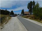
From the Gorenjska side, go through the Ljubelj border crossing to Klagenfurt or through Karawanks to Villach. Continue on the motorway towards the signs for Graz / Graz. Leave the motorway after about 2km through a tunnel in the direction of Bad St. Leonhard. Continue past the village of St. Peter and a little further on turn left towards the village of St. Anna. At the next crossroads follow the road towards Waldheim Hütte. Park in the pay parking lot next to the hut.
From Carinthia, drive first to Dravograd and then on to Austria. Follow the road towards St. Paul, St. Andra and Wolfsberg. In Wolfsberg, head towards Bad St. Leonhard and on to St. Peter. Continue following the description from Gorenjska.
From the Styrian side, take the Maribor and continue through the Šentilj border crossing into Austria. Follow the motorway in the direction of Klagenfurt / Klagenfurt. Leave the motorway in the direction of the Bad St. Leonhard exit. Follow the description from Gorenjska.
Path description:
From the parking lot, take the leftmost road towards Kohlerhütte. The path takes you along a winding road with occasional views. A little higher up, the road crosses a couple of streams and leads to a resting place called 'Maria in der Zirbe'. The road slowly gets a little worse and climbs a little more. After 40 minutes of walking, the path leads to a grassy slope where you can see a larger shepherd's hut on the right.
Continue along the road for another five minutes and you will reach the Turkenkreuz (Turkish Cross). Here you will come to a crossroads where you will continue up the meadow to the right by a pasture fence. After a few minutes of gentle ascent on a grassy slope, the path leads back to the road, where you continue to the left. The road starts to descend and leads us to the hut in a few minutes.
Pictures:
 1
1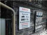 2
2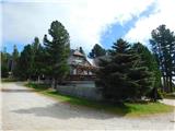 3
3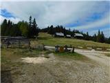 4
4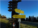 5
5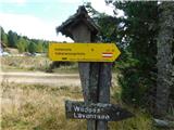 6
6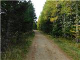 7
7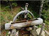 8
8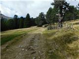 9
9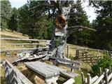 10
10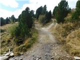 11
11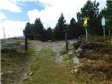 12
12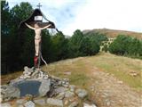 13
13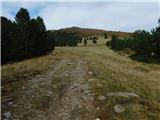 14
14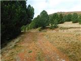 15
15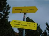 16
16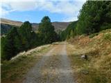 17
17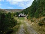 18
18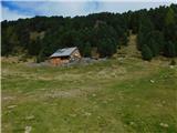 19
19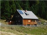 20
20
Discussion about the trail Waldheimhütte - Köhlerhütte (via Türkenkreuz)