Vrtovin - Kucelj (na Čavnu)
Starting point: Vrtovin (360 m)
| Lat/Lon: | 45,9099°N 13,8204°E |
| |
Time of walking: 2 h 15 min
Difficulty: easy marked way
Altitude difference: 877 m
Altitude difference po putu: 877 m
Map: Goriška 1:50.000
Recommended equipment (summer):
Recommended equipment (winter): ice axe, crampons
Views: 26.086
 | 1 person likes this post |
Access to the starting point:
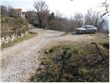
a) From the expressway Razdrto - Nova Gorica take the Ajdovščina exit, then turn left at the junction towards Nova Gorica. Continue along the regional road towards Nova Gorica to Vrtovin, and turn right in the middle of the village towards Čavno. Follow the road as it climbs through the village in the direction of St. Paul, Kuclj and Čavno at the crossroads. Park in the small parking lot at the end of the village, near the mountain signs.
b) From the motorway Nova Gorica - Razdrto take the exit Selo, then when you get on the old road Nova Gorica - Ajdovščina continue right towards Nova Gorica. Follow the regional road towards Ajdovščina to Vrtovin, and turn left in the middle of the village towards Čavno. Follow the road as it climbs through the village in the direction of St. Paul, Kuclj and Čavno at the crossroads. Park in the small parking lot at the end of the village, near the mountain signs.
Path description:
From the parking lot, continue along the road on the left in the direction of Kuclje and St. Paul. After a few minutes' walk, the road leads to a crossroads where the mountain path to Kucelj and Čaven branches off to the right (straight on along the St. Paul road). The ascent continues along the marked, partly stony cart track, which climbs through occasionally sparse forest. Slightly higher, you reach a marked crossroads, where you continue slightly left in the direction of Kuclje (right Mala gora and Čaven).
The well-marked cart track, which we follow in the direction of Kuclj, leads us slightly higher to a forest road, which we just cross. The way ahead climbs gently through sparse forest, but only to the point where the path from St Paul's joins us on the left.
The way ahead begins to climb steeply through the forest, through which we continue to climb for some time. Higher up, we cross the Middle Plain Trail, above which the forest slowly begins to thin out. A little higher still, the path comes quite close to the old road link between the Vipava valley and the plateau of the Trnovski Forest.
Here, the path to Visoki rob and Selovec branches off to the left, and we continue straight on the marked mountain path, which slowly turns slightly to the right. The forest finally ends, and the path, which offers views towards the High Rim, the Vipava valley and the Trstelj valley, leads us to the last crossroads on our route. We continue to the right again and in a few minutes we climb over the grassy slope to the top of Kuclja, which opens up a view towards Nanos and Golaki.

We can extend the trip to the following destinations: Veliki Rob
Pictures:
 1
1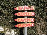 2
2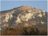 3
3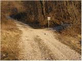 4
4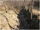 5
5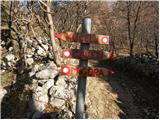 6
6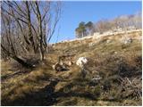 7
7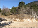 8
8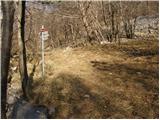 9
9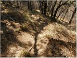 10
10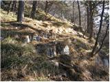 11
11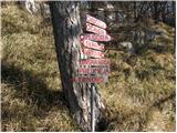 12
12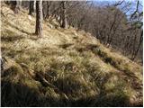 13
13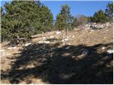 14
14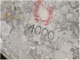 15
15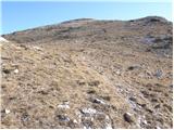 16
16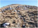 17
17 18
18
Discussion about the trail Vrtovin - Kucelj (na Čavnu)
|
| marei13. 03. 2008 |
Na pot smo se odpravili iz Vrtovina. Po težavnosti izleta to že ni kucelj, ampak gora. Lep izlet in ga priporočam.
|
|
|
|
| furioso24. 08. 2008 |
Včeraj sem bil na Kuclju iz Vrtovina.Pot je precej zaraščena, drugače je pa to kar naporen strm vzpon.
|
|
|
|
| pier18. 01. 2010 |
pot sem opravil v soboto 16.01. Sneg se zacne nekje na 1000m.,zgornji del pred dostopom na vrh je deloma leden (nic se ne vdira) tako da je vsaj cepin, ce ne ze dereze, obvezen. Na vrhu se nismo ustavljali, ker je tako pihal veter, da je dajal obcutek, da se vrnemo v dolino lete. Nadaljevali smo po gozdu do koce Antona Bavcerja na Cavnu, kjer so nam prijazni oskrbniki postregli z kosilom. Sestopili smo v smeri Male Gore in nadaljevali proti Lovski koci (kjer se sneg konca) in naprej do Vrtovina.
|
|
|
|
| urskabacar15. 08. 2016 |
Na Kucelj smo se včeraj povzpeli po opisani poti. Pot je strma, precej zaraščena in pogosto je potrebna previdnost (sploh pri sestopu) in seveda, pametna obutev. Razgled na vrhu je čudovit in obisk vsekakor priporočam, vendar mislim, da se da na vrh lažje priti po kateri od drugih poti.
|
|
|
|
| BT8815. 08. 2016 |
Ja letos je res zadeva bolj zarascena lani je bila ta pot v tem casu v celoti pokosena.
|
|
|
|
| akvarij9. 10. 2016 |
Danes smo šli po tej poti, je bila zelo lepo očiščena in tudi označena, razen na začetku, ko se gre po tistem kolovozu (oz, meni zgleda bolj kot struga hudournika).
Ker je pot res strma, pridejo za sestop prav palice, pa seveda primerna obutev.
|
|
|
|
| BT8811. 10. 2016 |
Da se izognemo strugi svetujem še 15 min od slike št 4.naprej po cesti in nato desno (pravtako tabla) kjer pridemo na lepo travnato stezico, ki bi jo svetoval tudi pri sestopu.Je pa omenjena pot znova lepo pokošena in očiščena.
lp
|
|
|
|
| akvarij15. 10. 2016 |
BT88, hvala. Saj se mi je zdelo, da ko sem šla pred časom k Sv.Pavlu, da sem tudi tam naprej videla table za Kucelj!
|
|
|
|
| smeh131. 10. 2016 |
Na poti na Kucelj na Čavnu najdeni ključi peugeot
|
|
|
|
| anazala7. 07. 2019 |
Če imate čas. predlagam, da si ga vzamete. pojdite malo od kamnoloma v hrib. pojdite najprej na Čaven do koče, potem še na Kucelj, potem pa iz Kuclja dol po Srednje čavenske poti. ko pridete na pot, ki je prava je označena -Tuneli. Obrnite se na levo. potem skoz po sredini hriba Čavna nazaj do pečine-plezalne stene. vmes boste opazili poti iz hriba na to pot. pojdite naprej, potem pridete do omenjene pečine tam je vrv, malo več pozornosti, ni nevarna. vseeno bodite previdni in ne prehitevajte planincev. katerega boste sigurno srečali. jaz sem plezalca. sem počakala, da je sestopil in plezal naprej. potem čez manjše melišče naravnost po poti do kamnoloma. super pot. jaz hodila nekje 6 ur s postanki. nekaj manjših.
|
|
|