Vrtinjlogarski graben / Val Bartolo - Gorjanski vrh / Göriacher Berg / Monte Goriane (over saddle Kot / Sella Canton)
Starting point: Vrtinjlogarski graben / Val Bartolo (960 m)
| Lat/Lon: | 46,5289°N 13,5463°E |
| |
Name of path: over saddle Kot / Sella Canton
Time of walking: 3 h 10 min
Difficulty: easy marked way, easy unmarked way
Altitude difference: 729 m
Altitude difference po putu: 805 m
Map: Julijske Alpe - zahodni del 1:50.000
Recommended equipment (summer):
Recommended equipment (winter): ice axe, crampons
Views: 823
 | 1 person likes this post |
Access to the starting point:
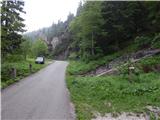
Via Border crossing Rateče, or via Border crossing Predel, drive to Trbiz / Tarvisio, then continue in the direction of the ski resort Svete Višarje / Monte Lussari. When Trbiz ends, from the roundabout behind the Eurospar store, take the exit towards Frogs / Camporosso and Valcanale, then immediately right towards the village. After the underpass under the railway go left, then follow the signs for Vrtinjlogarski graben / Val Bartolo. After the village, the asphalt ends and the road leads into the valley mentioned above, after which you climb up the usually fairly well-maintained dirt road, which you follow until you reach the place where you see the mountain signs for the 509 trail, which leads to the Angle Saddle / Sella Canton. Park at a suitable place on the roadside.
Path description:
From the starting point, follow the path towards the Kot / Sella Canton saddle, where you will immediately reach the old mulatier, which you will begin to climb. The mulatier is mostly through the forest, with only a short break in the forest at higher altitudes, where you cross a short steep slope and a torrential stream. After about an hour's walk, the path becomes a little more gentle and turns into a small valley, which leads up to the Kot saddle, where there is a marked crossroads and, at the crossroads, a large bell dating from 1926.
From the saddle, where we join the two paths from Trbiz / Tarvisio and the forest road from Kokovo / Coccau, we continue in the direction of Gorjanski vrh / Monte Goriane and continue along the worse macadam road, which then climbs mostly crosswise to the right, and in between we have a few nice views of Julian Alps, and higher up in the direction of Ojstrnik. The way ahead leads us along the south-west ridge of Veliki Kopinj for a while, after which the path, which continues gently along the wide grassy cart track, turns slightly to the right and bypasses the above-mentioned peak on the right. Once back on the ridge, a marked trail leads past the Vrtinjlogarski saddle on the left, and after the crossroads the border between Itali and Austria is reached. The route ahead follows the broad cart track, which runs along the Italian side of the border and continues with some short ascents and descents. Later on, on the south side, we pass Gorjanski vrh, and when the forest ends we reach Gorjanska planina, where, with good views, we reach the central part of the mountain pasture, located on the Austrian side of the border, where several huts are also situated.
From the huts at mountain pasture, continue to the left and start climbing along the ridge that runs along the border between Austria and Itali. With fine views of Dobratsch and Julian Alps, you reach the summit in a few minutes.
Starting point - saddle Kot 1:10, saddle Kot - Gorjanska planina 1:50, Gorjanska planina - Gorjanski vrh 10 minutes.
Description and pictures refer to the situation in 2018 (May).

Pictures:
 1
1 2
2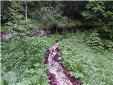 3
3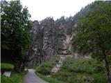 4
4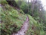 5
5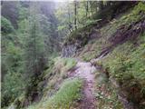 6
6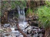 7
7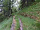 8
8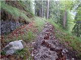 9
9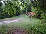 10
10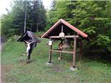 11
11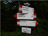 12
12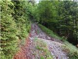 13
13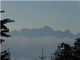 14
14 15
15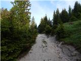 16
16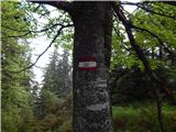 17
17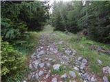 18
18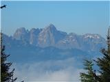 19
19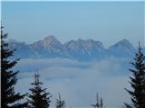 20
20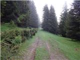 21
21 22
22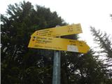 23
23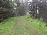 24
24 25
25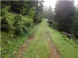 26
26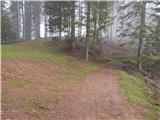 27
27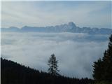 28
28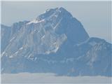 29
29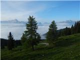 30
30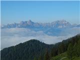 31
31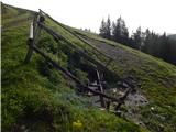 32
32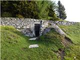 33
33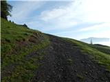 34
34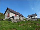 35
35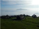 36
36 37
37 38
38 39
39 40
40 41
41 42
42 43
43 44
44 45
45 46
46 47
47 48
48
Discussion about the trail Vrtinjlogarski graben / Val Bartolo - Gorjanski vrh / Göriacher Berg / Monte Goriane (over saddle Kot / Sella Canton)