Vršič - Travnik (at Mojstrovke)
Starting point: Vršič (1611 m)
| Lat/Lon: | 46,4336°N 13,7435°E |
| |
Time of walking: 4 h 20 min
Difficulty: partly demanding marked way, difficult pathless terrain
Altitude difference: 768 m
Altitude difference po putu: 915 m
Map: TNP 1:50.000
Recommended equipment (summer): helmet
Recommended equipment (winter): helmet, ice axe, crampons
Views: 3.000
 | 3 people like this post |
Access to the starting point:
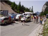
From Kranjska Gora or Trenta, drive to the Vršič pass, where you park. During the tourist season, there is a charge for parking.
Path description:
From the parking lot at the Vršič pass, follow the marked trail towards Mala Mojstrovka and Slemenova špice. The trail quickly splits, and we take the left trail towards Mala Mojstrovka (right Slemenova špica and the Hanzo trail to Malo Mojstrovka). There is a cross-climb to the left, first through lane of bushes and then between dwarf pines and a sparse larch forest, through which a wide, mostly rocky path leads. After about half an hour's ascent, we reach a large scree field where an unmarked path to Šitna glava branches off to the right, and we continue across the scree field. On the other side of the scree, we reach a crumbly gully, exposed to falling rocks. There follows about 15 minutes of steep and technically slightly more difficult climbing up the gully, ending at a small saddle called Vratca.
Here, where you also reach the ridge, continue to the right and then, with views of the coastal part of Julian Alps, continue your ascent. The way forward to the ridge retreats slightly to the left, where we are helped by a few wedges, and then splits. A marked path continues slightly to the left, leading below the ridge, and an unmarked path continues along the ridge to Malo Mojstrovka.
The marked trail continues to lead us over a scree slope, over which we cross-climb with increasingly beautiful views.
A few minutes below the top of Mala Mojstrovka, leave the marked trail and continue left towards the saddle between Malo and Velika Mojstrovka, and from the vicinity of the saddle, an unmarked trail leads us into a gully, up which we climb steeply towards the top of Velika Mojstrovka. The slope soon becomes less steep and the path turns right upwards. From here it is only a short climb up a rocky slope to the eastern summit of Velika Mojstrovka.
From the top, continue along the ridge in a westerly direction. The path then soon becomes slightly more difficult and starts to climb up the slightly crumbly slope on the south side of the ridge. The path is marked with a number of cairns signs. The ascent towards the ridge is followed, soon reaching the western summit of Velika Mojstrovka.
From the top, continue along a very scenic ridge. The ridge to the north is always precipitous, but it is wide enough that walking along it does not present any major problems. Later, the slope on the south side of the ridge becomes slightly steeper and there is a slightly steeper climb along the rocky ridge to the top of Zadnja Mojstrovka.
The path along the ridge becomes more difficult later on and if you are not used to walking on difficult unprotected terrain, it is advisable to go back a few minutes, where the southern slopes are not so steep, and descend to the unmarked trail, which runs a little lower on the less steep southern slopes parallel to the ridge. Continuing along the ridge, you initially descend a little on a narrow and rather exposed ridge. The path then gradually becomes less difficult again, and then leads to a slightly more grassy slope. There is virtually no track on this part and there is a steep slope to cross, which also has some rubble, so this part is dangerous for slipping. Shortly after this, there is a steep descent into a narrow notch, from which you then have to climb down a very steep slope. The climb is only a few steps, but you have to be very careful because the slope is exposed. The route then becomes less difficult and leads to the slopes below Travnik. Here the path turns slightly to the left and starts to climb over scree. Later, the path turns right and there is one last climb up the rocky slope to the top of Travnik.
You can descend either by the ascent route or by an easier route which runs a little lower on the south side parallel to the ridge.
Vršič - Velika Mojstrovka 2:30, Velika Mojstrovka - Zadnja Mojstrovka 0:35, Zadnja Mojstrovka - Travnik 1:15.

Pictures:
 1
1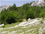 2
2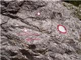 3
3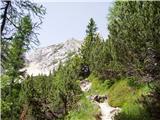 4
4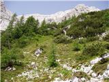 5
5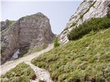 6
6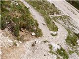 7
7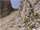 8
8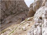 9
9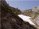 10
10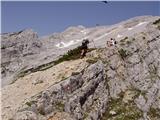 11
11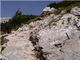 12
12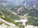 13
13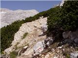 14
14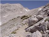 15
15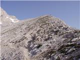 16
16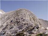 17
17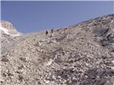 18
18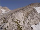 19
19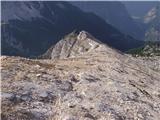 20
20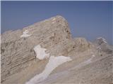 21
21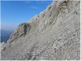 22
22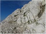 23
23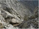 24
24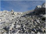 25
25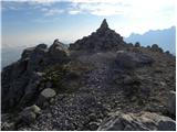 26
26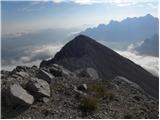 27
27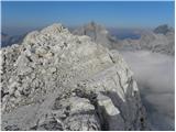 28
28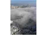 29
29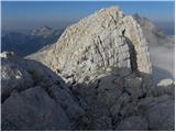 30
30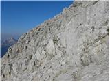 31
31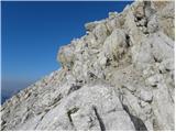 32
32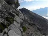 33
33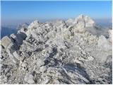 34
34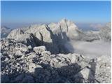 35
35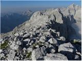 36
36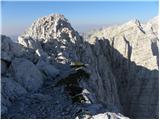 37
37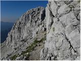 38
38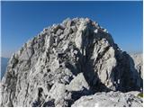 39
39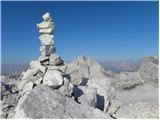 40
40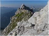 41
41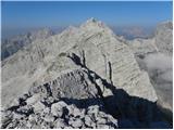 42
42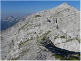 43
43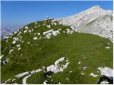 44
44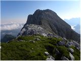 45
45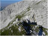 46
46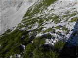 47
47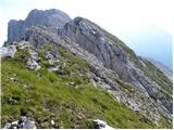 48
48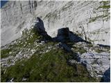 49
49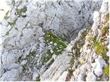 50
50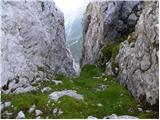 51
51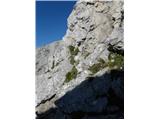 52
52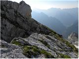 53
53 54
54 55
55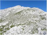 56
56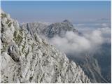 57
57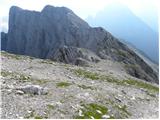 58
58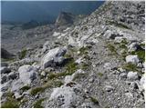 59
59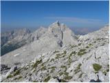 60
60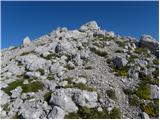 61
61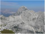 62
62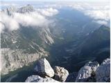 63
63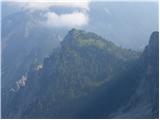 64
64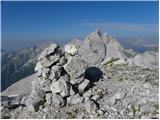 65
65
Discussion about the trail Vršič - Travnik (at Mojstrovke)