Starting point: Vršič (1611 m)
| Lat/Lon: | 46,4336°N 13,7435°E |
| |
Time of walking: 2 h 15 min
Difficulty: difficult pathless terrain
Altitude difference: 498 m
Altitude difference po putu: 600 m
Map: TNP 1:50.000
Recommended equipment (summer): helmet
Recommended equipment (winter): helmet, ice axe, crampons
Views: 16.842
 | 3 people like this post |
Access to the starting point:
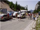
From Kranjska Gora drive towards Bovec or vice versa, but only as far as the Vršič pass, where you park.
Path description:
From the parking lot on Vršič, follow the initially poorly marked path leading to Mojstrovka and Sleme. After a short climb, the path leads us to a larger rock on which we see the inscription Mojstrovka on the left. Continue in the direction of Mojstrovka (to the right Mojstrovka on the Hanzo trail and Slemenova špica) along the trail, which climbs crosswise through a rare larch forest. After about half an hour's ascent, the path leads to a large scree field below Mojstrovka. Cross the scree on the upper side, and the path behind it leads into a crumbly ravine. There follows a steep and dangerous climb on rubble, which takes about 15 minutes to process. At the top of the ravine, the steepness eases and the "sunny" Primorska opens up in front of us. Here the path turns right and after a few steps begins to climb steeply (slip hazard in snow and ice). At the top of this climb, we come to a beautiful viewpoint, from which we have a beautiful view down towards Vršič. The way forward is to retreat slightly to the left and then cross two small ravines. Just a little further on, we leave the marked path to Mojstrovka and turn left slightly down into the valley between Malo and Veliko Mojstrovko. From here we can already see our destination, which we approach by following an easier trackless path (visible slightly to the left). The closer we are to Suhi vrh, the steeper it loks. When we reach the base of Suhi vrh on its right (north) side, we have two options for continuing. The easier but technically more difficult route (level 2 climbing) will lead us along a steep ridge straight up to the summit. The other easier route leads from the north face downwards, then keep slightly left until the scree below Suhim vrh opens up. Next, we climb the scree which leads us to the ridge we could have reached if we had climbed to the summit by the direct route. From here to the summit we have about 5 minutes of steep climbing with climbing up to the 1st step.

Pictures:
 1
1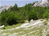 2
2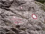 3
3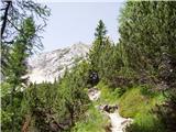 4
4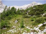 5
5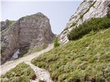 6
6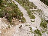 7
7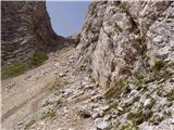 8
8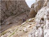 9
9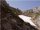 10
10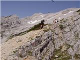 11
11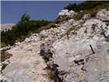 12
12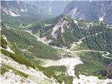 13
13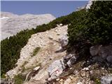 14
14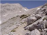 15
15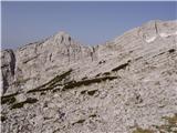 16
16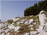 17
17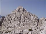 18
18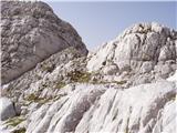 19
19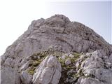 20
20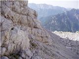 21
21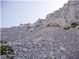 22
22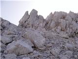 23
23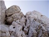 24
24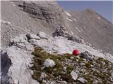 25
25
Discussion about the trail Vršič - Suhi vrh
|
| ločanka4. 08. 2015 |
Čudovit svet, mir in samota! Vrh vreden ponovitve!
|
|
|
|
| J.P.21. 06. 2021 21:03:30 |
|
|
|
|
| dominikfly6. 03. 2025 01:01:07 |
Skriti zaklad v osrčju preobljudenih Mojstrovk. Za ljubitelje divjine in samote, le streljal od Vršiča. Iskanje prehodov proti vrhu čisti užitek, če se držimo grebena z desne, lahko najdemo tudi kakšno višjo stopnjo od II, seveda v tem primeru po pameti.
|
|
|