Starting point: Vršič (1611 m)
| Lat/Lon: | 46,4336°N 13,7435°E |
| |
Name of path: via ridge
Time of walking: 4 h 55 min
Difficulty: difficult pathless terrain
Altitude difference: 739 m
Altitude difference po putu: 1000 m
Map: TNP 1:50.000
Recommended equipment (summer): helmet
Recommended equipment (winter): helmet, ice axe, crampons
Views: 13.362
 | 4 people like this post |
Access to the starting point:
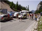
From Kranjska Gora drive towards Bovec or vice versa, but only as far as the Vršič pass, where you park.
Path description:
From the parking lot on Vršič, follow the initially poorly marked path leading to Mojstrovka and Sleme. After a short climb, the path leads us to a larger rock on which we see the inscription Mojstrovka on the left. Continue in the direction of Mojstrovka (to the right Mojstrovka on the Hanzo trail and Slemenova špica) along the trail, which climbs crosswise through a rare larch forest. After about half an hour's ascent, the path leads to a large scree field below Mojstrovka. At the point where the marked path to Mojstrovka approaches the wall, we come to an unmarked crossroads where we continue to the sharp right. Continue the ascent along the unmarked path, which leads us in a slight cross-climb towards the slopes of Šitna glava. A relatively visible path soon leads us into an unmarked valley between Mala Mojstrovka and Šitno glavo. Here the trail turns slightly left and climbs slightly more up the increasingly rocky slope. When the trail is quite close to the summit, it turns right, crosses a partly overgrown scree field and then climbs to a grassy summit.
From Šitna glava continue along the ridge, first gently down and then up towards Mojstrovka (unmarked). After a 20 minute walk from Šitna glava, a poorly visible path leads us to the place where we join the Hanzo trail to Mojstrovka. From here on, the orientation is easier, but the path becomes steeper and steeper. After a few more minutes, the steepness eases and the path leads us to a flatter world, which we go around on the right hand side. Next, the path approaches the ridge, and we see Mangart and Jalovec in front of us. Here the path turns slightly left and leads us to a steep part of the path. With the help of a few pegs, but mainly without the fixed safety gear, we climb up the steep summit slope of Mala Mojstrovka to its scenic summit.
From Mala Mojstrovka continue in the direction of Veliki Mojstrovka. At first, descend a little and take the path that leads slightly to the right towards the saddle between the two Mojstrovkas. The path then crosses a scree slope and begins to ascend the steep southern slopes below Velika Mojstrovka. The slope soon becomes less steep and the path turns right upwards. From here it is only a short climb up the rocky slope to the top of Velika Mojstrovka.
From the summit, continue along the ridge in a westerly direction. The path then soon becomes a little more difficult and starts to climb up the slightly crumbly slope on the south side of the ridge. The path is marked with a number of cairns signs. The ascent towards the ridge is followed, soon reaching the head of the Velika Mojstrovka.
From the top, continue along a very scenic ridge. The ridge to the north is precipitous throughout, but it is wide enough that walking along it does not present any major problems. Later, the slope on the south side of the ridge becomes slightly steeper and there is a slightly steeper climb along the rocky ridge to the top of Zadnja Mojstrovka.
The path along the ridge becomes more difficult later on and if you are not used to walking on difficult unprotected terrain, it is recommended that you go back a few minutes, where the southern slopes are not so steep, and descend to the unmarked trail, which runs a little lower on the less steep southern slopes parallel to the ridge.
Continuing along the ridge, you initially descend a little on a narrow and rather exposed ridge. The path then gradually becomes less difficult again, and then leads to a slightly more grassy slope. There is virtually no track on this part and there is a steep slope to cross, which also has some rubble, so this part is dangerous for slipping. Shortly after this, there is a steep descent into a narrow notch, from which you then have to climb down a very steep slope. The climb is only a few steps, but you have to be very careful because the slope is exposed.
The route then becomes less difficult and leads to the slopes below Travnik. Here the path turns slightly to the left and begins to climb over scree. Later, the path turns right and there is one last climb up the rocky slope to the top of Travnik.
From Travnik, continue along the ridge and start descending. The steep ridge can be followed slightly to the south and then cross the slope parallel to the ridge. At the end turn right and there is a short climb to the top of Kola.
You can descend either by the ascent route or by an easier route that runs a little lower on the south side parallel to the ridge.

Pictures:
 1
1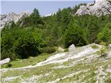 2
2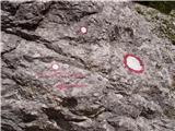 3
3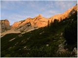 4
4 5
5 6
6 7
7 8
8 9
9 10
10 11
11 12
12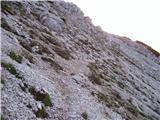 13
13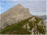 14
14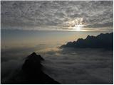 15
15 16
16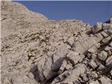 17
17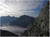 18
18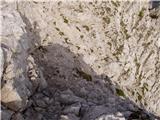 19
19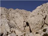 20
20 21
21 22
22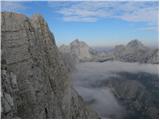 23
23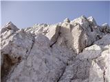 24
24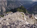 25
25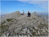 26
26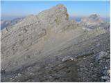 27
27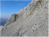 28
28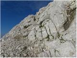 29
29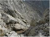 30
30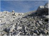 31
31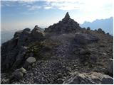 32
32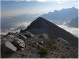 33
33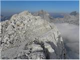 34
34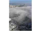 35
35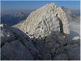 36
36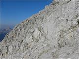 37
37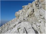 38
38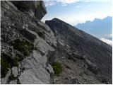 39
39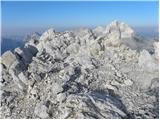 40
40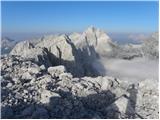 41
41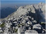 42
42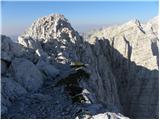 43
43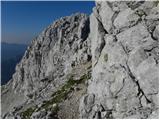 44
44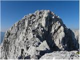 45
45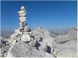 46
46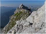 47
47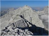 48
48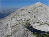 49
49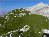 50
50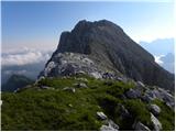 51
51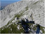 52
52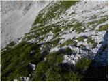 53
53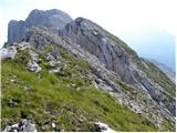 54
54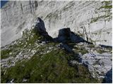 55
55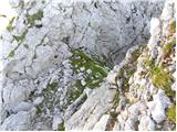 56
56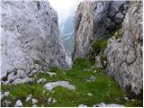 57
57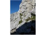 58
58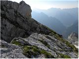 59
59 60
60 61
61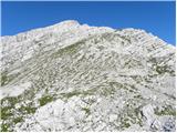 62
62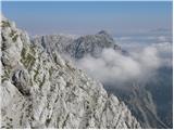 63
63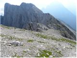 64
64 65
65 66
66 67
67 68
68 69
69 70
70 71
71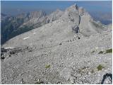 72
72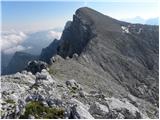 73
73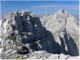 74
74 75
75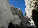 76
76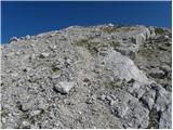 77
77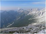 78
78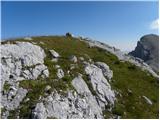 79
79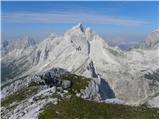 80
80
Discussion about the trail Vršič - Kol (via ridge)
|
| Kriška3. 08. 2009 |
Veličastna pot, krasne fotografije!
|
|
|
|
| rober4. 08. 2009 |
Odlične fotke,bo treba v živo doživet...
|
|
|
|
| cics5. 08. 2009 |
Zelo lepo, odlične slike,... morda ponovimo kdaj.... 
|
|
|
|
| štempilka6. 08. 2009 |
Noro,kako lepi razgledi,to bo pa za it pogledat kako je. Zaenkrat mi je uspelo samo do Male Mojstrovke.
|
|
|
|
| lukk22. 06. 2014 |
Mene zanima kakšne so razmere na poti in kako je pot zahtevna.
|
|
|
|
| ločanka5. 01. 2015 |
Lep slike in zelo dober opis!
|
|
|
|
| goretz2. 08. 2022 22:56:40 |
Živjo, zanima me, ali je pot po grebenu še označena z možici, ter če je res do Kola, v kolikor gremo čez vse naštete vrhove ob poti res samo 4h 45 min.. Zdi se mi malce premalo glede na to, da se je treba na vsak vrh konec koncev povzpeti in sestopiti.. Lp in srečno
|
|
|
|
| ppegan3. 08. 2022 14:24:58 |
Četudi ni možicev, se držiš grebena, ne moreš kaj dost falit  Jaz se žal ne spomnim, koliko časa sva s kolegom hodila, se mi pa zdi, da je čas kar realen.
|
|
|
|
| goretz9. 08. 2022 17:47:44 |
@ppegan hvala za odgovor. Se spomniš mogoče kako tehnično zahtevna je pot na določenih odsekih? Iz opisa poti lahko razberem da je nekaj plezanja, ampak ali je pot primerna za novince, ki sicer imajo kondicijo? Hvala in lp
|
|
|
|
| felix9. 08. 2022 18:56:41 |
Po samem grebenu ni težav, vprašanje je, kje se nameravaš vrniti. Če se nameravaš spustit na nekdanjo spodnjo pot (le tu in tam se vidi kakšna zbledela markacija), moraš najti primeren prehod navzdol, ki pa nikjer ni lahko. Jaz sem se pred leti vrnil na Travnik in poiskal primeren prehod, potem pa nad Suhim vrhom do Vratc.
|
|
|
|
| ppegan10. 08. 2022 08:08:29 |
@goretz, če nisem že prepozna - tehnično najbolj zahtevna je škrbina (slike 56-58), a se da lepo splezat, ni tako hudo, kot zgleda na slikah. Tudi mene je ta škrbina najbolj skrbela, a se je potem na terenu izkazalo, da ne predstavlja nekih težav (moja laična ocena je, da je tu II. za splezat, a gre le za 2-3 metre). Načeloma pa pot ni preveč zahtevna, pazit je treba le, da ti ne zdrsne zaradi grušča. Korak mora biti varen in stabilen. Pa srečno
|
|
|
|
| sAleska10. 08. 2022 16:33:43 |
Ta škrbina je res najbolj zahtevna, a bi rekla da ni dvojka ali pa komaj pa še to le en gib ali dva. Je pa izpostavljeno, to pa. Oprimki in stopi so odlični skala trdna.
Največji hakelc je zelo shojena steza iz škrbine levo navzdol. Ni treba iti tam, ker je bistveno bolj nevarna (drobir na nagnjenih ploščah) in predvsem naporna, ker se precej spustiš potem pa spet gor. Da pa se. Ena od nas je šla tam pa ji je bilo žal.
Pomembno je, da si v škrbini dobro ogledaš skale in boš videl logičen prehod. Ta gre direktno iz škrbine kakšen meter gor nato rahlo desno gor po nagnjeni polički. Tam že presenečen pogledaš čez rob na prostrano zelenico. Vsega skupaj je komaj za višino kakšnega košarkaša.
Pa srečno.
|
|
|
|
| goretz11. 08. 2022 22:15:20 |
Najlepša hvala za odgovore. Na pot se nameravamo odpraviti v ponedeljek, v kolikor bo vreme seveda dopuščalo.
|
|
|