Starting point: Vrh Bače (1273 m)
| Lat/Lon: | 46,2381°N 13,9804°E |
| |
Time of walking: 1 h
Difficulty: easy marked way
Altitude difference: 242 m
Altitude difference po putu: 280 m
Map: TNP 1:50.000
Recommended equipment (summer):
Recommended equipment (winter): ice axe, crampons
Views: 6.086
 | 1 person likes this post |
Access to the starting point:
a) First drive to Bohinjska Bistrica, then continue to Soriška planina and Tolmin. Before you reach the parking lot below the Soriška planina ski centre, i. e. about 400 m down, a dirt road turns off to the right and you follow it to its end.
b) From Železniki or Podbrdo, take the first exit to Soriška planina and from there start descending towards Bohinjska Bistrica. After about 400 m of descending, pay attention to the left fork of the macadam road, as this is the road you will continue on. Follow this road to its end, where you will park.
Path description:
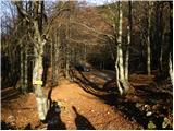
From the end of the road, continue right towards Črna prsti. The path initially leads us along cart track, which quickly turns into a footpath and leads us to the GRS hut after a mostly cross-country climb.
The way forward takes us from deciduous forest into coniferous forest, which is becoming increasingly scarce. Just a little further on, the path leads us to the Koble ridge, which opens up a beautiful view. There is a steep climb up the ridge, which is very steep on the south side and dangerous to slip in the wet. After a few minutes of climbing along the ridge, the path leads us to the pre-peak of Kobla. Here the ridge turns to the right and the path, which still follows the ridge, is followed for about 30 m to the highest point of the undistinguished peak of Kobla.
From the top, continue along the path, which descends slightly and crosses a short lane of forest. The path then crosses a grassy slope and then goes back into the forest, where it leads to a crossroads.
Here we turn left upwards in the direction of Kobla vrh and the stamp. Follow the steep and slippery ridge path in the wet all the way to the top, which is reached after less than five minutes of further walking.

Pictures:
 1
1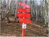 2
2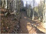 3
3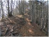 4
4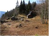 5
5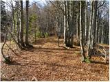 6
6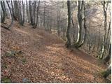 7
7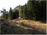 8
8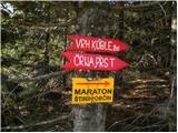 9
9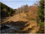 10
10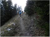 11
11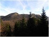 12
12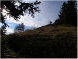 13
13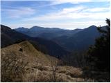 14
14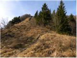 15
15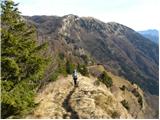 16
16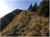 17
17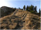 18
18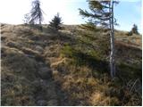 19
19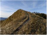 20
20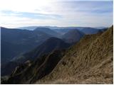 21
21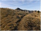 22
22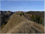 23
23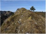 24
24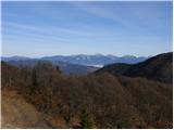 25
25 26
26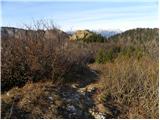 27
27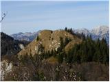 28
28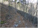 29
29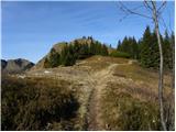 30
30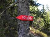 31
31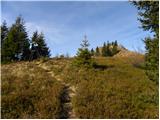 32
32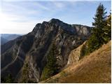 33
33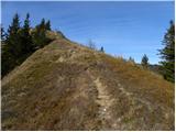 34
34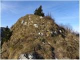 35
35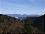 36
36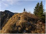 37
37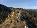 38
38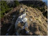 39
39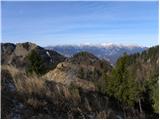 40
40
Discussion about the trail Vrh Bače - Krevl