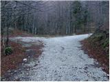
Starting point: Vrh Bače (1273 m)
| Lat/Lon: | 46,2381°N 13,9804°E |
| |
Time of walking: 3 h 10 min
Difficulty: easy marked way
Altitude difference: 571 m
Altitude difference po putu: 775 m
Map: TNP 1:50.000
Recommended equipment (summer): helmet
Recommended equipment (winter): helmet, ice axe, crampons
Views: 25.798
 | 1 person likes this post |
Access to the starting point:
a) First drive to Bohinjska Bistrica, then continue to Soriška planina and Tolmin. Before you reach the parking lot below the Soriška planina ski centre, i. e. about 400 m down, a dirt road turns off to the right and you follow it to its end.
b) From Železniki or Podbrdo, take the first exit to Soriška planina and from there start descending towards Bohinjska Bistrica. After about 400 m of descending, pay attention to the left fork of the macadam road, as this is the road you will continue on. Follow this road to its end, where you will park.
Path description:
From the end of the road, walk to the mountain signposts, and from there continue to the right in the direction of Črna prsti. A few minutes' climb through the forest follows, and then the path is laid and leads to the GRS hut. A short descent follows, and the path gradually moves from the slopes of Šanc to the less vegetated slopes of Koble. Here we first climb through a sparse forest, and then the path leads us to a slightly exposed ridge, along which we begin to climb steeply (in the wet there is a danger of slipping in some places). Higher up, the ridge is laid, and the path turns to the right, which after a minute of further walking leads us to the undistinguished top of Koble.
Kobla is followed by a slight descent, and then the path continues along a less steep ridge towards the neighbouring Krevlo. Towards the top of Krevla, a marked path in the direction of "Kobla žig" branches off slightly to the left, and we continue straight ahead, passing the top on the right hand side, which is only a few 10 steps walk away.
On the other side of Krevla, the path starts to descend again, this time to the nearby ski resort. When you reach the edge of the ski slope, you will see the signs for Črna prst pointing down to the left. There is some more downhill, and then you reach the small swamp Na Kalu, where there is also a less visible crossroads. Continue on the right path (to the left, over a small saddle, leads an old shepherd's path which crosses the southern slopes of the lower Bohinj Mountains, only this is joined over time by the path from Podbrdo to Črna prst), which continues to descend gently and leads us slightly lower to a marked crossroads, where we are joined from the right by the path with mountain pasture Za Črno gora.
At this crossroads, continue slightly to the left and then start climbing moderately through the forest. Higher up, the track makes a few long serpentines, and then leads us out of the increasingly sparse forest or belt of scrub to the scree below Rušni vrh. Here the path lays down transiently and then, on the other side of the scree, begins to climb steeply along a grassy trough below the Home ridge. There is an increased risk of falling rocks in late spring. Higher up, the gully ends and the path crosses a short steep slope where snow may linger until early summer. Above the steep part, join the trail from Orožnove hut, and a few metres higher, climb to the ridge, which is reached at the Čez Suho saddle.
Continue right here and, with views of Baška grapa, Bohinj and the highest peaks of Julian Alps, you will climb in a few minutes to the Doma na Črna prst, which is located just a few metres below the summit.
Go around the Zorko Jelinčič House on the left and climb the short steep slope to the summit in a few steps.

Pictures:
 1
1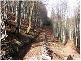 2
2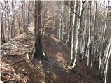 3
3 4
4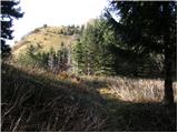 5
5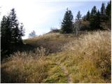 6
6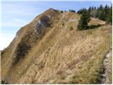 7
7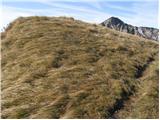 8
8 9
9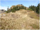 10
10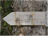 11
11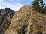 12
12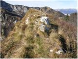 13
13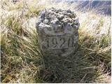 14
14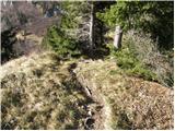 15
15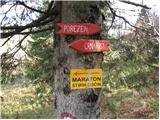 16
16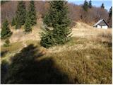 17
17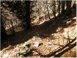 18
18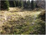 19
19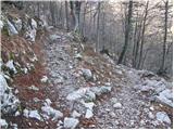 20
20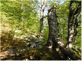 21
21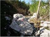 22
22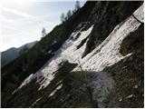 23
23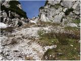 24
24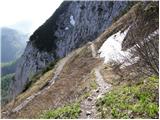 25
25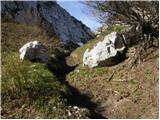 26
26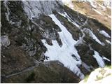 27
27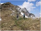 28
28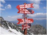 29
29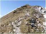 30
30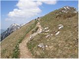 31
31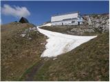 32
32 33
33
Discussion about the trail Vrh Bače - Črna prst
|
| Guest3. 11. 2007 |
In kako pridem na izhodišče s primorske strani?
|
|
|
|
| Guest4. 11. 2007 |
Čez Soriško planino, če je cesta neprevozna pa z avtovlakom iz Podbrda v Bohinjsko Bistrico in od tam naprej po opisani poti.
|
|
|
|
| Guest4. 11. 2007 |
S primorske se lahko zapeljemo do Podbrda ,nato levo do vasi Bača in naprej peš po stezi do Vrha Bače.Tako imamo priliko si ogledat zanimivo vasico ki ima tudi svojo cerkvico.
|
|
|
|
| Guest6. 11. 2007 |
Hvala! Če bo ugodno, gremo v nedeljo po tej poti na Črno prst. 
|
|
|
|
| mavrinc22. 08. 2016 |
Ali se mi le zdi, ali res nekaj opisa manjka? Kolikor jaz poznam teren je od parkirišča pri smučišču do vrha Bače kar nekaj hoda, ali pa to ni parkirišče pri smučišču.
|
|
|
|
| Tadej22. 08. 2016 |
Hvala za opozorilo. Pri opisu dostopa do izhodišča je bilo napačno napisano. Parkira se na koncu ceste v bližini sedla Vrh Bače in ne na parkirišču pod Soriško planino.
|
|
|
|
| mlostr8. 09. 2020 |
Zelo rada bi šla po tej poti na Črno prst. Poskušala sem že pred leti pa tega odcepa pod Soriško planino nisem našla. Je zdaj morda kaj označeno?
|
|
|
|
| Janez Seliškar8. 09. 2020 |
Do izhodišča na sedlu Vrh Bače vodi gozdna cesta in šele na tem sedlu stopimo na markirano planinsko pot.
|
|
|
|
| pikica18. 09. 2020 |
Živjo, ko sem jaz hotela it v juliju al avgustu od tukaj na ČP nisem prišla do konca ceste. Na cesti so bili gozdarski stroji in ena zajla čez cesto. Jaz sem pol obrnila in šla nazaj. Je bil pa postavljen znak na začetku ceste, da je zaprta a sem ga namerno spregledala  Kako je pa v tem času pa ne vem, če je znak še tam na tleh, cesta še verjetno ni prevozna.Lp.
|
|
|
|
| mlostr9. 09. 2020 |
Hvala, torej odcep z glavne ceste je, tega nisem našla.
|
|
|
|
| edoo13. 09. 2020 |
Slab kilometer od Litostrojske koče na Soriški pl. v smeri B. Bistrica se ostro levo odcepi makadamska gozdna cesta, ki pelje do sedla Vrh Bače, 4 km solidnega makadama.
|
|
|
|
| MateZ22. 09. 2020 |
V nedeljo je bilo z gozdno cesto znova vse v redu. Bi je pa niti ne ocenil kot “solidno”, prej “za silo”. Pazite podvozje oz. raje izberite turo s Petrovega Brda. 
|
|
|