Vitovlje - Vitovski hrib (west path)
Starting point: Vitovlje (360 m)
| Lat/Lon: | 45,9342°N 13,7695°E |
| |
Name of path: west path
Time of walking: 40 min
Difficulty: easy marked way
Altitude difference: 244 m
Altitude difference po putu: 250 m
Map: Goriška - izletniška karta 1:50.000
Recommended equipment (summer):
Recommended equipment (winter): crampons
Views: 10.687
 | 3 people like this post |
Access to the starting point:
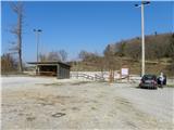
a) From the expressway Vipava - Nova Gorica take the exit Selo and then continue on the regional road to Nova Gorica and Šempas. After a few kilometres, you will reach the village of Vitovlje, where you will turn right in the direction of the farm Maloščevo. A little further on, the road splits into two parts (Vitovska Circular Route), and we continue to the right, keeping to the left at the next junctions. The relatively steep road leads us higher up through the hamlet of Vožice, where it turns slightly more to the left. From the hamlet we drive for a short distance and then arrive at a large event space and sports ground in Vitovlje, where we park.
b) From Nova Gorica, drive to Šempas, and from there continue along the old road towards Ajdovščina. When you reach the village Vitovlje, turn left in the direction of the farm Maloščevo. A little further on, the road splits into two parts (Vitovska Circular Route), and we continue to the right, keeping to the left at the next junctions. The relatively steep road leads us higher up through the hamlet of Vožice, where it turns slightly more to the left. From the hamlet we drive for a short distance and then arrive at a large event space and sports ground in Vitovlje, where we park.
Path description:
From the parking lot, first walk to the asphalt road and follow it to the left. After a minute or two, you will reach a marked crossroads, where you continue to the right in the direction of the Vitov Church and Vitov Lake.
From the crossroads, continue along a less good macadam road, which quickly turns into a forest, through which it climbs gently to moderately. It does not take long before you reach the next well-marked crossroads, where you leave the minor road and continue climbing left in the direction of the Vitov church (straight ahead past Vitov Lake). Continue along the gently sloping path, which crosses the slopes to the left, and then even descends gently. When the short descent ends, continue to the right (straight ahead to Vitovlje on one of several paths) on a gradually steeper path. The path through the forest leads us past a small stone chapel, where it becomes completely flat. There is a short, moderate climb, and then we join a wider path, which we follow to the right, and we climb quickly to a viewpoint just below Vitov Hill. Here we continue to the left and climb a few steps to the nearby church of Vitov.

Pictures:
 1
1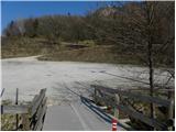 2
2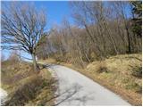 3
3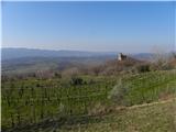 4
4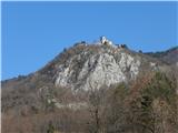 5
5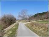 6
6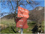 7
7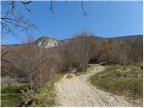 8
8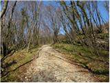 9
9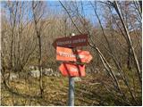 10
10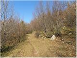 11
11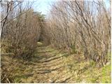 12
12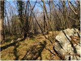 13
13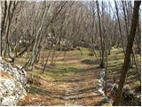 14
14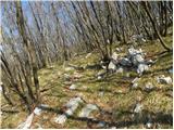 15
15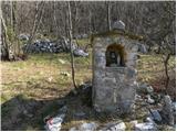 16
16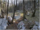 17
17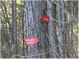 18
18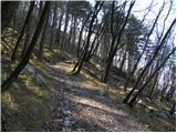 19
19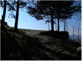 20
20 21
21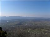 22
22 23
23
Discussion about the trail Vitovlje - Vitovski hrib (west path)
|
| grega_p24. 02. 2021 |
Lepa, v srednjem delu dokaj strma pot, ki v teh toplih dneh pričara ob južni legi pravo poletje.
Zaradi hladnejšega morja od ozračja, je bilo polno vlage v zraku, tako da se je videlo komaj do Trstelja. Tipično za to letno obdobje.
Drugače pa cerkvica z idealno sončno lego, ob sestopu na vzhod pa jezero in zraven osvežilen vodni izvir ter malo nižje prelepa jasa s starimi kostanji. Priporočam!
Popravek in opomba - naselje (zaselek) se imenuje Užiče, parkirni prostor je pa tudi pri razcepu (slika št. 6) - za cca 4 avtomobile
|
|
|