Starting point: Vitovlje (360 m)
| Lat/Lon: | 45,9342°N 13,7695°E |
| |
Time of walking: 20 min
Difficulty: easy marked way
Altitude difference: 85 m
Altitude difference po putu: 85 m
Map: Goriška - izletniška karta 1:50.000
Recommended equipment (summer):
Recommended equipment (winter):
Views: 7.653
 | 2 people like this post |
Access to the starting point:
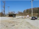
a) From the expressway Vipava - Nova Gorica take the exit Selo and then continue on the regional road to Nova Gorica and Šempas. After a few kilometres, you will reach the village of Vitovlje, where you will turn right in the direction of the farm Maloščevo. A little further on, the road splits into two parts (Vitovska Circular Route), and we continue to the right, keeping to the left at the next junctions. The relatively steep road leads us higher up through the hamlet of Vožice, where it turns slightly more to the left. From the hamlet we drive for a short distance and then arrive at a large event space and sports ground in Vitovlje, where we park.
b) From Nova Gorica, drive to Šempas, and from there continue along the old road towards Ajdovščina. When you reach the village Vitovlje, turn left in the direction of the farm Maloščevo. A little further on, the road splits into two parts (Vitovska Circular Route), and we continue to the right, keeping to the left at the next junctions. The relatively steep road leads us higher up through the hamlet of Vožice, where it turns slightly more to the left. From the hamlet we drive for a short distance and then arrive at a large event space and sports ground in Vitovlje, where we park.
Path description:
From the parking lot, first walk to the asphalt road and follow it to the left. After a minute or two, you will reach a marked crossroads, where you continue to the right in the direction of the Vitov Church and Vitovlje Lake.
From the crossroads, continue along a less good macadam road, which quickly turns into a forest, through which it climbs gently to moderately. It does not take long before you reach the next well-marked crossroads, where you continue straight on in the direction of Vitovlje Lake (on the left, the western path to Vitovski hrib (signposted for the church of Vitebsk)). The road then gradually changes to cart track, which initially leads you across a hayfield. A little further on, cart track turns left, and two paths branch off to the right, leading to the nearby Vitov Lake. It does not matter whether you go in the direction of Vitovlje Lake at the first or the second turning, in both cases after about 2 minutes you will reach a small lake.
Pictures:
 1
1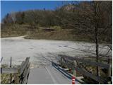 2
2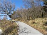 3
3 4
4 5
5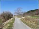 6
6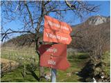 7
7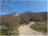 8
8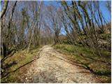 9
9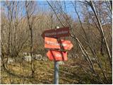 10
10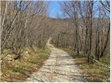 11
11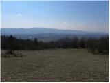 12
12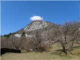 13
13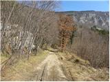 14
14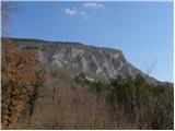 15
15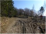 16
16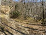 17
17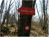 18
18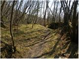 19
19 20
20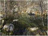 21
21
Discussion about the trail Vitovlje - Vitovlje Lake