Vikrče - Šmarna gora (Westrova pot)
Starting point: Vikrče (320 m)
| Lat/Lon: | 46,1285°N 14,4446°E |
| |
Name of path: Westrova pot
Time of walking: 1 h 30 min
Difficulty: partly demanding marked way
Altitude difference: 349 m
Altitude difference po putu: 400 m
Map: Ljubljana - okolica 1:50.000
Recommended equipment (summer):
Recommended equipment (winter): ice axe, crampons
Views: 31.685
 | 2 people like this post |
Access to the starting point:
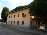
a) From the Ljubljana - Jesenice motorway, take the Ljubljana - Šmartno exit and then continue to Tacno. In Tacno, just before the road crosses the Sava River via a bridge, turn slightly right in the direction of Pirnič. Just after Ljubljana ends, we arrive in Vikrče, and we follow the road to the Kovač Inn, which is located near the bus stop. There are no suitable parking places at the starting point.
b) From Šentvid, drive to Tacen, then turn left immediately after the bridge over the Sava River towards Pirničy. Just after Ljubljana ends, we arrive in Vikrče, and we follow the road to the Kovač Inn, which is located near the bus stop. There are no suitable parking places at the starting point.
c) From Medvode, we drive to Zgornje and then to Spodnje Pirniče, and we follow the road to Tacno. When we arrive in Vikrče, we join the road leading from Smlednik to Tacno, and we continue to the right here and follow the road to the nearby Kovač Inn, where the starting point of our route is. There are no suitable parking places at the starting point.
d) The starting point can also be reached by LPP bus 15.
Path description:
Head towards the village Vikrče, but only as far as the traffic sign by the pavement. At the sign, the Wester Trail to Grmada branches off to the right. The signpost for the Westro trail warns that it is a difficult trail, but it is only a steeper trail, which is not a problem for the average mountaineer. More caution is needed in wet or snowy conditions.
The path climbs steeply up the western slopes of Grmada for about 20 minutes, after which the steepness eases. After this, the climbing route from the village of Vikrče joins from the right. It is followed by a climb along a wide vegetated ridge to the top of Grmada, where a fine view opens up.
From the top of Grmada, continue along the marked trail, which begins to descend through the forest. After about 15 minutes of descent, the path leads to the saddle between Grmada and Šmarna gora, where we join the path from Tacno and Šmartno pod Šmarno gora.
Continue along the road from which the footpath to Šmarna Gora soon branches off. From here you have two options to get to the top (I recommend the circular route). You can either climb to the top along the forest road, which takes you past the wishing bell and children's games, or along the steep footpath, which takes you past the chapel in a few minutes and leads to the top, where the two paths merge.

Pictures:
 1
1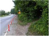 2
2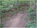 3
3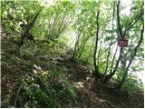 4
4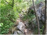 5
5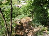 6
6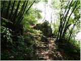 7
7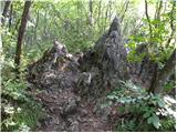 8
8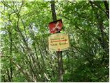 9
9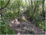 10
10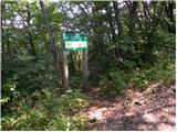 11
11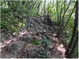 12
12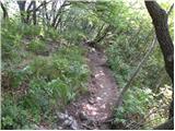 13
13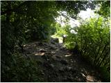 14
14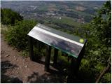 15
15 16
16 17
17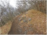 18
18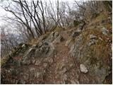 19
19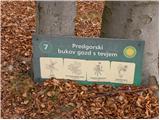 20
20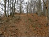 21
21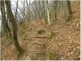 22
22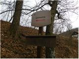 23
23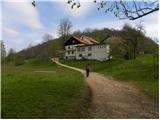 24
24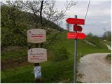 25
25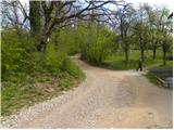 26
26 27
27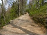 28
28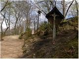 29
29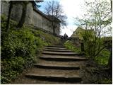 30
30 31
31 32
32
Discussion about the trail Vikrče - Šmarna gora (Westrova pot)
|
| iztok10. 04. 2008 |
Moram pohvaliti tiste, ki so po končanju del vodovoda zelo lepo uredili pot(ni več blata,ipd)
|
|
|
|
| fpetel13. 03. 2009 |
Westrova pot je na začetku zelo strma. Posebej navzdol si pomagamo s koreninami. Glede na to, da povprečen planinec (prav gotovo pa skoraj vsak planinec v mokrem)uporabi na najtežjih delih roke bi rekel, da je oznaka, da gre za (mestoma) 'zahtevno pot' kar pravilna - v mokrem nevarno za zdrs.
|
|
|
|
| VanSims17. 04. 2010 |
Je kar hudir na začetku ja, pol pa gre. Dol šel po Kovačevi poti.
|
|
|