Vikrče - Šmarna gora (Kovačeva steza)
Starting point: Vikrče (320 m)
| Lat/Lon: | 46,1285°N 14,4446°E |
| |
Name of path: Kovačeva steza
Time of walking: 1 h 10 min
Difficulty: easy marked way
Altitude difference: 349 m
Altitude difference po putu: 360 m
Map: Ljubljana - okolica 1:50.000
Recommended equipment (summer):
Recommended equipment (winter): crampons
Views: 7.849
 | 1 person likes this post |
Access to the starting point:
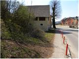
a) From the Ljubljana - Jesenice motorway, take the Ljubljana - Šmartno exit and then continue to Tacno. In Tacno, just before the road crosses the Sava River via a bridge, turn slightly right in the direction of Pirnič. Just after Ljubljana ends, we arrive in Vikrče, and we follow the road to the Kovač Inn, which is located near the bus stop. There are no suitable parking places at the starting point.
b) From Šentvid, drive to Tacen, then turn left immediately after the bridge over the Sava River towards Pirničy. Just after Ljubljana ends, we arrive in Vikrče, and we follow the road to the Kovač Inn, which is located near the bus stop. There are no suitable parking places at the starting point.
c) From Medvode, drive to Zgornje and then Spodnje Pirniče, and we follow the road to Tacno. When you arrive in Vikrče, join the road leading from Smlednik to Tacen, and we continue to the right here and follow the road to the nearby Kovač Inn, where the starting point of our route is. There are no suitable parking places at the starting point.
d) The starting point can also be reached by LPP bus 15.
Path description:
After the Kovač Inn, continue right into the forest, where you will immediately reach a crossroads of two marked trails. Take the left path marked Kovačeva steza (slightly to the right Westrova pot), which begins to climb crosswise to the left. After a short climb, the Learning Trail branches off slightly to the left, and we continue slightly to the right along the Kovačeva steza (Kovac's Trail). Higher up, the path bends slightly to the left and then back to the right, where it gradually turns into a small erosion gully. There is a short, slightly steeper climb and then you reach cart track, where you continue to the left (right Grmada - the path joining the Westro path).
A short crossing follows and the path leads to a minor road leading to Sedlo below the Šmarna gora peak. Higher up, the road leads out of the forest onto the slopes. With a view of the Šmarna gora and Kamnik Savinja Alps peak, we quickly reach the Žumberačka gora homestead, from which there is a short walk to the marked crossroads Na Sedlu.
Here, continue left along the road, which soon splits into two parts. You can continue your ascent along the road, in which case you will climb to the top past the wishing bell, or you can continue to the right along the marked footpath, which also leads you to the top of Šmarna Gora, past the Chapel of St. Sobota.

Pictures:
 1
1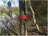 2
2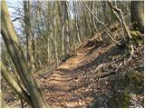 3
3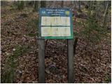 4
4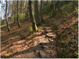 5
5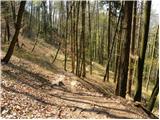 6
6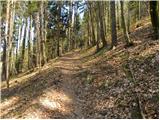 7
7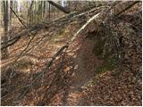 8
8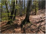 9
9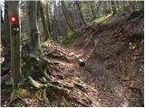 10
10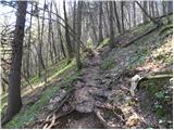 11
11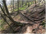 12
12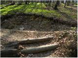 13
13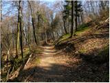 14
14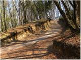 15
15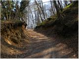 16
16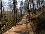 17
17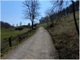 18
18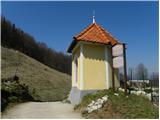 19
19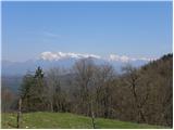 20
20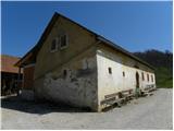 21
21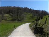 22
22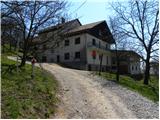 23
23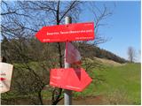 24
24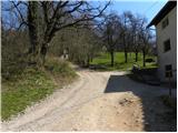 25
25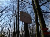 26
26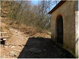 27
27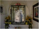 28
28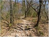 29
29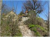 30
30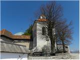 31
31 32
32
Discussion about the trail Vikrče - Šmarna gora (Kovačeva steza)
|
| francimedved20. 04. 2013 |
Na tej poti smo uredili neka stopnic, tako da je pristop sedaj malo lažji.
|
|
|
|
| tinky22. 04. 2013 |
Me je zanimalo kaj je obnovljenega, pa ni sile. Štiri stopnice spodaj in tri obnovljene pri vrhu. Podrta drevesa pa še vedno ovirajo hojo po stezi. Še enega z motorko gor.
|
|
|
|
| francimedved22. 04. 2013 |
Tinky seveda ni sile,hvala za obvestilo o podrtih drevesih, bomo zrihtali.
|
|
|
|
| tinky22. 04. 2013 |
Mislim da je največji problem Kovačeve, Westrove, Mazijeve, Čez Peske in tudi Pogačnikove, parkiranje.
|
|
|
|
| francimedved22. 04. 2013 |
Ja vem, da je parkiranje problem. Parkirni prostor za obiskovalce Šmarne gore je pri diskoteki Lipa, samo kaj, ko je pa treba mislim da en evro plačat. Tam je tudi parkirni prostor za avtobuse. Od tega parkirnega prostora pa ni daleč do izhodišč vseh omenjenih poti.
|
|
|
|
| tinky22. 04. 2013 |
Pravijo da je ura 1,5 evra.Če malo poklepetaš na vrhu, v eni uri neprideš dol .Barabam pa 3 evre ne dam.
|
|
|
|
| jax22. 04. 2013 |
Zastonj pa se parkira pri cerkvi ali Mercatorju v Pirničah. Je treba potem par minut hodit po asfaltu, ampak tako pač je.
|
|
|
|
| francimedved22. 04. 2013 |
Tinky, prav imaš tudi jaz jim nebi dal. Še sreča, da sem doma tik pod Šmarno goro in teh problemov nimam. Zastonj parkiranje(ne vem koliko časa še), je tudi pri mostu blizu gostilne Košir, samo tam je težko najti prostor.
|
|
|
|
| Enka22. 04. 2013 |
Anya, kje so ta teniška igrišča?
|
|
|
|
| francimedved22. 04. 2013 |
Mislim da je ta. Na zemljevid najdi si odtipkaj,
Novi šrc Šturmova 13
|
|
|
|
| Enka23. 04. 2013 |
Aha našla, hvala francimedved.
|
|
|