Velacher Kotschna/Belska Kočna - Goli vrh
Starting point: Velacher Kotschna/Belska Kočna (968 m)
| Lat/Lon: | 46,4023°N 14,5664°E |
| |
Time of walking: 2 h 45 min
Difficulty: easy marked way
Altitude difference: 819 m
Altitude difference po putu: 819 m
Map: Kamniške in Savinjske Alpe 1:50.000
Recommended equipment (summer):
Recommended equipment (winter): ice axe, crampons
Views: 15.103
 | 1 person likes this post |
Access to the starting point:
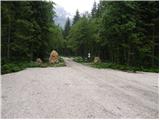
First, we drive to Jezersko, then continue our drive towards Austria. From Jezersko, the road climbs in a few serpentines to the Jezerski vrh border crossing, and from there it starts to descend steeply in a number of serpentines. Lower down, at Bela / Bad Velach, you come to a marked crossroads, where you continue right in the direction of Belska Kočna / Velacher Kotschna. The road crosses the Bela stream and a few metres further on leads to the next crossroads. Here, continue straight ahead on the right-hand road and continue driving along the aforementioned stream. Follow this road to a parking area next to a ramp which prevents further traffic.
It is also possible to access the road via the Pavlič saddle. In this case, turn left at Bela. Continue as described above.
Due to the construction of the new forest road (2009) at Jenkova planina, the parking area by the barrier may be full of logs, so park a little lower down in a suitable place by the road.
Path description:
From the parking lot continue along the road, which after 3 minutes of walking leads us to a crossroads, where we continue along the right road in the direction of the summit "Goli" (in Slovenian Goli vrh, straight Savinjsko sedlo). We continue our ascent along a macadam road, from which soon to the left branches off a rather overgrown marked path leading towards Jenkovemu sedlo. The initially gently sloping path soon climbs steeply and then leads to a forest road, which you follow to the right. The climb up the road takes only a few steps, and then the markings direct us to a less well-trodden footpath, which crosses the relatively new forest road a few more times. Higher up, the marked path finally leaves the forest road and then climbs steeper. The steepness then gradually eases and the rather overgrown path quickly leads to Jenkova planina, where a small unmaintained hut stands.
Near the hut on Jenkova planina we will notice an Austrian direction sign with the inscription "Goli 615", which directs us to the initially difficult footpath. After a few steps, the path goes into the forest, where it crosses some steep and, in the wet, slippery slopes in a barely significant ascent. A little further on, the path passes to the indistinct eastern ridge Goli vrh, where it starts to climb steeply. Higher up, the trail gradually moves out of the forest and onto the increasingly scenic slopes of Goleg vrh. Just when we think we have only a few steps to the summit, a view opens up of the "main" summit, which is still less than a 5-minute walk away.
The mountain trail described above is CLOSED until further notice (July 2009).

Pictures:
 1
1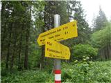 2
2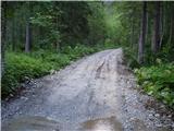 3
3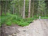 4
4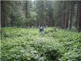 5
5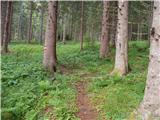 6
6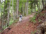 7
7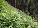 8
8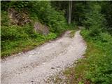 9
9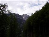 10
10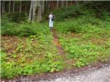 11
11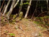 12
12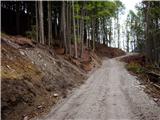 13
13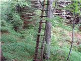 14
14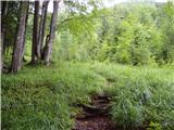 15
15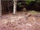 16
16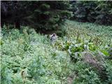 17
17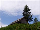 18
18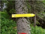 19
19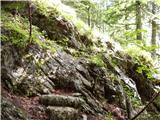 20
20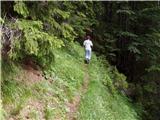 21
21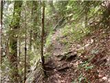 22
22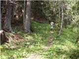 23
23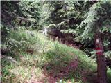 24
24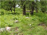 25
25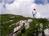 26
26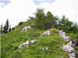 27
27 28
28 29
29
Discussion about the trail Velacher Kotschna/Belska Kočna - Goli vrh
|
| Koroški hams29. 09. 2018 |
Šel danes z Belske Kočne na Jenkovo planino. Pot je še vedno izredno zaraščena, dodatno pa še deloma opustošena od zimskega viharja 2017, ki je pometal drevesa po 'poti', deloma pa je 'pot' izginila zaradi lesnih del. Nadaljevanje markirane poti na sliki številka 9 ni bilo za najti. Zaradi tega sem zapustil cesto in jo mahnil po celem navzgor in višje zopet našel gozdno cesto. Nadaljeval po cesti, dokler se ni od desne pridružila markirana pot. Nadaljeval po gozdni cesti do naslednjega ovinka (treba bi bilo še dosti dalje po gozdni cesti naprej). Ker nikjer ni bilo markacije sem se vrnil do prejšnega združenja markirane poti in gozdne ceste. Tam sem se odločil, da zopet skusim srečo po celem navzgor. Poiskal sem si stezice po strmem navzgor. Na markirano pot sem zopet naletel šele nekaj 10 višinskih metrov pod Jenkovo planino. V sestopu zopet skusil slediti markirani poti. Čeprav sem sledil markacijam večinoma nisem vedel kje naj je steza. Pri sestopu sem videl, da se bi moral dosti dalje držati gozdne ceste (velja predvsem za mesto, kjer sem drugič iskal pot). Pri sestopu sem z dodatno pazljivostjo v bližini slike štev. 9 sledil markirane poti in kljub temu nisem mogel najti vstopa oz. odcepa od gozdne ceste. Verjetno steza zginila z leti pod visoko travo in grmovjem.
Užival sem turo od prvega do zadnjega metra, saj je po moji varianti pot bila 60% brezpotje in 40% markirano brezpotje ter 100% jurčki.
Na nevralgičnih mestih (vedno ko se pot združi z gozdno cesto) manjkajo markacije. Navsploh je pot v spodnjem delu skromno markirana. Še najbolj v pomoč sta bila možička, ki sta bila postavljena pri dveh odcepih markirane poti z gozdne ceste.
Vožnja po cesti do parkirišča v Belski Kočni je dovoljena od 1.4 do 2.11 od 5.00 - 18.00 (stanje 29.9.2018).
|
|
|
|
| zokipoki19. 08. 2024 16:24:26 |
Je kdo v zadnjem času hodil kam iz Belske Kočne? Zanima me prevoznost ceste do rampe?
|
|
|
|
| sla19. 08. 2024 19:38:12 |
14 dni nazaj je bila cesta v redu.
|
|
|
|
| Hribolazec8115. 04. 2025 20:28:27 |
Kako je s to potjo, je odprta?
Je na izhodišču parkirnina?
Hvala
|
|
|
|
| zokipoki17. 04. 2025 09:56:51 |
Januarja je bila pot brez posebnosti, parkiranje pa brezplačno.
|
|
|