Valley of stream Žep - Koča na Travniku
Starting point: Valley of stream Žep (790 m)
| Lat/Lon: | 46,3977°N 14,8279°E |
| |
Time of walking: 2 h 20 min
Difficulty: easy marked way
Altitude difference: 758 m
Altitude difference po putu: 800 m
Map: Kamniške in Savinjske Alpe 1:50.000
Recommended equipment (summer):
Recommended equipment (winter): ice axe, crampons
Views: 11.126
 | 2 people like this post |
Access to the starting point:
From the Ljubljana - Maribor motorway, take the Šentrupert exit and follow the road towards Logarska dolina. In the village Ljubno ob Savinji, the sign for Smrekovec points to the right. The road then takes you through the centre of the village, where you turn left again after the Smrekovec sign. The road then leads to Ljubenske Rastke, where you turn left at the crossroads near the church. Follow this road to a sharp right turn, in the middle of which a macadam road splits off straight ahead, which you follow to the mountain signs for Žep, Robnik and Lovsko hut. Park in one of the smaller parking areas along the road (a more suitable space is slightly higher up).
Path description:
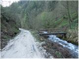
First, cross the Žep stream with the help of a wooden bridge, and then the mountain signs direct you to the initially quite overgrown and steep footpath. The path quickly passes into a dense spruce forest, where it continues to climb steeply. Soon we emerge from the forest onto grassy slopes, where the path disappears. Here, a little higher up, you will notice a marking on a tree that directs you straight up the slope. After a short climb, cross cart track and the path will lead you to the ruins of a former farm.
Continue along the poorly visible but marked path, which climbs parallel to a slightly wider track. Higher up, the path joins the cart track, which immediately splits. Continue sharp left along the slightly steeper cart track, which turns into a footpath higher up, and soon leads to a forest road, which you follow to the right. After a few minutes' walk along the road, we emerge from the forest, where we see the vast Počka mountain pasture in front of us.
With mountain pasture we continue on the road, which quickly leads us to a crossroads where we continue left in the direction of Komno and Travnik (right partisan hospital). The road, which continues to climb steeply, then leads us to the next crossroads, where we continue left towards the hunting lodge Robnik.
From the hunting lodge, continue south along the road, which descends gently for a short time and then, after a short climb, joins the marked path from Ljubno ob Savinja.
Continue sharp right along the marked cart track, which begins to climb steeply through the forest. Cart track leads us higher out of the forest to a rather overgrown clearing (this is also the path), and then it turns left and leads us to a grassy ridge which offers a wonderful view of Ojstrica and part of the Dleskovská plateau. The ascent continues along the edge of the grassy slope until the path leads us to a small prevala at which we see a cross and a memorial plaque. A short descent follows and the path leads us to the shepherd's hut at mountain pasture Mali Travnik.
From mountain pasture continue along the wide marked path, passing the top of Mali Travnik on the right. The path soon enters the forest, where it descends gently and then continues on a slight ascent. A little further on, the path leads us out of the forest, where the path from the higher starting point (starting point Kolarica) joins us on the right. Continue along the pleasant gently sloping path, which leads us after 5 minutes of further walking to the mountain hut at Travnik.

Pictures:
 1
1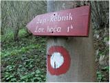 2
2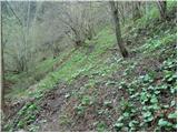 3
3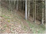 4
4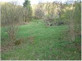 5
5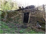 6
6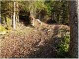 7
7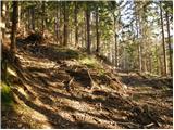 8
8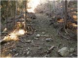 9
9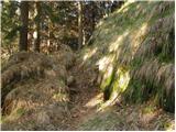 10
10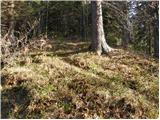 11
11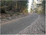 12
12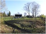 13
13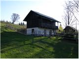 14
14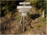 15
15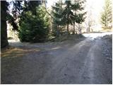 16
16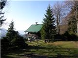 17
17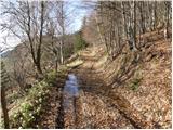 18
18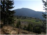 19
19 20
20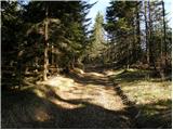 21
21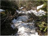 22
22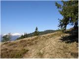 23
23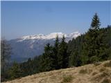 24
24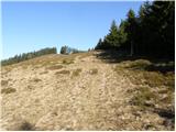 25
25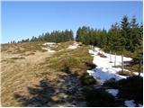 26
26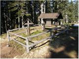 27
27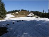 28
28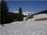 29
29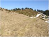 30
30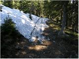 31
31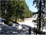 32
32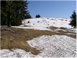 33
33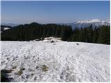 34
34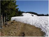 35
35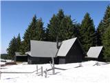 36
36
Discussion about the trail Valley of stream Žep - Koča na Travniku