Ukanc - Ožarjeni kamen (Ferata Ožarjeni kamen)
Starting point: Ukanc (531 m)
| Lat/Lon: | 46,27926°N 13,82942°E |
| |
Name of path: Ferata Ožarjeni kamen
Time of walking: 1 h 50 min
Difficulty: extremely difficult marked way
Ferata: D
Altitude difference: 429 m
Altitude difference po putu: 460 m
Map: TNP 1:50.000
Recommended equipment (summer): helmet, self belay set
Recommended equipment (winter): helmet, self belay set, ice axe, crampons
Views: 31.490
 | 5 people like this post |
Access to the starting point:
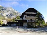
From the Ljubljana - Jesenice motorway, take the Lesce exit and follow the road towards Bled, Bohinjska Bistrica, Ribčev Laz and Ukanec. On the western side of the lake, leave the road towards Koča pri Savici and turn right towards Ukanec. Follow this road to the parking lot near the abandoned Hotel Zlatorog where you park. Parking is also possible in one of the other car parks on the west side of the lake. There is a charge for parking.
Path description:
The route described is CLOSED until further notice! Date of update 7. 7. 2021.
From the parking lot, continue along the main road to the first crossroads where you can take the footpath towards the lake. At the lake, continue north on the path that leads around the lake. At the north-western edge of the lake, where there is a crossroads, turn right and walk for a short distance along the path around the lake, then follow the signpost for the Uket climbing centre, which points left onto a narrow path.
Take the above-mentioned path, which first climbs a few times in the keys. There are also a few fallen trees on the path. Quickly reach a crossroads where a sign on a rock directs you to the right towards a climbing area, while a path to the left leads towards the Savica River.
The trail is marked with red dots and runs eastwards all the way. The path is relatively poorly trodden and mostly ascends gently, but in a few places it also descends slightly. Here, through the forest, we occasionally get a nice view towards Bohinjsko jezero and the Vogel. When you reach the climbing area, you will first notice the sign "Uket" on the rock, we continue here for a short time on the path that crosses the slopes to the east and then you will notice the ropes on the left.
Before entering the climbing route, be sure to equip yourself with a self-protection kit and a helmet. Climbing gloves are highly recommended. It is not recommended to climb the protected route in wet conditions.
The protected route is quite difficult from the start and initially climbs up the wall transversely. Soon the path turns left and you are facing the first difficult almost vertical climb. The path then climbs up a monolithic rock all the way, and there is often some grass and trees or bushes along the way. The trail offers magnificent views of Lake Bohinj the whole time. The path, which is very exposed throughout, climbs almost vertically a few more times and there are some short, difficult crossings along the way. This trail then goes all the way to the end of the protected trail where there is also a marked crossroads.
To the right, the path leads downhill, marked "bivouac" and secured with a rope. This path leads to a ravine surrounded by overhanging cliffs, which provides shelter.
At the crossroads we continue straight up and the path soon turns left and then crosses the slopes to the west. The path, which runs along mostly wooded slopes, then climbs slightly. The slope becomes more grassy and the path soon turns slightly to the right. There is a final short climb to the top where there is a registration box.
Descend steeply down the slope to the left, which is secured with a rope and a rope. After a steep descent, there is a traverse which leads to scree. Continue left down a long scree slope, which allows a quick descent. At the end of the scree, enter the forest and continue slightly left and down to join the path marked with red dots. Continue right down to the lake and then back to the starting point.
The trail described is of difficulty level D and is suitable only for experienced mountaineers with sufficient strength in their arms. The rope can cause some additional problems, as it is a bit thinner than usual on such difficult routes. The crampons are attached to drill bits and not to the larger pegs seen on most other protected routes. The rappel is often completely against the wall, which makes it a bit more difficult to get the self-protection kit on.
The climbing part of the route has 300 vertical metres and will take approximately one hour to climb.

Pictures:
 1
1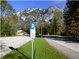 2
2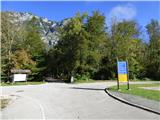 3
3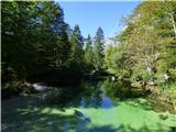 4
4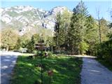 5
5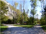 6
6 7
7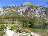 8
8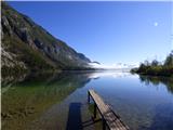 9
9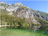 10
10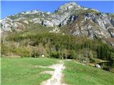 11
11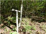 12
12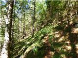 13
13 14
14 15
15 16
16 17
17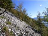 18
18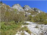 19
19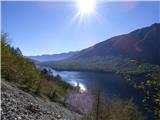 20
20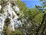 21
21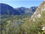 22
22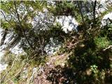 23
23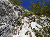 24
24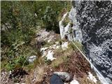 25
25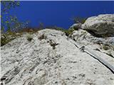 26
26 27
27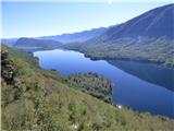 28
28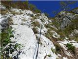 29
29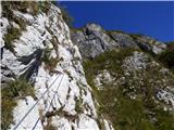 30
30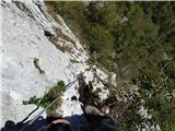 31
31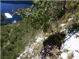 32
32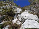 33
33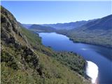 34
34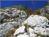 35
35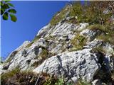 36
36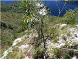 37
37 38
38 39
39 40
40 41
41 42
42 43
43 44
44 45
45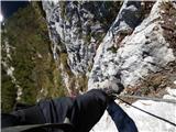 46
46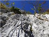 47
47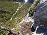 48
48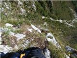 49
49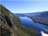 50
50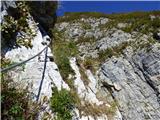 51
51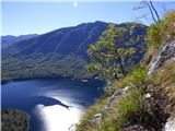 52
52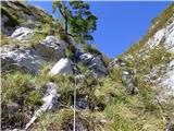 53
53 54
54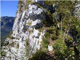 55
55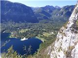 56
56 57
57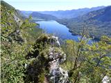 58
58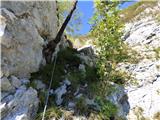 59
59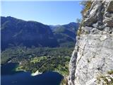 60
60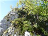 61
61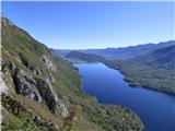 62
62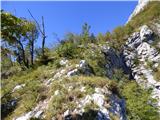 63
63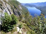 64
64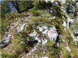 65
65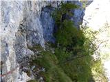 66
66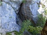 67
67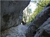 68
68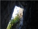 69
69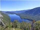 70
70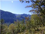 71
71 72
72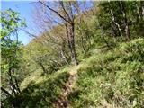 73
73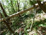 74
74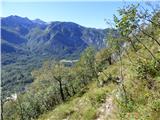 75
75 76
76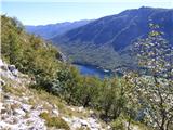 77
77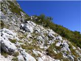 78
78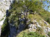 79
79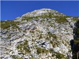 80
80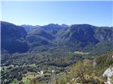 81
81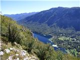 82
82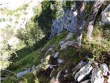 83
83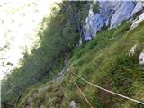 84
84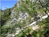 85
85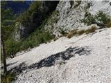 86
86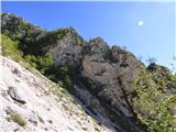 87
87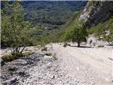 88
88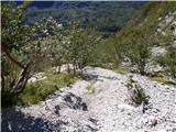 89
89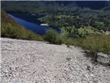 90
90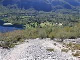 91
91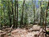 92
92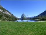 93
93
Discussion about the trail Ukanc - Ožarjeni kamen (Ferata Ožarjeni kamen)
|
| Michel3. 05. 2019 |
Odlična ferata, precej hribovska po mojem mnenju. Vmes so tudi navrtana sidrišča, odlična tura za vajo vrvne tehnike in gibanja v navezi.
Nekaj mest je zahtevnejših. Priporočam čevlje za pristop "approach".
Razgledi so fantastični!
Koordinate začetka ferate: 46.2882609, 13.8359730
|
|
|
|
| janezs733. 05. 2019 |
Zgoraj opisani del je zgolj spodnja polovica ferate, težji del je zgoraj. Na tem forumu imamo že dodatne opise in številna mnenja. forum ozarjeni kamen
|
|
|
|
| Parkeljc23. 05. 2019 |
Dostop do ferate je sicer odlično označen in opisan, a le do odcepa za plezališče. Od možica, ki označuje odcep proti plezališču, mi pa nadaljujemo vedno strmeje še nekaj minut do vstopa v ferato, "pot" praktično izgine. Pa tudi zelo strmo se vzpne. Do vstopa sem potreboval cca 30 min. Itaq kot na vseh feratah, tudi ta v vlažnem ali mokrem ni primerna za vzpon. Priznam, sprva sem jo rahlo podcenjeval, od začetka je bila psiha rahlo na preizkušnji, mogoče zato, ker sem bil sam, težavnost,.. Sestop je tudi prepuščen "prosto po Prešernu". Še posebej, ko zapustimo jeklenico, iščemo najprimernejša mesta po meliščih za sestop in občasno je treba biti tudi nekoliko bolj previden. Užitek pri spustu (pa ne za gojzarje  ) nastopi šele nekoliko nižje. Omeniti tudi velja, da na melišču orientacijskih točk ni. Sledimo le najnižji točki melišča. Brez plezalnih rokavic se nikar ne podajajte v ferato, jeklenica je tanjša in oprijem mora biti temu primerno močnejši, a kljub temu drsi (žulji  ).
|
|
|
|
| don kihott29. 05. 2019 |
Svedrovci namesto raztežajnih klinov!!! 
|
|
|
|
| Tadej8. 07. 2021 07:11:24 |
Opisana pot je do nadaljnjega ZAPRTA!
|
|
|
|
| LISAC20. 08. 2025 19:57:55 |
Živjo. Je pot še vedno zaprta? Ali kdo ve kaj se, če se bo z njo dogajalo v prihodnje? Hvala in pozdrav.
|
|
|