Uglov laz - Koča na Kamnem griču (via Dom na Travni Gori)
Starting point: Uglov laz (856 m)
| Lat/Lon: | 45,7471°N 14,6061°E |
| |
Name of path: via Dom na Travni Gori
Time of walking: 2 h
Difficulty: easy marked way
Altitude difference: 160 m
Altitude difference po putu: 335 m
Map:
Recommended equipment (summer):
Recommended equipment (winter):
Views: 1.581
 | 2 people like this post |
Access to the starting point:
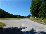
a) From the road Ljubljana - Kočevje, at the settlement Žlebič turn right (from Kočevje turn left) in the direction of Sodražica, and from Sodražica continue in the direction of Loški Potok. After a climb of just under 5 km from Sodražica, you will reach a crossroads where the macadam road to Travna Gora branches off to the left. Turn left here and then park at a suitable place along the road, preferably at a wider lay-by.
b) From the Bloža plateau, drive to Ravne na Blokah, then drive through Kračali and Janeži. You pass the settlement of Križeti on the left and then join the main road leading from Sodražica towards Hrib-Loški Potok. Follow the road to the right, then just a little further on at the first crossroads continue left towards Travna Gora. Park in a suitable place along the road, preferably on a wider shoulder.
c) From Mali Log, Retij, or Hriba-Loški Potok, drive towards Sodražica. After a few kilometres, when you reach the place where you see the signs for Travna Gora, continue to the right and then park at a suitable place along the road, preferably at a wider diversion.
Path description:
From the crossroads, the road passes through a meadow for a short distance before entering a forest and gradually climbing. Higher up, the road is laid and leads out of the woods, where you pass a shooting range on the right-hand side. The road continues with a few short ups and downs, leading partly through the forest and partly across karst meadows. After passing Pšeničev vrh on the right, the road starts to descend more steeply, and at the right-hand bend we are joined on the left by the marked path from Sodražica. From the bend, continue descending, and after a few metres, a worse road branches off to the right, leading towards Ravný dol.
Continue along the main wider road, which stops descending, and then in a few minutes leads to a signpost marking the beginning of the Travna Gora settlement. Here the road leads between pastures, and at the crossroads continue along the right-hand road (straight ahead to Travna Gora). The path ahead takes you past a few cottages, then climbs to the next crossroads, where you continue right again in the direction of Doma na Travna Gora. Walk along the road for a few minutes and then you will reach a crossroads directly above the Dom na Travna Gora. Continue straight ahead and cross the meadow and within a minute's walk you will reach the aforementioned home.
From the house, return to the road and continue left (from the direction of arrival this is the right-hand road) along the dirt road, which continues without any major changes in elevation. The way forward takes us past the mountain signs, and we walk along the road from here for about 500 metres, or until the place where the markings in the parking lot direct us to the right. After a few metres of walking, at the point where the path passes into the forest, we see the mountain markings for Koča na Kamnem griču.
The way forward initially climbs up the gently sloping and usually quite muddy cart track, which after a few minutes climbs steeper. When the steepness subsides, you reach a poorly marked crossroads, where you continue to the right. Continue walking along the wider but poorly marked cart track, which after a short descent turns into a dirt road, which quickly leads to the next crossroads. Continue to the left, along the worse macadam road towards Kamný hill. At a small turning point the road changes to cart track, and here we continue straight on (poorly marked) along the pleasant cart track, which leads us out of the woods onto pleasant grassy slopes. On the other side of the meadow you arrive at a marked crossroads, where you continue to the right in the direction of the hut, to which you have a 5-minute climb up the moderately steep cart track, which climbs over the aforementioned meadow. Starting point - Dom na Travna Gora 1:10, Dom na Travna Gora - Koča na Kamnem griču 50 minutes.

Pictures:
 1
1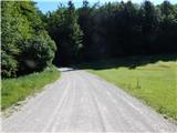 2
2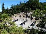 3
3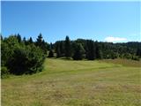 4
4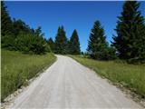 5
5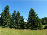 6
6 7
7 8
8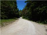 9
9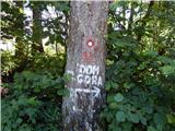 10
10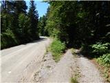 11
11 12
12 13
13 14
14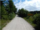 15
15 16
16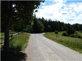 17
17 18
18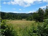 19
19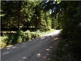 20
20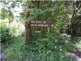 21
21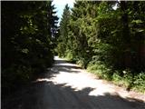 22
22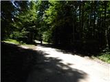 23
23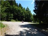 24
24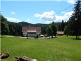 25
25 26
26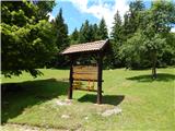 27
27 28
28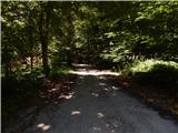 29
29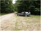 30
30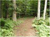 31
31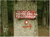 32
32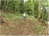 33
33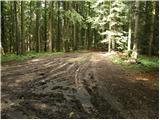 34
34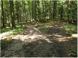 35
35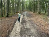 36
36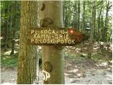 37
37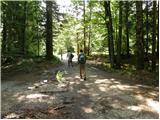 38
38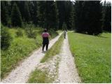 39
39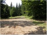 40
40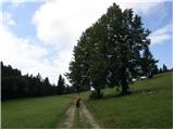 41
41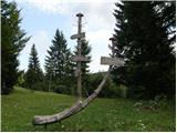 42
42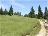 43
43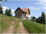 44
44 45
45
Discussion about the trail Uglov laz - Koča na Kamnem griču (via Dom na Travni Gori)