Starting point: Trnovec (521 m)
| Lat/Lon: | 46,092°N 14,3434°E |
| |
Time of walking: 1 h 35 min
Difficulty: easy marked way
Altitude difference: 500 m
Altitude difference po putu: 520 m
Map: Ljubljana - okolica 1:50.000
Recommended equipment (summer):
Recommended equipment (winter): ice axe, crampons
Views: 15.169
 | 2 people like this post |
Access to the starting point:
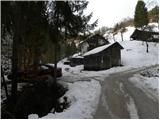
a) From Ljubljana, Kranj or Vodice, drive to Medvode and from there continue to Sora. At the crossroads at the beginning of Sora, just after the small bridge, turn left in the direction of Katarina and the village of Trnovec. Continue along the Ločnice valley, where the road leads past the Legastja Inn. From the inn, follow the main road for another 500 m, and then the signs for Setnica (next to the sign for Setnica there are also mountain signs for Grmada and Tošč, and the open-door farm of Gonte) direct you to the right on what was originally still an asphalt road. The narrower road then climbs along the stream (during the climb "overlook" the right-hand turn-offs and go straight ahead), and we follow it to a right-hand bend, at which we see a woodshed and above it a dwelling house. Park at the beginning of the bend in a suitable space on the roadside.
b) We first drive to Škofja Loka and from there we continue driving towards Sora. At the end of Sora, turn right towards Katarina and the village of Trnovec. Continue along the valley of the Ločnica River, where the road leads past the Legastja Inn. From the inn, follow the main road for another 500 m, and then the signs for Setnica (next to the sign for Setnica there are also mountain signs for Grmada and Tošč, and the open-door farm of Gonte) direct you to the right on what was originally still an asphalt road. The narrower road then climbs along the stream (during the climb "overlook" the right-hand turn-offs and go straight ahead), and we follow it to a right-hand bend, at which we see a woodshed and above it a dwelling house. Park at the beginning of the bend in a suitable space on the roadside.
c) Leave the Primorska motorway at the Brezovica exit and continue driving in the direction of Dobrova and Polhov Gradec. Continue along the Gradaščice valley and follow the main road towards Polhov Gradec to a small crossroads where the road to the right branches off towards the villages of Osredek, Topole (Katarina) and Belo (the turn-off from the main road is located just before the beginning of the village of Hrastenice). When we arrive in the village Topole, the road to the village of Belo branches off sharply to the left at first, and a little further on, the signs for Medvode direct us slightly to the left, onto a road that gradually starts to descend (we continue on the main road through the village the whole time). The road then descends for quite some time, and we follow it to the beginning of the settlement of Trnovec. Here we will see the signs for Setnica (next to the sign for Setnica there are also mountain signs for Grmada and Tošč and the Gonte Open Door Farm), which direct us left onto the initially still asphalted road. The narrower road then climbs along the stream (during the climb we "overlook" the right-hand turn-offs and go straight ahead), and we follow it to a right-hand bend, at which we see a woodshed and above it a dwelling house. Park at the beginning of the bend in a suitable space on the roadside.
Path description:
From the starting point, continue along the initially still macadam road in the direction of Grmada, Tošča and Gont. Climb along the stream for a few minutes, then the road becomes asphalt and turns sharp left. The road then leads us past a few houses, above which we gradually get a better and better view, at first only of the nearby hills, but higher up and further away. After about 50 minutes of climbing on a relatively steep road, we reach the Gonte Open Door Farm (usually open on Saturdays, Sundays and public holidays), above which is a marked crossroads.
From the Gonte farm, continue right towards Tošča (left Polhograjska Grmada) along the wide cart track, from which a marked footpath branches off to the left after only a few metres. Continue the ascent along the above-mentioned footpath, which turns into a forest and begins to climb moderately. The path then crosses some scenic grassy slopes and then passes to the Mali Tošč ridge, the top of which is reached after a few minutes.
A short descent follows from Mali Tošč, and then the path leads us to a small saddle, where the path from Govejk joins us from the right. Continue in the direction of Tošča along a slightly steeper path, which you then follow through the forest all the way to the top.

Pictures:
 1
1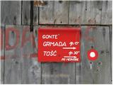 2
2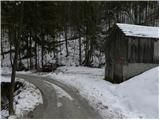 3
3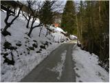 4
4 5
5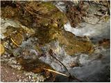 6
6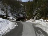 7
7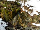 8
8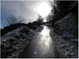 9
9 10
10 11
11 12
12 13
13 14
14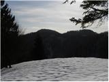 15
15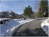 16
16 17
17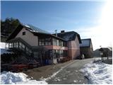 18
18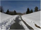 19
19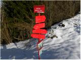 20
20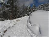 21
21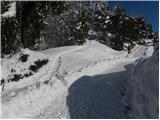 22
22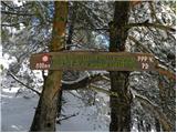 23
23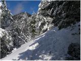 24
24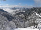 25
25 26
26 27
27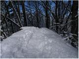 28
28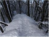 29
29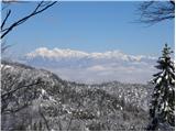 30
30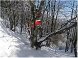 31
31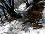 32
32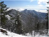 33
33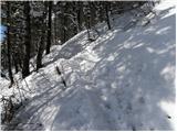 34
34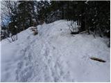 35
35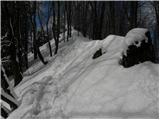 36
36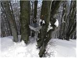 37
37 38
38 39
39
Discussion about the trail Trnovec - Tošč
|
| KARAMELICA1. 04. 2013 |
Po isti poti smo šli že velikokrat do Gont, samo mi smo nadaljevali levo na Grmado. Mika pa me tudi pot na Tošč, to pot imam že dolgo v mislih, tako da ob prvem lepšem vremenu grem gor, zagotovo. Super slikce. 
|
|
|