Topole - Debeli vrh (above Topole)
Starting point: Topole (324 m)
| Lat/Lon: | 46,1768°N 14,5548°E |
| |
Time of walking: 25 min
Difficulty: easy marked way
Altitude difference: 122 m
Altitude difference po putu: 125 m
Map:
Recommended equipment (summer):
Recommended equipment (winter):
Views: 945
 | 1 person likes this post |
Access to the starting point:
a) Leave the Gorenjska motorway at the Vodice exit and continue driving towards Kamnik. In Most at Komenda turn right towards Mengeš, then after about 2 km turn right into Topole. At a small crossroads, continue straight ahead (left Mengeš, right Suhadole), then drive to a parking lot next to a sports field, where you park.
b) From Kamnik or Komenda, drive towards Vodice, and after crossing the main road Brnik - Mengeš, turn left towards Mengeš, then after about 2 km turn right into the village Topole. At a small crossroads, go straight on (left Mengeš, right Suhadole), then drive to the parking lot next to the sports ground, where you park.
c) Take the Mengeš, then from the main crossroads in the centre of Mengeš, continue driving towards Kranj. A little further on from the main road, turn slightly left onto the road towards Vodice and Topole. When Mengeš ends, the main road towards Vodice soon turns left, and we continue straight ahead on a narrower road, which leads to the settlement Topole, where we turn left in the middle of the settlement towards a sports ground. After approximately 200 m of further driving, you will reach the sports ground, where you will park in a marked asphalted parking lot.
Path description:
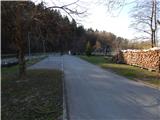
From the parking lot, cross the Pšata River over the bridge, then before the Chapel of St Lucy, continue left along the forest road, and after a few steps, at a small cross, turn right onto the initially relatively steep footpath, which first climbs crossways, then, when it reaches a ridge, turns right and levels off slightly. A little higher up, we reach a bench with a nice view of Topole, and we continue along the path, accompanied by blue and white markings. The path ahead leads us along an undistinguished ridge, where it descends a little, then climbs moderately until we reach the undistinguished Debeli vrh, which we recognise by a small wooden cross.
Description and pictures refer to the situation in 2017 (March).
Pictures:
 1
1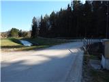 2
2 3
3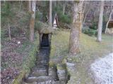 4
4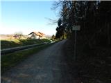 5
5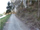 6
6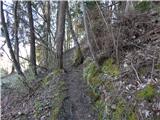 7
7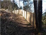 8
8 9
9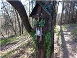 10
10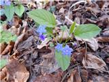 11
11 12
12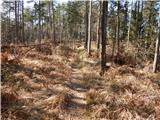 13
13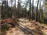 14
14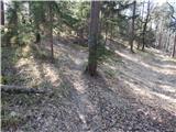 15
15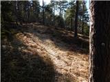 16
16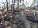 17
17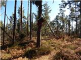 18
18
Discussion about the trail Topole - Debeli vrh (above Topole)