Topol - Sveti Jakob (via homestead Na Vihri)
Starting point: Topol (651 m)
| Lat/Lon: | 46,0936°N 14,3695°E |
| |
Name of path: via homestead Na Vihri
Time of walking: 45 min
Difficulty: easy marked way
Altitude difference: 155 m
Altitude difference po putu: 180 m
Map: Ljubljana - okolica 1:50.000
Recommended equipment (summer):
Recommended equipment (winter):
Views: 7.262
 | 1 person likes this post |
Access to the starting point:
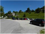
a) From Ljubljana, Kranj or Vodice, drive to Medvode and from there continue to Sora. At the crossroads at the beginning of Sora, just after the small bridge, turn left in the direction of Katarina and the village of Trnovec. The road rises above the valley and leads to the beginning of the village Topole, where you park in the large parking lot next to the primary school.
b) First drive to Škofja Loka, and from there continue to Sora. At the end of Sora, turn right towards Katarina and the village of Trnovec. The road rises above the valley and leads to the beginning of the village Topole, where you park in the large parking lot next to the primary school.
c) Leave the Primorska motorway at the Brezovica exit and continue driving in the direction of Dobrova and Polhov Gradec. Continue along the Gradaščice valley, and follow the main road towards Polhov Gradec to a small crossroads where the road turns right towards the villages of Osredek, Topole (Katarina) and Belo (the main road turns off just before the beginning of the village of Hrastenice). When you arrive in the village Topole, the road to the village of Belo branches off sharply to the left at first, and a little further on, the signs for Medvode direct you slightly to the left, onto a road that gradually begins to descend. Before the road starts to descend steeply towards the Ločnica valley, we reach the primary school, where we park in a large parking lot.
Path description:
From the parking lot at the primary school, follow the main asphalt road up to the chapel by the Dobnikar Inn, then turn left, and at the next crossroads, a few metres further on, turn left again in the direction of Sv. Jakob, Slavkovega dom and Medvoda. The way forward climbs steeply along the asphalt road, which first leads us past the ARSO meteorological station, and then, with beautiful views of part of the Ljubljana Marshes, the Krim and the surrounding hills, we arrive at the upper part of the settlement, where we reach the next chapel and, at the same time, another crossroads.
From this crossroads, continue left (to the right St Catherine's Church, Jeterbenk, Slavkov dom na Golem Brdu. . . ) towards the inn or homestead at Vihra and St James. The way forward leads past the aforementioned inn, and the asphalt ends just above it.
From the place where the asphalt ends, we continue straight into the forest on the macadam road, which leads us past the water reservoir and which is slightly further on joined by another path with Topole (the path from the parking lot at the primary school and past the excursion farm pr Mamovc). The way ahead takes us along a narrower macadam road for a few minutes, and we walk along it to the hamlet of Brezovica pri Medvodah (one of the homesteads has a Porentov well, restored a few years ago).
The marked trail bypasses the hamlet on the right and then continues along the wide cart track, from which we have a beautiful view of our destination and, in good weather, of the Kamnik and Savinja Alps and the Posavje hills. On the other side of the meadow, the path approaches the forest, where we join the path from Sora and Preska. Here, too, we continue to the left, and we walk along the cart track for only a few more 10 steps, as the signs then lead us to the right on a relatively steep path that continues along the edge of the forest (even if we continue along the cart track we will reach the top). During the ascent we have a nice view towards Polhograjska Grmada, and from the top, which we reach after a few minutes, towards the other peaks of the Polhograje hills.

Pictures:
 1
1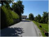 2
2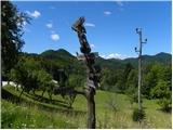 3
3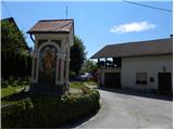 4
4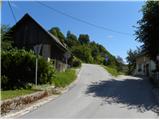 5
5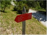 6
6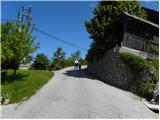 7
7 8
8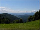 9
9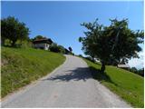 10
10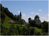 11
11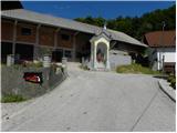 12
12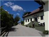 13
13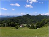 14
14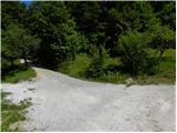 15
15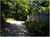 16
16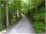 17
17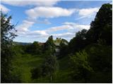 18
18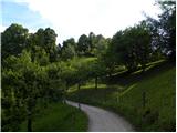 19
19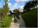 20
20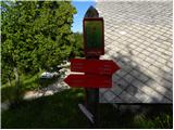 21
21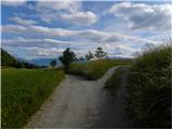 22
22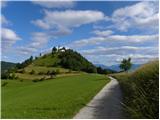 23
23 24
24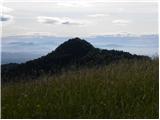 25
25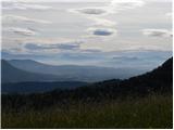 26
26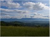 27
27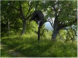 28
28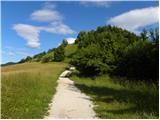 29
29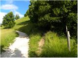 30
30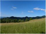 31
31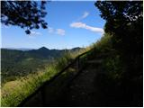 32
32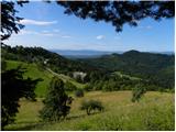 33
33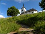 34
34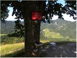 35
35 36
36
Discussion about the trail Topol - Sveti Jakob (via homestead Na Vihri)