Tonnerhütte - Zirbitzkogel
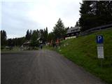
Starting point: Tonnerhütte (1594 m)
| Lat/Lon: | 47,05213°N 14,53002°E |
| |
Time of walking: 2 h 32 min
Difficulty: easy marked way
Altitude difference: 802 m
Altitude difference po putu: 802 m
Map: WK 212 Seetaler Alpen 1:50.000
Recommended equipment (summer):
Recommended equipment (winter): ice axe, crampons
Views: 911
 | 2 people like this post |
Access to the starting point:
a) Drive through Border crossing Ljubelj into Austria and follow the signs for Klagenfurt am Wörthersee / Klagenfurt am Wörthersee. In Klagenfurt, turn right at the McDonalds onto the southern bypass / Südring, and at the next major junction turn right again towards Velikowiec / Völkermarkt and Mostič / Brückl. The road to Velikowiec is soon left, as a little after the Obi shop turn right towards the motorway and Mostič. Continue past the Ikea store, following the signs for Mostič and past the motorway entrances. When you arrive in Mostič, follow the signs for Lead / Eberstein and Hüttenberg and then Mühlen, which is already in Styria / Steiermark. Mühlen is reached by turning right off the main road, and through the village we follow the signs for Jakobsberg and Tonnerhütte, and higher up just follow the signs for Tonnerhütte, where we park in a pay-and-display parking lot (€4 private car, June 2020).
b) Take the Border crossing Jezerski Vrh, Holmec or Vič into Austria, then follow the signs for Velikovec / Völkermarkt, and from there the signs for Mostič / Brückl. Once in Mostič, follow the signs for Svinec / Eberstein and Hüttenberg and then Mühlen, which is already in Styria / Steiermark. Mühlen is reached by turning right off the main road, and through the village we follow the signs for Jakobsberg and Tonnerhütte, and higher up just follow the signs for Tonnerhütte, where we park in a pay-and-display parking lot (€4 private car, June 2020).
Path description:
From the parking lot, walk above the hut where the path splits and we take the Panoramaweg (Panorama Trail) on the right (Zirbenweg on the left). At first, we walk along the road as it climbs crosswise to the right, but just after the left-hand bend, we leave the road and continue to the right in the direction of the Zirbitzkogel (Zirbitzkogel). The path continues along the edge of the ski slope, and when the ski slope ends, the path is laid. Follow the marked path through the lane of a forest to open pastures, where you quickly reach lookout point Herterhöhe, where there are panoramic billboards.
We continue straight on towards Zirbitzkogel, where, with the views getting better and better, we reach the next marked crossroads, where a path branches off to the left towards the peaks of Kreiskogel (2306 m) and Wenzelalpe (2151 m) and the Winterleitenhütte hut (1782 m), and we continue straight on. There is a fairly steady climb, which gives us nice views, but before crossing the first stream, the winter path to Zirbitzkogel branches off to the left (the branch is not marked and is harder to see), and we continue across the stream and start climbing cross-climbing to the right. We cross several more streams, and we follow the south-western slopes of Zirbitzkogel up to the south ridge, where there is a marked crossroads.
Continue left towards Zirbitzkogel (straight over the fence and then Lake Lavantsee on the left, Fuschkogel on the right), where you continue along the ridge. At first there is a moderate climb, followed by some shorter steeper climbs, and as you approach the top the ridge retreats to the right, and then in a traverse you reach the Zirbitzkogelhaus hut, where you join some more paths.
Go left here and past the stone chapel you quickly reach the summit, from which the view reaches all the way to the Slovenian and Italian mountains.
Starting point - Herterhöhe 0:40, Herterhöhe - Zirbitzkogelhaus 1:50, Zirbitzkogelhaus - Zirbitzkogel 0:02.
Description and pictures refer to the situation in June 2020.

Pictures:
 1
1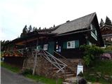 2
2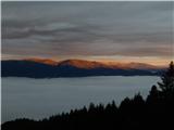 3
3 4
4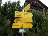 5
5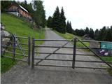 6
6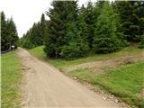 7
7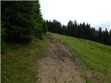 8
8 9
9 10
10 11
11 12
12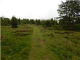 13
13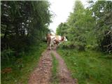 14
14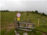 15
15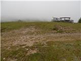 16
16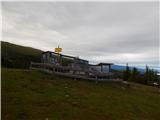 17
17 18
18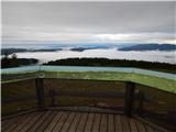 19
19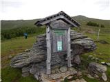 20
20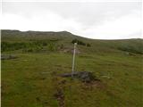 21
21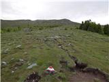 22
22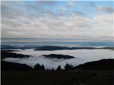 23
23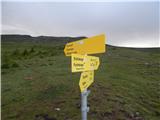 24
24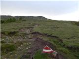 25
25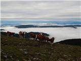 26
26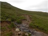 27
27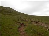 28
28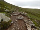 29
29 30
30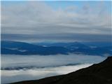 31
31 32
32 33
33 34
34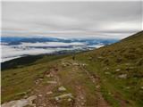 35
35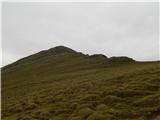 36
36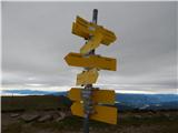 37
37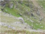 38
38 39
39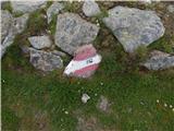 40
40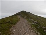 41
41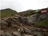 42
42 43
43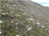 44
44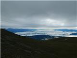 45
45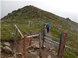 46
46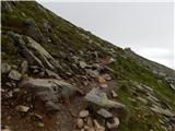 47
47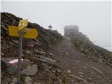 48
48 49
49 50
50 51
51 52
52 53
53 54
54 55
55
Discussion about the trail Tonnerhütte - Zirbitzkogel