Tinčkova koča - Pautz/Zelenjak
Starting point: Tinčkova koča (1070 m)
| Lat/Lon: | 46,4228°N 14,1991°E |
| |
Time of walking: 2 h 55 min
Difficulty: very difficult unmarked way
Altitude difference: 954 m
Altitude difference po putu: 975 m
Map: Karavanke - osrednji del 1:50.000
Recommended equipment (summer): helmet
Recommended equipment (winter): helmet, ice axe, crampons
Views: 6.660
 | 1 person likes this post |
Access to the starting point:
From the Ljubljana - Jesenice motorway, take the Lesce exit and follow the road towards Žirovnica and Jesenice. After a few km of driving, you will come to a crossroads where the road to Žirovnica and Moste turns right (from Jesenice, left). Just a few metres further, at the next crossroads, turn left into Moste (right into Žirovnica). Continue past the memorial to the fallen fighters, where the road starts to climb uphill under the railway line. At the top of the hill, turn right (at the Vila Karin sign) and we continue towards Završniškem jezero and Valvasor's home. The road then bends and leads to a crossroads where the road to Valvasor's home branches off to the left, and we continue straight ahead on the initially still asphalted road. The road soon becomes macadam, and we follow it to a parking area near Tinček's hut. The road is often in a rather bad condition in the upper part.
Path description:
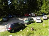
From the parking lot at Tinčková's cottage, continue along the wide stone cart track towards the cottage at the source of the Završnice River. After a few steps, the signs direct us slightly to the right, onto a slightly steeper footpath that climbs over a grassy slope with a view, and then returns to the aforementioned cart track, which we follow to the right. "After a few minutes' further walking, Cart track, which climbs relatively steeply through the wods, leads to a pasture fence, beyond which a marked crossroads is reached.
Continue straight ahead (slightly to the right of Roblek's house) along the still stony cart track, which leads us higher out of the forest onto the vast grassy slopes of Smokuč mountain pasture. Here the steepness gives way and the increasingly scenic route leads us in 15 minutes of further walking to the hut at the source of the Završnice River.
From the hut, continue right along the marked footpath towards Zelenice. After a few steps, the path leads us to the source of the Završnice River, behind which we step onto a pleasant meadow. Behind the meadow, the path climbs slightly steeper and after a few minutes of further walking leads us to the foot of the western part of the Zelenica ski resort. Here we leave the marked trail leading to Dom na Zelenici and continue our ascent along the ski lift, while we walk along it to a small boulder, where we rejoin the marked trail. Follow the above-mentioned path to the left (right Dom to Zelenica), which descends slightly and after a few minutes of further walking leads us to the outlet of the valley of Suhego dwarf pines, where the unmarked path to Palec branches off to the right upwards.
Continue towards Palec (straight ahead Hochstuhl and Vertatscha) on the path which climbs through the lane of a forest and leads higher up to the scree of Vertatscha and Palec. Here the steepness eases and the path then leads us along the valley of the dwarf pines. Higher up, the path turns slightly to the right and climbs steeply again. After a few minutes of further walking, we reach the border ridge (Žleb 1916 m) from where we have a view of the Austrian side.
Continue left (right Palec) along the path, which climbs crosswise over the scree below Zelenjak. After a few minutes of ascent, the path leads to the next saddle, this time on the western side of Zelenjak. From here, continue to the right along a faintly visible path that climbs crossways up the very steep top slope of the mountain. The path, which shows the route cairns, leads us along a steep slope which is dangerous for slipping. After about 10 minutes of difficult work, we reach the summit.

Pictures:
 1
1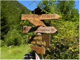 2
2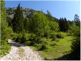 3
3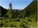 4
4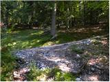 5
5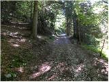 6
6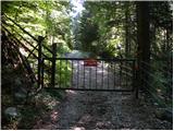 7
7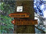 8
8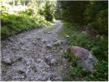 9
9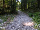 10
10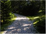 11
11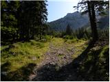 12
12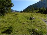 13
13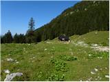 14
14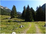 15
15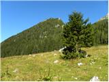 16
16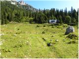 17
17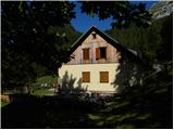 18
18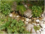 19
19 20
20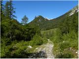 21
21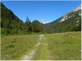 22
22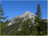 23
23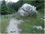 24
24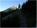 25
25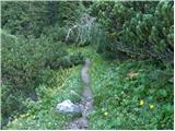 26
26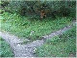 27
27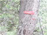 28
28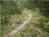 29
29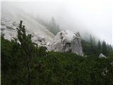 30
30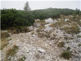 31
31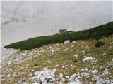 32
32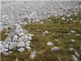 33
33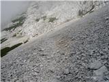 34
34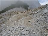 35
35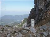 36
36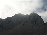 37
37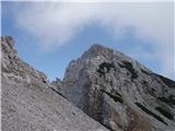 38
38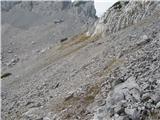 39
39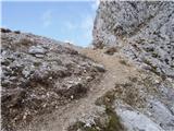 40
40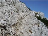 41
41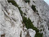 42
42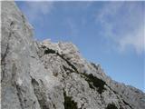 43
43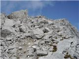 44
44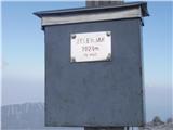 45
45
Discussion about the trail Tinčkova koča - Pautz/Zelenjak