Tinčkova koča - Hochstuhl/Stol (via Smokuška planina)
Starting point: Tinčkova koča (1070 m)
| Lat/Lon: | 46,4228°N 14,1991°E |
| |
Name of path: via Smokuška planina
Time of walking: 4 h 15 min
Difficulty: easy marked way
Altitude difference: 1166 m
Altitude difference po putu: 1350 m
Map: Karavanke - osrednji del 1:50.000
Recommended equipment (summer):
Recommended equipment (winter): ice axe, crampons
Views: 18.331
 | 2 people like this post |
Access to the starting point:
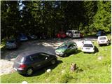
From the Ljubljana - Jesenice motorway, take the Lesce exit and follow the road towards Žirovnica and Jesenice. After a few km of driving, you will come to a crossroads where the road to Žirovnica and Moste turns right (from Jesenice, left). Just a few metres further, at the next crossroads, turn left into Moste (right into Žirovnica). Continue past the memorial to the fallen fighters, where the road starts to climb uphill under the railway line. At the top of the hill, turn right (at the Vila Karin sign) and we continue towards Završniškem jezero and Valvasor's home. The road then bends and leads to a crossroads where the road to Valvasor's home branches off to the left, and we continue straight ahead on the initially still asphalted road. The road soon becomes macadam, and we follow it to a parking area near Tinček's hut. The road is often in quite bad condition in the upper part.
Path description:
From the parking lot at Tinčková's cottage, continue along the wide stone cart track towards the cottage at the source of the Završnice River. After a few steps, the signs direct us slightly to the right, onto a slightly steeper footpath that climbs over a grassy slope with a view, and then returns to the aforementioned cart track, which we follow to the right. "After a few minutes' further walking, Cart track, which climbs relatively steeply through the wods, leads to a pasture fence, beyond which a marked crossroads is reached.
Continue straight ahead (slightly to the right of Roblek's house) along the still stony cart track, which leads us higher out of the forest onto the vast grassy slopes of Smokuč mountain pasture. Here the steepness gives way and the increasingly scenic route leads us in 15 minutes of further walking to the hut at the source of the Završnice River.
From the hut, continue left along the marked footpath towards Hochstuhla. After a few minutes, the path leaves cart track and enters a small valley between Srednji vrh on the left and Vertatscha on the right. The moderately steep path, which passes through a sparse forest, climbs steeply for a short time higher up and after a few minutes of further walking leads us to the Šija saddle, where there is a marked crossroads.
Continue straight ahead (left Srednji vrh, right Vertatscha and Hochstuhl upper path) along the path, which descends slightly at first and then gradually begins to climb. Here, the unmarked path over Zagon joins us almost imperceptibly from the left, and we continue straight along the path surrounded by lush bushes. the relatively gently sloping path soon leads us to the high mountain cirque, where the (upper) path from the house on Zelenica joins us from the right.
We continue westwards, this time along a path that leads us through a beautiful high mountain valley, surrounded on the left by the lesser-known Srednja peč (1920 m), and on the right by Svačiča and the ridge of Belščice, which blocks our view towards Austria. Just a little further on, a path branches off to the right to Bielschitza and Klagenfurter Hutte, and we continue straight on the increasingly high mountain path, which leads us in a gentle ascent to a large scree slope below Celovška špica (2105 m). The path then climbs over a relatively steep scree slope and leads us to an undistinguished saddle between the Small and the Large Hochstuhl. Here we continue to the right (left Prešernova koča 5 minutes) in the direction of Hochstuhl, the top of which we reach after 10 minutes of further walking. Starting point - hut at the source of the Završnice River 1:00, hut at the source of the Završnice River - Hochstuhl 3:15.

Pictures:
 1
1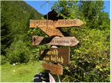 2
2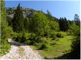 3
3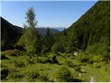 4
4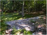 5
5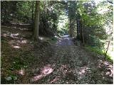 6
6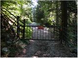 7
7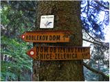 8
8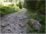 9
9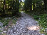 10
10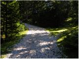 11
11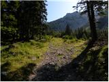 12
12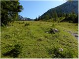 13
13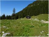 14
14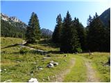 15
15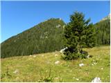 16
16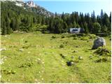 17
17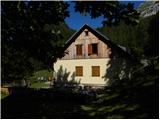 18
18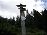 19
19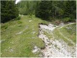 20
20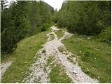 21
21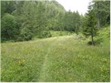 22
22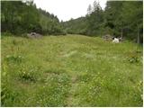 23
23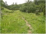 24
24 25
25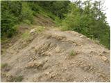 26
26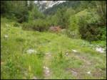 27
27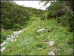 28
28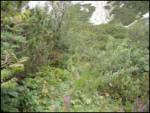 29
29 30
30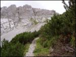 31
31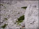 32
32 33
33 34
34 35
35 36
36 37
37 38
38 39
39 40
40 41
41 42
42 43
43 44
44 45
45
Discussion about the trail Tinčkova koča - Hochstuhl/Stol (via Smokuška planina)