The Krma Valley - Okroglež
Starting point: The Krma Valley (930 m)
| Lat/Lon: | 46,3851°N 13,9071°E |
| |
Time of walking: 2 h 55 min
Difficulty: difficult marked way
Altitude difference: 1035 m
Altitude difference po putu: 1065 m
Map: TNP 1:50.000
Recommended equipment (summer): helmet
Recommended equipment (winter): helmet, ice axe, crampons
Views: 1.110
 | 2 people like this post |
Access to the starting point:
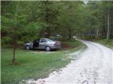
Drive to Mojstrana, then follow the signs for the Kot and Krma valleys and the settlement Radovna. A relatively steep road then leads past a TNP sign, after which the road soon becomes a dirt road, leading to a crossroads where a dirt road branches off to the right into the Kot valley. Continue straight ahead on the road as it begins to descend. In the middle of the descent, the road to the Krma valley (straight ahead Radovna) branches off to the right. A little further on, you come to the next crossroads, where you continue to the right in the direction of Krma. The macadam road then leads us to Kovinarska hut, and we follow it further. Occasionally, a slightly worse road then leads us to the parking area in front of the Krme valley lock.
Path description:
About 50 metres before the parking lot, a marked trail branches off up to the left, leading to Debela peč and Blejska koča on Lipanca. Take this path, which after an initial three-minute walk begins to climb steeply. A few minutes higher up, the path leads us under the cliffs, where we see an inscription that the path we are going to follow was built in 1952.
The path continues to climb steeply through the forest to a slightly more difficult crossing, where we are helped by rungs, less steep steps and a rope. The path ahead leads between dwarf pines and is followed to a mighty torrential ravine, which is slightly descended, and on the other side of which a steep slope is traversed.
Crossing the ravine is difficult or even impossible after heavi rainfall, but as the slopes are steep the water drains away quickly. The path continues through the forest, still steeply uphill. As we continue, we get closer and closer to the steep slopes and rocky cliffs. When the forest becomes much thinner, the path climbs even steeper and for a short time becomes so steep that you have to help yourself a little with your hands. This part is particularly dangerous for slipping in wet conditions, but in dry conditions it is not a major hazard. The path then leads under steep rocky cliffs where, especially in spring, there is a high risk of falling rocks. The crossing under the cliffs is almost horizontal, and then the path climbs again. Again, a small steel cable helps us, leading to grassy slopes. Next, we cross the slopes again, exposed to falling rocks, and soon afterwards we reach a less steep part of the path, where we climb along an increasingly scenic path, which runs mainly between dwarf pines and sparse woods. When you reach a crossroads, turn left towards Debele Peća.
The way ahead leads us in a moderate ascent in a few minutes to Lipanska vrata, from which we descend in a few steps to the crossroads.
Continue left in the direction of Brdo and Debela peč and continue walking along the path surrounded by dwarf pines. Walking almost horizontally, the path branches off twice to the left to the top of Brda, and we follow the gently sloping path to a crossroads where the usual approach from Pokljuka to Debelo peć joins from the right.
A few 10 steps further, leave the well-trodden path towards Debela peč and continue ascending to the right towards the summit of Okroglež. The ascent follows a less distinct path, which leads us through lane of dwarf pines in less than 5 minutes of further walking to the scenic summit of Okroglež, where there is a stamp on a metal pole.

Pictures:
 1
1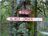 2
2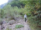 3
3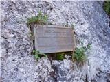 4
4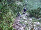 5
5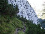 6
6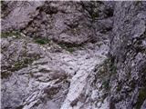 7
7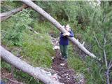 8
8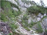 9
9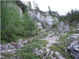 10
10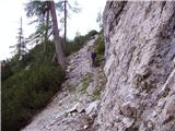 11
11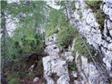 12
12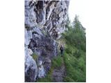 13
13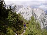 14
14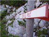 15
15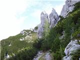 16
16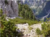 17
17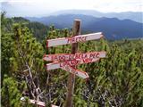 18
18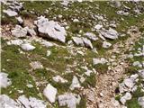 19
19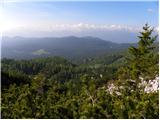 20
20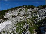 21
21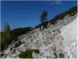 22
22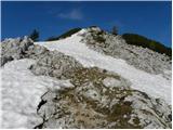 23
23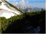 24
24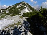 25
25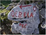 26
26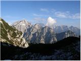 27
27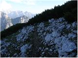 28
28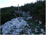 29
29 30
30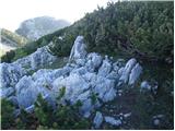 31
31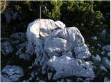 32
32 33
33
Discussion about the trail The Krma Valley - Okroglež