Starting point: The Kot Valley (950 m)
| Lat/Lon: | 46,4157°N 13,8977°E |
| |
Time of walking: 4 h 55 min
Difficulty: difficult pathless terrain
Altitude difference: 1588 m
Altitude difference po putu: 1595 m
Map: Triglav 1 : 25.000
Recommended equipment (summer):
Recommended equipment (winter): ice axe, crampons
Views: 18.105
 | 2 people like this post |
Access to the starting point:
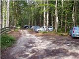
Leave the Gorenjska motorway at the Hrušica exit and follow the road towards Kranjska Gora. Just before the village of Dovje, the road branches off to the left and leads to Mojstrana (Vrata, Kot and Krma). Follow the road in the direction of the village of Radovna and the valleys of Krma and Kot. The relatively steep road then leads us past the TNP signboard, after which the road soon lays down and leads us to a crossroads where a dirt road branches off to the right into the Kot valley (straight ahead to Radovna and Krma). This sometimes slightly worse road is then followed to a parking area, where you will also see mountain signs.
Path description:
From the starting point, continue along the worse road, which after a few minutes leads to a turning point (parking here is not recommended). The path ahead turns slightly left and crosses a torrent. On the other side of the torrent, we climb steeply through the forest for some time. After half an hour's walking, the path starts to climb. There are a few dozen steps of walking on a steep path, where we are helped by wedges, which are not strictly necessary in dry conditions. The steepness then eases and the path leads us to a small spring (which dries up in the dry season) at 1340m. Here an unmarked path branches off to the left to Macesnovec, and we continue on the marked path that crosses the torrent. There is a short steep section where we are helped by a rope ladder (not difficult). The path then crosses the lane of dwarf pines and climbs higher up on rockier slopes, where we see the Thick Stone (a large boulder visible at the top of the slope). We climb up to the Thick Stone on a rough path surrounded by the dwarf pines path (not difficult). Next, the path climbs up along a small scree slope and turns slightly higher to the right, where it leads to a crossroads. Continue left in the direction of Stanič's home and Rjavina (to the right of Vrbanove Špice, a very difficult path). The steepness then eases and there are a few minutes of easy walking to the next crossroads. Continue on the right path towards Stanič's home, passing the Pekel sinkhole, which can be seen on the right below us (the path to the left leads to Rjavina on the climbing route). Continue climbing steeply up to Stanič's home, which offers a beautiful view of Triglav.
Continue in the direction of Kredarica on the path which climbs steeply under the scree Rži, then crosses the scree. In the upper part of the scree, you will notice a less well-trodden path (often barely visible due to avalanches), which leaves the marked path towards Kredarica. The path, which branches off the marked path to the left, after a short steep climb over a scree slope and higher up a small ravine, leads to the Rži ridge. Here, continue left and follow the "path" along and, in places, along the ridge to the top.
In the upper part, the cairns helps us to find the passages, but in the lower part they are often destroyed by avalanches. Kot - Staničev dom 4:00, Staničev dom - Rž 45 minutes.

Pictures:
 1
1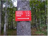 2
2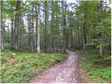 3
3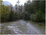 4
4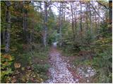 5
5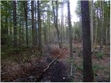 6
6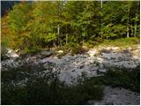 7
7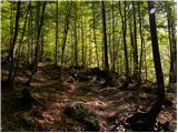 8
8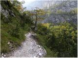 9
9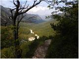 10
10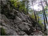 11
11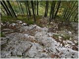 12
12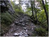 13
13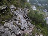 14
14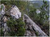 15
15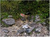 16
16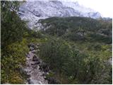 17
17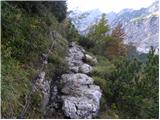 18
18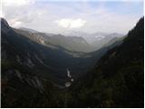 19
19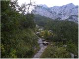 20
20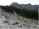 21
21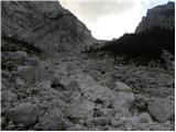 22
22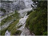 23
23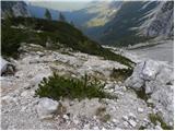 24
24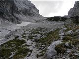 25
25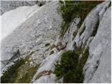 26
26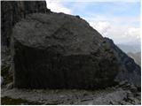 27
27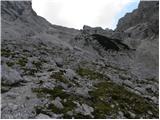 28
28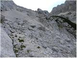 29
29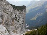 30
30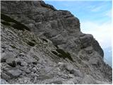 31
31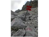 32
32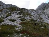 33
33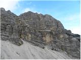 34
34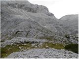 35
35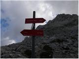 36
36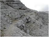 37
37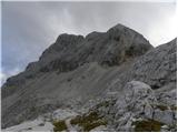 38
38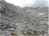 39
39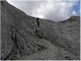 40
40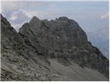 41
41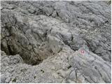 42
42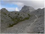 43
43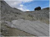 44
44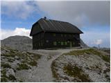 45
45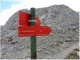 46
46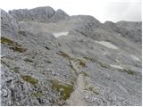 47
47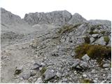 48
48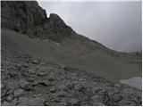 49
49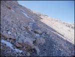 50
50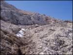 51
51 52
52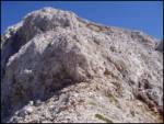 53
53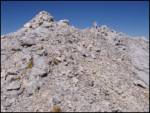 54
54
Discussion about the trail The Kot Valley - Rž
|
| Guest17. 08. 2007 |
Jaz bi šla samo do Staničeve koče. Zanima me, ali je pot z doline Kot do Staničeve koče kje izpostavljena.
Hvala za odgovor.
|
|
|
|
| Guest29. 08. 2007 |
Imaš nekaj nepotrebnih jeklenic. Pot je lepa.
|
|
|
|
| hribi31. 08. 2007 |
Hvala za vzpodbudo, ob priliki sigurno grem
|
|
|
|
| bo_zl10. 08. 2019 |
Povsem po krivici zanemarjena gora, ki je na 18. mestu med najvišjimi slovenskimi vrhovi. Orientacija ne povzroča težav. Razgledi z vrha pa prekrasni. za vse ki imate radi mir dobra izbira.
|
|
|
|
| tango21. 09. 2020 |
Kljub ne najbolj obetavni vremenski napovedi sva se z ženo odločila osvojiti Rž. Pristop po melišču, torej ko zavujemo levo s poti Staničev dom-Kredarica, je konkretno strmo, na grebenu pa naju je pričakala res gosta megla in sva obrnila, praktično na vrhu ter za uteho skočila na Visoko Vrbanovo špico, ki pa je bila še v soncu. Nazaj v Kot je bila pot pod Debelim kamnom, po prečenju struge, izjemno spolzka in sva porabila več časa za dol kakor za gor, za zakjluček pa naju je od studenca do avta kar primerno namočilo. Vseeno, prima dan!
|
|
|