Temnica - Sveti Ambrož (Tabor) (northern path)
Starting point: Temnica (402 m)
| Lat/Lon: | 45,8452°N 13,6764°E |
| |
Name of path: northern path
Time of walking: 50 min
Difficulty: easy unmarked way
Altitude difference: 129 m
Altitude difference po putu: 160 m
Map: Goriška - izletniška karta 1:50.000
Recommended equipment (summer):
Recommended equipment (winter):
Views: 430
 | 1 person likes this post |
Access to the starting point:
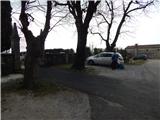
a) Drive to Dornberk (to get here from the Vipava expressway, take exit Selo, or from Šempeter pri Gorici), and then continue driving to Branik. At Dornberk, leave the road towards Branik and turn right towards Potok and Trstelja. After Železna vrata, the road levels off and we follow the signs for Lipa and then Kostanjevica na Krasu. Shortly after Lipa ends, go left into the village of Temnica, where you drive to the church and cemetery, where you park.
b) Drive to Sežana, then continue driving towards Komno and then Kostanjevica na Krasu. Shortly after Vojščica, turn right towards Temnica, and when you reach the village, park in the cemetery parking lot.
Path description:
From the cemetery parking lot, take the road leading north-east and follow it quickly to the NOB memorial. From the crossroads by the memorial, go left and then slowly start descending and soon leave the village of Temnica. Cross the main road below and continue on a side road towards Trstelj. After a few minutes of easy walking, you will pass another NOB memorial, and gradually start to climb behind the memorial.
From the next crossroads, where there is a memorial commemorating the 1991 War of Independence, continue right and then climb cross-country. A little after crossing the route of a high-voltage power line, the cart track branches off to the right, leading to the summit of St Ambrose or peak Tabor (the western trail), and we continue along the road here, which we follow to the pass north of peak Tabor, or St Ambrose.
Here we see a path on the right which starts to climb through lane of bushes and low forest. Follow this path for about 10 minutes and then you will reach the top, where you will see the ruins of the Church of St Ambrose.

Pictures:
 1
1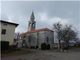 2
2 3
3 4
4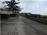 5
5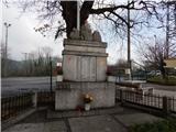 6
6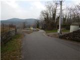 7
7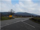 8
8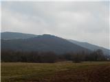 9
9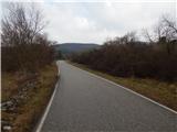 10
10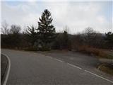 11
11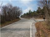 12
12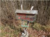 13
13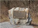 14
14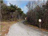 15
15 16
16 17
17 18
18 19
19 20
20 21
21 22
22 23
23
Discussion about the trail Temnica - Sveti Ambrož (Tabor) (northern path)
|
| *Sanda*11. 10. 2024 22:41:35 |
Danes (Oktober 2024) delno po tej poti (z prevala) na vrh. Pot neoznacena ampak kar vidna. Na poti opazim vejevje nametano po poti (tezji dostop), ampak pridem do rusevin cerkve. Tu se mimo rusevin zacnem spuscati navzdol in opazim ograjo spodaj desno. Medtem ko gledam kje je pot se od odspodaj navzgor mi zacne priblizevati clovek in hitro razberem da je psiho in se skusam oddaljiti, vendar mi sledi. Ne prestrasi ga niti lajez enega izmed mojih psov, pa sem jih imela tri s seboj. Malo pod adrenalinom pot koncno najdem in hitro odhitim proti izhodiscu. Skratka zelo neprijetna izkusnja. Da sem opis poti prebrala pred odhodom mogoce me ta vrh ne bi videl.
|
|
|