Teharje - Babni vrh (Pot I. Celjske čete)
Starting point: Teharje (241 m)
| Lat/Lon: | 46,2296°N 15,29761°E |
| |
Name of path: Pot I. Celjske čete
Time of walking: 2 h 15 min
Difficulty: easy marked way, easy unmarked way
Altitude difference: 512 m
Altitude difference po putu: 577 m
Map: Celjska kotlina, 1:50000
Recommended equipment (summer):
Recommended equipment (winter):
Views: 309
 | 1 person likes this post |
Access to the starting point:
Teharje has a rich history. They are first mentioned indirectly in written sources as early as the 12th century. The local history is closely linked to the Counts of Celje, as the Teharcans acquired nobility. Today, Teharje is the seat of the eponymous local community, which is home to around a thousand inhabitants. The town lies on the right side of the river Voglajna, east of Celje, so the easiest access is by road from Celje. The starting point of our route is at the bridge over the Voglajna, and parking is possible in the nearby large parking lot next to the former guesthouse, just before the protected railway crossing and the aforementioned bridge, near the large industrial halls, in the area of the former Štore Ironworks.
Path description:
The major part of our trip initially leads from the starting point along the marked mountain trail of the I. Celje Troop, which is looked after by PD Grmada Celje. At the starting point, there is a signpost pointing the way along the asphalt road that runs along the left bank of the Voglajna River. After about 700 metres of walking on the asphalt at the crossroads, turn right onto the macadam road into the forest. Leave the road at the memorial monument higher up and follow the forest path uphill. After leaving the forest, you will arrive in Osenica, where you will have a view of Bavč and Grmada. Soon you will reach a crossroads where the Celjska planinska pot (CPP), leading from the route of Stary grad, joins from the right. Go around the meadow and continue along the asphalt road leading higher up to Pečovje. After about 900 metres of walking on the asphalt, leave the asphalt at a neatly marked trestle and continue to the right along the forest road. After 500 metres of pleasant views of the nearby hills, where our destination is, we enter the forest, where the path leading from the starting point in Zvodne joins from the right. From the parking lot, it is a 1-hour walk, 3. 36 km distance, 167 metres ascent and 18 metres descent.
Continue straight ahead on the forest road. After about 100 metres, you will come to a new crossroads, at which you leave the forest road and continue left down the cart track in the direction of Štor or Bojanski graben. After descending all the way to the ravine, at the crossroads continue sharp right along the Bojanski brook. Follow the marked path in the narrow gorge by the stream, but only until the next crossroads, where the path branches off to the left. Follow the signs, leave the Bojanski brook gorge and continue on a steeper ascent. Shortly after coming out of the forest, turn left onto the forest road, which leads at a gentle slope to Zarovice. After a few steps, we reach a saddle on the south side of Velika and Mali Bojanski vrh, where the path from Žlajfa joins us from the left. This is where the I. Celjska čete Trail ends.
Continue on the marked path Štore - Dom na Svetina, maintained by PD Železar Štore, sharp right on the asphalt, through a short stretch in the forest and through the courtyard of the homestead between the tower silo, the house and the barn. Continue straight up south into the pasture and cow pasture part, and after about 140 metres turn left at the cart track turnoff, leave the marked path towards Svetina, and head towards the distant forest to the east. As a landmark for the turn-off, notice the concrete well to the left of the path. Soon leave the meadow and enter the forest. The path alternates between the forest for a while and the meadow at the edge of the forest for a while. When you get between the houses, after a short stretch on macadam, you soon come across a signpost for the XIVth Division. Here you continue to the left, but only a few steps to the edge of the forest, where you continue to the right along the edge of the forest, through a pleasant clearing, where you can enjoy beautiful views of the surrounding peaks. At the end of the clearing, turn slightly left onto a path into the forest, which soon joins the cart track coming from the right. Continue on cart track, where you will soon have a view towards the eastern hills, and just before the forest, leave cart track and follow the narrow path that leads slightly right up towards the summit. A few more steps along a moderately sloping ridge and you are on Babne vrh.

Pictures:
 1
1 2
2 3
3 4
4 5
5 6
6 7
7 8
8 9
9 10
10 11
11 12
12 13
13 14
14 15
15 16
16 17
17 18
18 19
19 20
20 21
21 22
22 23
23 24
24 25
25 26
26 27
27 28
28 29
29 30
30 31
31 32
32 33
33 34
34 35
35 36
36 37
37 38
38 39
39 40
40 41
41 42
42 43
43 44
44 45
45 46
46 47
47 48
48 49
49 50
50 51
51 52
52 53
53 54
54 55
55 56
56 57
57 58
58 59
59 60
60 61
61 62
62 63
63 64
64 65
65 66
66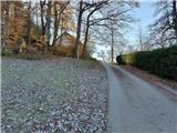 67
67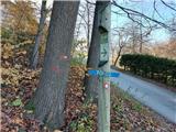 68
68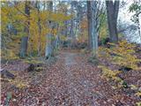 69
69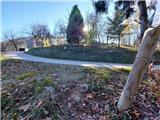 70
70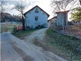 71
71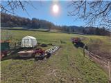 72
72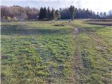 73
73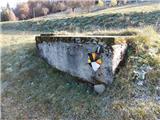 74
74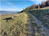 75
75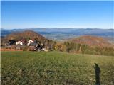 76
76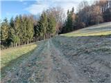 77
77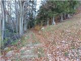 78
78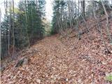 79
79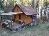 80
80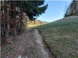 81
81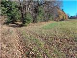 82
82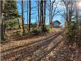 83
83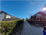 84
84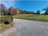 85
85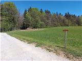 86
86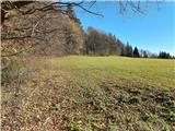 87
87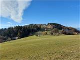 88
88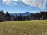 89
89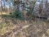 90
90 91
91 92
92 93
93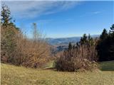 94
94 95
95 96
96 97
97 98
98 99
99
Discussion about the trail Teharje - Babni vrh (Pot I. Celjske čete)