Sveti Vid (Vidovska planota) - Sveti Primož in Felicijan (Osredek)
Starting point: Sveti Vid (Vidovska planota) (846 m)
| Lat/Lon: | 45,8506°N 14,4612°E |
| |
Time of walking: 50 min
Difficulty: easy marked way
Altitude difference: -95 m
Altitude difference po putu: 60 m
Map: Snežnik 1:50.000
Recommended equipment (summer):
Recommended equipment (winter):
Views: 4.498
 | 1 person likes this post |
Access to the starting point:
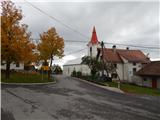
a) From Ig, Črna vas or Brezovica pri Ljubljani drive to Podpeč, from there continue to Rakitna and then on to Cerknica. Shortly before the pass and the settlement of Pikovnik, leave the main road and drive left towards Sveti Vid on the initially macadam road. After a few kilometres, we join the road leading from Župeno towards Sveti Vid, and we follow it to the left. When you reach the village of Sveti Vid (there are no signs for the beginning of the village from the route you are coming from), turn left at the crossroads and drive for about 100 m to the parking area next to the church of Sveti Vid (near the parking area there is also a firemen's lodge and a commemorative memorial to the Polish National Liberation Struggle on it).
b) Leave the Primorska motorway at exit Unec, then continue towards Cerknica. Shortly before Cerknica, turn left towards Begunje pri Cerknici, and from Begunj continue towards Rakitna, while we follow the main road towards the above-mentioned place only as far as the end of the settlement Selšček, as from there we continue to the right towards the settlement of Topol pri Begunje (Topol pri Begunje). We continue through a few more villages, and follow the signs to Sveti Vid. When you arrive in the village, park in the parking lot in front of the church.
c) From Ljubljana, drive towards Kočevje, then turn right at Velike Lašče (left from Kočevje) in the route "Nova vas 18km". Continue driving through Mala Slevica, Karlovica, Podstrmec and along the ascending serpentine road through Zakraj and you will reach a crossroads where you will turn right towards the settlements Lahovo, Ravnik, Zavrh, Polšeče, Jeršiče and Sveti Vid, where you will also park in the parking lot in front of the church.
d) First drive to Sodražica and from there continue to Nova vas na Bloki. From Nova vas, turn right towards Nemški vas and then towards Sveti Duh. Before the village, turn left towards Lahovo, Ravnik, Zavrh, Polšeče, Jeršiče and Sveti Vid, where you can park in the parking lot in front of the church.
Path description:
From the parking lot of the Church of St. Vid, return to the main road, and from there continue towards Osredko. After only a few 10 metres, you reach a crossroads by the chapel, where you turn left towards Osredek and then left again at an unmarked crossroads. The asphalt road, which continues without any major changes in elevation or even descends slightly, will lead us to the settlement of Zala after a while. Here, we first get a nice view of the surrounding hills, and then we walk past a few more houses in the village.
After the village, a path branches off to the left down to the Kotel waterfall, 20 minutes away, and we continue straight on, where the path or road leads us past the Zala quarry. After the quarry, the road turns eastwards, first passing Preska on the south side (Preska is an 805 m high peak slightly above the road), and then continuing along and along the ridge of Debeli hrib.
There is a slightly longer descent from Debele hill, and then we reach the next marked crossroads, where the marked trail joins Rakitna on our left, and we continue straight on towards Bukovec, Krvava Peč and Iški Vintgar along the road, which climbs slightly.
From the crossroads onwards, the forest thins out and the road passes to the meadows, from where a beautiful view opens up over the hills above the Iška River and the hills above its tributaries. After a few minutes of further walking, we reach the beginning of the village of Osredek, and we continue a little further to the nearby tourist farm, where we can have a snack, or a little further to the church of St Primož and Felicijan.

Pictures:
 1
1 2
2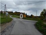 3
3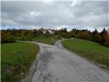 4
4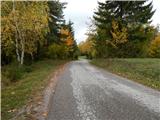 5
5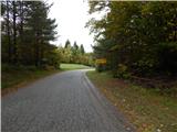 6
6 7
7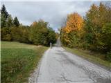 8
8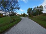 9
9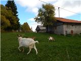 10
10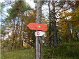 11
11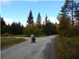 12
12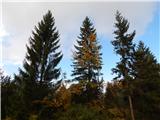 13
13 14
14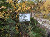 15
15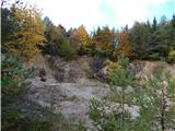 16
16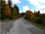 17
17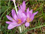 18
18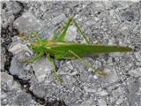 19
19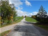 20
20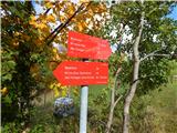 21
21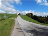 22
22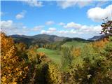 23
23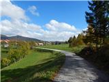 24
24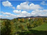 25
25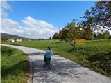 26
26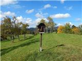 27
27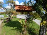 28
28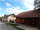 29
29 30
30 31
31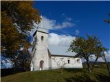 32
32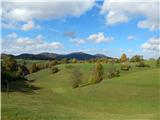 33
33
Discussion about the trail Sveti Vid (Vidovska planota) - Sveti Primož in Felicijan (Osredek)
|
| Laščan12. 11. 2013 |
Tadej-prosim za popravek pri opisu dostopa do izhodišča c.), saj po opisanem nikakor ni dostopno:.... Iz Ljubljane se peljemo proti Kočevju, nato pa v naselju Velike Lašče zavijemo desno (iz smeri Kočevja levo) v smer "Nova vas 18km". Nadaljujemo vožnjo skozi Malo Slevico, Karlovico, Podstrmec in po vzpenjajoči serpentinasti cesti skozi Zakraj in pridemo do križišča, kjer zavijemo desno proti naseljem Lahovo, Ravnik, .... nato sledi opis kot pri opisu d.)
|
|
|
|
| Tadej12. 11. 2013 |
Hvala za obvestilo, sem popravil.
|
|
|