Sveti Jurij ob Ščavnici - Gomila
Starting point: Sveti Jurij ob Ščavnici (223 m)
| Lat/Lon: | 46,5685°N 16,0235°E |
| |
Time of walking: 2 h 55 min
Difficulty: easy marked way
Altitude difference: 129 m
Altitude difference po putu: 250 m
Map:
Recommended equipment (summer):
Recommended equipment (winter):
Views: 288
 | 1 person likes this post |
Access to the starting point:
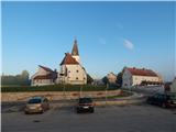
a) From the Maribor - Lendava motorway take the Sveti Jurij ob Ščavnici exit, then follow the signs for the above-mentioned place and park in the centre of the village in the asphalt parking lot under the parish church of St. George, next to the bus station and the Jasmina pastry shop. There are two car parks, one on the main road and the other slightly larger one about 60 metres away.
b) Take Ptuj, then follow the signs to Gornja Radgona and Sveti Jurij ob Ščavnici, and follow the main road to Sveti Jurij ob Ščavnici, where you will park in the centre of the village in the asphalt car park under the parish church of St George, next to the bus station and the Jasmina pastry shop. There are two car parks, one on the main road and the other slightly larger one about 60 metres away.
Path description:
From the parking lot, walk to the main road, cross it carefully at the pedestrian crossing, and then continue along the pavement along the road leading to Lenart in Slovenske gorice. First, pass the parish church of St. George on the right and then continue along the pavement on the right side of the road, passing the primary school Sveti Jurij ob Ščavnici. The road continues through the village of Blaguš, where the pavement ends at the hunting lodge of LD Videm ob Ščavnici. Here, go carefully back to the left side of the road and continue through the forest. When you reach a marked crossroads where the road to the left branches off towards the settlements Sovjak, Ženik, Kokolajnščak, Stara Gora, Kutinci and Galušak, and the marked path to Blaguško jezero branches off to the right downhill, continue to the left.
From the crossroads, at which there are also signs for the educational trail, you will quickly reach the settlement of Brezje, through which you can easily climb, and along the way you will be accompanied by occasional markings and information boards of the educational trail. A little further on, at a small crossroads, go left up towards Stara Gora and the nature trail, and just after the crossroads we reach the settlement Ženik. From here there is a bit of a climb, and then the fairly scenic road that leads between the occasional houses, gives way. In the second part of Ženik, the road starts to descend gently, and then we continue along an unmarked ridge, where we are accompanied by beautiful views of the Slovenian mountains. After a few minutes of walking and a slight climb, we reach the village of Stara Gora, where the Church of the Holy Spirit is located just a little further from the Janja Oštarije. At the Church of the Holy Spirit, go right in the route Gomila and gradually start descending. At first you pass a windmill and then descend alongside fields and individual farms. At a lower level, we reach another road, and we follow it to the left and walk along it without any major changes in altitude until we reach a crossroads, where we reach the main road Sveti Jurij ob Ščavnici - Ptuj.
Follow the road to the right towards Ptuj, and walk along it for a few minutes or until you reach a point where signs direct you to the left onto a side road, along which there are also signs for a wine bar. The asphalt road then ascends, leading between the houses of the nearby hamlets, where you follow the signs at the crossroads. Higher up, the asphalt ends, and a few minutes further on we arrive in the hamlet Grabšinci, where the road becomes asphalt again. There are a few short ascents and descents, and at the junctions you continue to follow the signs. Later on, you will reach Mali Moravščak, and a little further on, you will reach a crossroads, where you will reach a slightly wider road, which you will follow to the right. Continue on this road for a few minutes, then before the next crossroads go left into the woods, where you climb up a forest path for a short distance, then return to the tarmac road, which you follow upwards (turn right to return to the crossroads).
Climb moderately for a few minutes and walk past the houses, and higher up, the paths from Rucmanci and Trnovci join from the left.
A few steps further and you will reach the Café at the Tower, and a few steps further to the lookout tower at Gomila.
Description and pictures refer to the situation in June 2020 and January 2022.

Pictures:
 1
1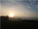 2
2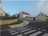 3
3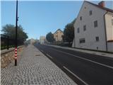 4
4 5
5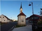 6
6 7
7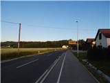 8
8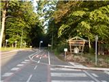 9
9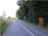 10
10 11
11 12
12 13
13 14
14 15
15 16
16 17
17 18
18 19
19 20
20 21
21 22
22 23
23 24
24 25
25 26
26 27
27 28
28 29
29 30
30 31
31 32
32 33
33 34
34 35
35 36
36 37
37 38
38 39
39 40
40 41
41 42
42 43
43 44
44 45
45 46
46 47
47 48
48 49
49 50
50 51
51 52
52 53
53 54
54 55
55 56
56 57
57 58
58 59
59 60
60 61
61 62
62 63
63 64
64 65
65 66
66
Discussion about the trail Sveti Jurij ob Ščavnici - Gomila