Sv. Andrej - Sveti Ožbolt (above Zminec)
Starting point: Sv. Andrej (610 m)
| Lat/Lon: | 46,1373°N 14,3034°E |
| |
Time of walking: 1 h
Difficulty: easy marked way
Altitude difference: 249 m
Altitude difference po putu: 249 m
Map: Škofjeloško in Cerkljansko hribovje, Kod-Kam, Izletniška karta, 1:50.000
Recommended equipment (summer):
Recommended equipment (winter):
Views: 25.903
 | 3 people like this post |
Access to the starting point:
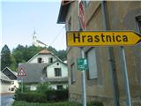
Drive towards Škofja Loka and at the beginning of the road at the semaphorised junction turn left down towards Poljanska dolina (signposted Gorenja vas, Žiri) and drive through the old part of Škofja Loka only to the junction where the road climbs up to the right towards Loško castle and the further route to Poljanska dolina, and at this junction we turn left in the direction of Puštal. Cross the bridge and shortly after you will see a turn-off with a signpost saying Hrastnica. We turn right in this direction and drive along the narrower asphalt road along the Hrastnica stream through the settlements for a while until we see on our right a fork in the asphalt road that climbs a bit more steeply towards St. Andrew (the fork is not currently marked with a signpost). We then drive along the narrower asphalt road that climbs moderately for about 2 km and arrive at St. Andrew, where we find a place where we can park. There is quite a lot of space on the right hand side of the road, and if you visit the Pri Ruparju guest house, they also have quite a lot of parking space for their guests.
Path description:
Bear left up past the Pri Ruparju pub, slightly right uphill through the meadow, and you will see the church of St Andrew a few metres above us on your right. The marked path then leads us in a moderate ascent mostly along the forest road or cart track, part of the way also along a path through the forest. As we leave the forest, a marker on a tree points us sharp left to cart track, and straight ahead we can already see our destination - the church of St. Ožbolt on the hill of the same name. Walk along this cart track for a few minutes, and then the signs direct you slightly left up through the farmyard, and then back to cart track. After a few metres, you can choose to continue along this cart track, which climbs moderately to the top of the hill, or to turn slightly to the left onto a steep, narrow path which leads you more directly to your destination.
From the top, you will have a beautiful view towards Škofja Loka and the surrounding villages, Lubnik, Stari vrh and Blegoš, and of course the higher mountains beyond.

Pictures:
 1
1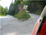 2
2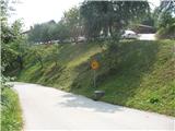 3
3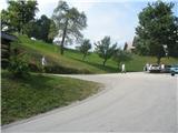 4
4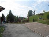 5
5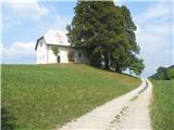 6
6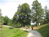 7
7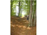 8
8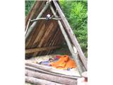 9
9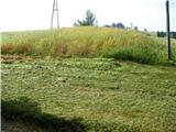 10
10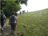 11
11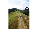 12
12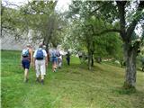 13
13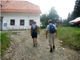 14
14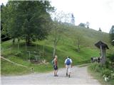 15
15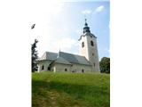 16
16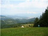 17
17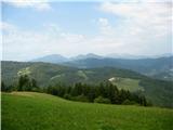 18
18 19
19
Discussion about the trail Sv. Andrej - Sveti Ožbolt (above Zminec)
|
| Lisica21. 03. 2018 |
Danes po tej poti na Sveti Ožbolt. Iz smeri LJ zavijem pred ŠKL levo v smeri nove obvoznice in v predor, ven grem na prvi izvoz, takoj po predoru desno za Puštal in na vrhu ceste zavijem desno v smeri Hrastnice. Naprej kot opisano zgoraj. Ko pridem do parkinga pod gostiščem Rupar je cesta desno okrog, ki gre direkt do cerkve Sv. Andreja zato ne vidim smisla Ruparju hodit po travi. 
|
|
|