Strane - Vojkova koča na Nanosu
Starting point: Strane (664 m)
| Lat/Lon: | 45,7861°N 14,0873°E |
| |
Time of walking: 2 h 15 min
Difficulty: easy marked way
Altitude difference: 576 m
Altitude difference po putu: 650 m
Map: Nanos 1:50.000
Recommended equipment (summer):
Recommended equipment (winter): ice axe, crampons
Views: 27.234
 | 1 person likes this post |
Access to the starting point:
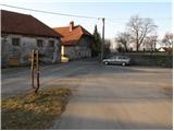
From the Ljubljana - Koper motorway, take the Razdrto exit and follow the parallel old road towards Postojna. Soon you will see signs pointing to the left in the direction of the villages Veliko Ubeljsko and Strane. In the village Malo Ubeljsko you will come to the next crossroads, where you continue slightly right in the direction of Strane (left Veliko Ubeljsko). Follow the road, which climbs slightly further, until you reach the centre of the village Strane, where you will see mountain direction signs. Park a few metres away, near the children's playground (do not park in the playground).
Path description:
Signs for Nanos direct us to a climbing road, which we follow past a few houses. The road soon loses its tarmac surface and only a little higher up turns into a wide cart track, which we continue to climb. Cart track soon turns into a dense forest and leads us past a small well, in a moderate ascent, to a marked crossroads. Continue right in the direction of St Brice (left Nanos) along the path which, after 2 minutes' further walking, leads us to the church.
From Brice, we return to the nearby crossroads, and then continue our ascent in the direction of Nanos. The path continues to climb crosswise along the slightly narrower cart track, which crosses steeper and steeper slopes. The easy path, which opens up some views of the nearby outcrops, leads us higher up to a crossroads where the marked path to Suhi vrh branches off to the right.
Continue straight towards Vojkove huts along the path, which gradually lays down. The path branches off to the right twice more, and in both cases we continue straight on in the direction of Vojka's hut. Higher up, the path climbs steeply for a short time and leads us out of the forest onto the viewing slopes, from which we have a view of the valley and the slopes of the Nanos.
The path continues to climb for some time, then passes to the other side of the ridge, where it descends for a short time. The path continues through a slightly more sparse forest with some short ascents and descents. Follow this pleasant path, which is not technically difficult, all the way to Vojka's hut on Nanos.
Strana - Sveti Bric 45 minutes, Sveti Bric - Vojkova koča 1:30.

Pictures:
 1
1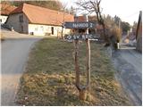 2
2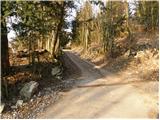 3
3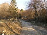 4
4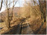 5
5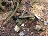 6
6 7
7 8
8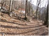 9
9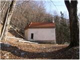 10
10 11
11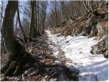 12
12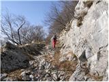 13
13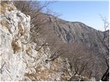 14
14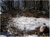 15
15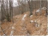 16
16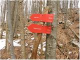 17
17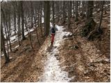 18
18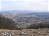 19
19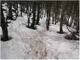 20
20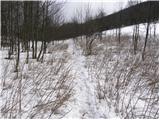 21
21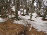 22
22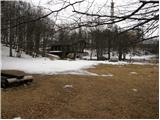 23
23 24
24
Discussion about the trail Strane - Vojkova koča na Nanosu
|
| lipnes10. 02. 2011 |
šla lani poleti z ženo. Lepa turca. samo nazaj grede sva pri sestopu skrenila s poti, ker se ne vidi dobro kje je pot. Sreča da so kmalu neki pohodniki šli mimo in sva jih opazila ter našla stezo. 
|
|
|
|
| darh16. 02. 2011 |
Po tej poti smo se povpeli minuli torek. Razmere so bile precej podobne, kot so na teh slikah; morda je bilo snega še nekaj več. Več pa si lahko preberete tule.
|
|
|