Štore - Srebotnik (via Marija and south approach)
Starting point: Štore (240 m)
| Lat/Lon: | 46,2213°N 15,3215°E |
| |
Name of path: via Marija and south approach
Time of walking: 1 h 45 min
Difficulty: easy marked way
Altitude difference: 460 m
Altitude difference po putu: 540 m
Map: Posavsko hribovje Boč - Bohor 1:50.000
Recommended equipment (summer):
Recommended equipment (winter):
Views: 9.373
 | 2 people like this post |
Access to the starting point:
Štore ideally accessible by rail. By road. . . leave the motorway in Celje and head towards Štore or Šentjur, practically in the centre of Celje. Park your car near the Štore railway station, where there are plenty of parking spaces and also the start of a marked mountain trail.
Path description:
The route starts at the railway station in Štore. Go via Voglajna, where a direction sign immediately points right in the direction of Svetina and shortly afterwards straight through the area of the old Stora Ironworks. Continue along the asphalt road in the lower part by the Bojan ditch to a new fork in the path, where you continue straight ahead, marked ,,past Marija,, left path ,,across Žlajfa,,. Soon the road turns sharp left slightly uphill, flattens out again at the playground in the Pečovje settlement, decades ago a coal mine, and from here we can also follow the signs of Barbara's path and after a few terraced houses turn left onto the forest road, which turns into a forest path at the last homestead. Soon the path "through Bojanski graben" branches off to the left, while we continue right up through the dense forest and when the slope gives way, the path from Celje and Tehari soon joins from the right. Continue left along the forest road by two or three houses/vikends and then left again along a slightly narrower forest path partly also logging trail higher up. The path climbs again a little steeper and there are also a few railings on the left, more as a fence than as a handrail.
A crossroads is soon reached. We could continue straight up, where there are also CPP markings or the inscription Srebotnik but today we take the "slightly around" option, and we go left down by the chapel with the image of the Virgin Mary carved into the wall of Srebotnik. Bench and table with a sign-in box for a short rest. Continue up and along the wide forest path, partly logging trail, reaching a crossroads again with a table and bench, and continue right up the forest road, while straight ahead the path to Svetina continues.
Follow the Gozdnik road for a few hundred metres, it is well fortified, where you turn right again at the crossroads and, with excellent signposting, into the final south ascent to Srebotnik. In the first part, a pleasant forest mountain trail leads us close to the southern precipice wall of Srebotnik. Continue slightly downhill and soon right along the rocky path to the steep final climb to the summit. The last ten metres are protected by ropes for a safer approach to the summit. At the top, we are rewarded with beautiful views.

Pictures:
 1
1 2
2 3
3 4
4 5
5 6
6 7
7 8
8 9
9 10
10 11
11 12
12 13
13 14
14 15
15 16
16 17
17 18
18 19
19 20
20 21
21 22
22 23
23 24
24 25
25 26
26 27
27 28
28 29
29 30
30 31
31 32
32 33
33 34
34 35
35 36
36 37
37 38
38 39
39 40
40 41
41 42
42 43
43 44
44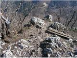 45
45
Discussion about the trail Štore - Srebotnik (via Marija and south approach)
|
| bruny26. 03. 2014 |
Spoštovanje preostalim, nekaterim tudi višjim v Celjskem hribovju ampak No.1 je nekje Srebotnik…Večerno/nočna miniAtura po zgoraj opisani poti, tudi sestop iz strani moje pohodniške malenkosti. Bili smo trije in kolega prvič na Srebotniku. Kar navdušena oba, časa je bilo ravno dovolj, pot brez posebnosti in razgledi lepi s pomočjo umetne svetlobe v dolini Voglajne in Savinje in ,,to je bilo to,,. Ob povratku še skok v sotesko Bojanskega grabna, kjer pa je žled naredil veliko škode, graben je slabo prehoden in pot je bila kar mala avantura med podrtim drevjem in nanosi materiala v strugi. Ponovno uporaba prijazne logistike za prihod/odhod na izhodišče in ob manjku časa v svetlem delu dneva…večerno/nočne prava in optimalna izbira med tednom. Trasa GPS: Srebotnik, 26.03.2014
|
|
|
|
| seinfeld25. 02. 2020 |
Včeraj smo opravili to pot. Res so fenomenalni ti naši hribi okoli Celja. Krvavica, Kamnik, Srebotnik,...kljub nizki višini imajo vse ali še več kot dvatisočaki. Pot na Srebotnik bi lahko bila vsaj delno zahtevna, saj je nekaj mest kjer se zdrs ne bi dobro končal. Mi smo šli gor mimo Marije, dol po grebenu kjer je že v suhem zoprno, v mokrem pa verjetno nevarno.
Če se pride z avtom je bolje parkirati kar v ali pred naseljem Pečovje, ker se pot od železniške po asfaltu precej vleče. V tem letnem času je tudi zrak v Štorah precej slab, ima okus.
Hoja je bila ležerna, v gornjem času, razdalje slabih 8,5km.
|
|
|