Štefanja Gora - Sveti Nikolaj (Možjanca) (by road)
Starting point: Štefanja Gora (705 m)
| Lat/Lon: | 46,2856°N 14,4902°E |
| |
Name of path: by road
Time of walking: 45 min
Difficulty: easy marked way
Altitude difference: -16 m
Altitude difference po putu: 20 m
Map: Karavanke - osrednji del 1:50.000
Recommended equipment (summer):
Recommended equipment (winter):
Views: 1.640
 | 2 people like this post |
Access to the starting point:
a) From the motorway Ljubljana - Jesenice take the exit Vodice, then continue to the first semaphore crossing in Vodice, where you turn left towards Cerkelj na Gorenjskem and Brnik. When you reach the main roundabout at Spodnji Brnik, continue driving in the direction of Cerkeliai and the ski resort Krvavec. At the end of Cerklje na Gorenjskem, leave the main road, which continues towards Velesovo and Visoke, and turn slightly right onto the road towards the ski resort Krvavec. Continue past the bottom station of the cable car to Krvavec, and when the road levels out and leads to a small pass where the village of Štefanja Gora begins, park in a suitable place on the roadside.
b) From the motorway Jesenice - Ljubljana, take the exit Kranj - East, and then continue to Brnik, Komenda and Mengeš. When you reach the main roundabout at Spodnji Brnik, continue driving towards Cerkeliai and the ski resort Krvavec. At the end of Cerklje na Gorenjskem, leave the main road, which continues towards Velesovo and Visoke, and turn slightly right onto the road towards the ski resort of Krvavec. Continue past the bottom station of the cable car to Krvavec, and when the road levels out and leads to a small pass where the village of Štefanja Gora begins, park in a suitable place on the roadside.
Path description:
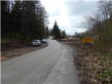
From the starting point, the path to Kopa, Davovec and Krvavec branches off to the right, and we walk along the asphalt road to a crossroads some 10 metres away, where we continue along the lower right road (left Štefanja gora through Spodnja Štefanja vas) in the direction of Mežnar and the church. After the crossroads, you quickly reach the first houses in the hamlet of Zgornja Štefanja vas, and then, when the houses have finished, continue along the slightly right-hand road in the direction of Možjanca (left St Stephen's Church on Štefanja Gora). The road continues along the pasture for a while, and then passes into the forest. There is a slight descent, then the forest thins out and the path opens up to some views of Gorenjska. After a few minutes of crossing, you reach the first houses, then a crossroads, where you continue to the right towards the Church of St Nicholas (1 minute), or straight towards the Rožmarin cafeteria (2 minutes).
Description and pictures refer to the situation in 2016 (April).

Pictures:
 1
1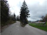 2
2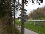 3
3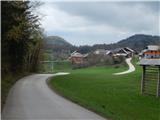 4
4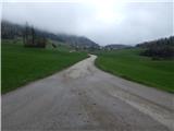 5
5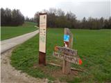 6
6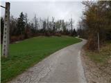 7
7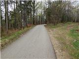 8
8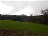 9
9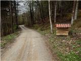 10
10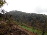 11
11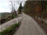 12
12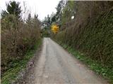 13
13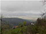 14
14 15
15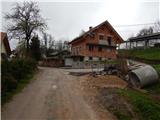 16
16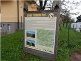 17
17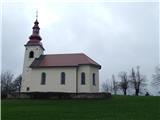 18
18
Discussion about the trail Štefanja Gora - Sveti Nikolaj (Možjanca) (by road)