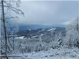
Stara Žaga - Veliki Javornik (Bohor) (via Skalica)
Starting point: Stara Žaga (518 m)
| Lat/Lon: | 46,08884°N 15,41743°E |
| |
Name of path: via Skalica
Time of walking: 2 h 10 min
Difficulty: easy marked way
Altitude difference: 505 m
Altitude difference po putu: 505 m
Map: Celjska kotlina, 1:50000
Recommended equipment (summer):
Recommended equipment (winter):
Views: 2.590
 | 1 person likes this post |
Access to the starting point:
Veliki Javornik, the highest peak of Bohor, can also be climbed from Planina pri Sevnici or from the hamlet of Stara Žaga below it, where there is a large parking lot next to the bus station with signposts to Skalica, Koča na Bohorju and Lisca. You can get here from Sevnica, Šentjur or from Rimske Toplice through the Gračnice valley.
Path description:
From the starting point Stara Žaga, follow the signs to Skalica along the asphalt road towards Bohor. About 100 metres later, leave the road behind the houses to the right and follow a pleasant forest path up to a clearing with a hunting observation post and a feeding station. Then the forest welcomes you back. Higher up, you reach a dirt road, which you first cross and then follow, gently downhill in the last part. We arrive at Hunting lodge Bohor, which stands on a saddle below the top of Možnice. Continue along the forest road, following the signs, towards Skalice. Before it, you will come to a large crossroads. The right path leads to the precipitous peak Skalica, and we take the left path towards Veliki Javornik (and onwards to Koča na Bohorju).
We continue eastwards. Soon we get on the road and reach a crossroads below Veliki Javornik, which we climb by cart track and a steep track. At the top we are greeted by a large meadow where, at the highest point, a concrete pillar with a registration box and a stamp is erected. Unfortunately, the top is not visible, so it is worth crossing the meadow to the west, where an excellent viewpoint opens up with a bench and a view to the west.

Pictures:
 1
1 2
2 3
3 4
4 5
5 6
6 7
7 8
8 9
9 10
10 11
11 12
12 13
13 14
14 15
15 16
16 17
17 18
18 19
19 20
20 21
21 22
22 23
23 24
24 25
25 26
26 27
27 28
28 29
29 30
30 31
31 32
32 33
33 34
34
Discussion about the trail Stara Žaga - Veliki Javornik (Bohor) (via Skalica)
|
| garmont6. 04. 2022 14:43:47 |
Zaradi del na glavni cesti, parkiranje pri AP zaenkrat ni mogoče. Tudi smernih tabel pri postaji ni. So pa cca 100 metrov naprej, tako, kot je opisano.
|
|
|