Stara Fužina - Jezerski Stog (čez planino Krstenica in Jezerski preval)
Starting point: Stara Fužina (573 m)
| Lat/Lon: | 46,2903°N 13,8868°E |
| |
Name of path: čez planino Krstenica in Jezerski preval
Time of walking: 4 h 50 min
Difficulty: partly demanding unmarked way
Altitude difference: 1467 m
Altitude difference po putu: 1535 m
Map: Triglav 1:25.000
Recommended equipment (summer):
Recommended equipment (winter): ice axe, crampons
Views: 9.842
 | 2 people like this post |
Access to the starting point:
From the Ljubljana - Jesenice motorway, take the Lesce exit and follow the road towards Bled and on to Bohinjska Bistrica. Continue towards Bohinjsko jezero (Ribčev laz), at which you will come to a crossroads where you will turn right towards Stara Fužina. At Stara Fužina, at the crossroads by the chapel, turn sharp left onto the ascending road towards mountain pasture Blato, mountain pasture Vogar and the Voja valley. Follow this road to the parking lot where tolls and parking fees are collected.
Path description:
From the parking lot, continue right towards the Mostnice riverbeds along a wide path, which will take you to the Devil's Bridge in a few minutes, from which you can get your first view of the riverbeds. At the bridge, turn left onto a minor road, which you follow for a short distance, as the signs for the troughs then direct you to the right onto a well-maintained tourist trail. The path ahead soon leads us to the central trough, along which we then climb steeply. During the ascent along the troughs, we come across the "Elephant" markers (a rock hollowed out by water in the shape of an elephant - worth a look). The way forward continues to climb for some time along Mostnica, then turns slightly to the left, where after a few minutes of further walking it leads us to a forest road leading towards the valley of the Voja valley. Follow the road to the right and it will quickly lead you to the NOB monument (you can also drive here, this will shorten the journey by about 45 minutes).
At the monument, leave the road and continue to the left following the gently sloping cart track, which quickly leads to a small crossroads where you continue along the left marked path. The ascent continues on a moderately steep path which, after a short climb, leads to a woded ridge. Here the path turns to the right and transitively lays down. A little further along the way you will notice a small cross, and the path from here on becomes steeper and steeper.
For some time, the path climbs steeply through the dense forest. At an altitude of approximately 1300 m, the path is laid, and a few metres higher up it leads us to a place where we cross the unmarked path mountain pasture Blato - mountain pasture Zgornja Grintovica. The crossing of this path is almost imperceptible, as there are a lot of fallen trees covering both paths.
Continue in the same direction and soon you will rejoin the well-traced, but less well-marked path. The way ahead climbs for some time through the dense forest and then slowly approaches the nearby mountain pasture. Higher up, the forest becomes thinner and the path less steep. A little further on, we emerge from the forest, where the unspoilt world of mountain pasture Krstenica opens up before us. Again a less visible path, it turns slightly to the left and leads us first in a moderate ascent and then in a slight descent to the shepherds' tents at mountain pasture Krstenica. From mountain pasture continue along the path which is initially slightly less visible on the west (left) side of mountain pasture. After a few tens of metres, several smaller paths merge into one clearly visible path. The path continues with a few short ascents and descents, crossing the slopes of Krstenišký (Little) and later Jezerski Stog. After about half an hour's walk from mountain pasture Krstenica, the path leads us into the grassy world of the abandoned mountain pasture Jezerce.
From mountain pasture Jezerce, continue to the right along the marked path, which begins to climb steeply over the grassy slopes. After 40 minutes of further walking, the path leads us to Jezerski preval, from which we have a beautiful view towards Triglav.
Continue to the right (straight down mountain pasture below Mišelj vrh) on the unmarked path, which leads us along an increasingly scenic ridge to the steep summit slope of the mountain. Here the path climbs steeply and leads to the summit within 5 minutes of further walking (this part of the path is dangerous for slipping due to the considerable steepness).

Pictures:
 1
1 2
2 3
3 4
4 5
5 6
6 7
7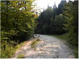 8
8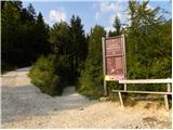 9
9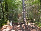 10
10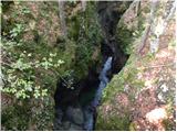 11
11 12
12 13
13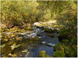 14
14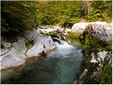 15
15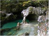 16
16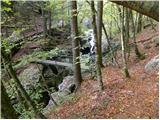 17
17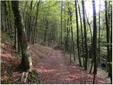 18
18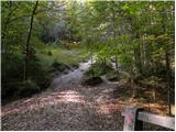 19
19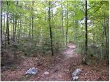 20
20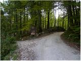 21
21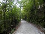 22
22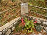 23
23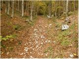 24
24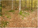 25
25 26
26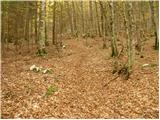 27
27 28
28 29
29 30
30 31
31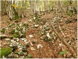 32
32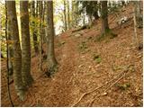 33
33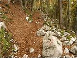 34
34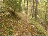 35
35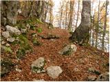 36
36 37
37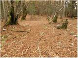 38
38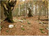 39
39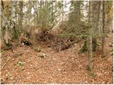 40
40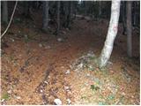 41
41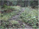 42
42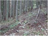 43
43 44
44 45
45 46
46 47
47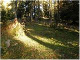 48
48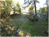 49
49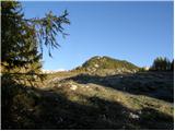 50
50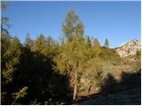 51
51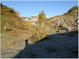 52
52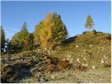 53
53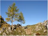 54
54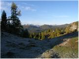 55
55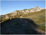 56
56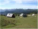 57
57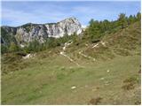 58
58 59
59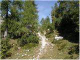 60
60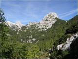 61
61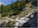 62
62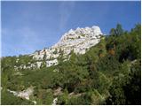 63
63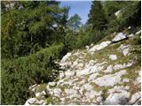 64
64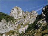 65
65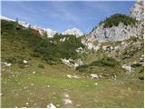 66
66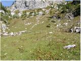 67
67 68
68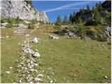 69
69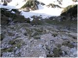 70
70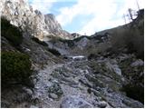 71
71 72
72 73
73 74
74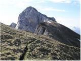 75
75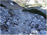 76
76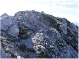 77
77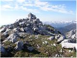 78
78
Discussion about the trail Stara Fužina - Jezerski Stog (čez planino Krstenica in Jezerski preval)
|
| NENSY5. 10. 2009 |
Včeraj prehodila to pot,vreme jasno in sončno,razgled enkraten.Triglav na dlani.Priporočam obisk!
|
|
|
|
| exwannabe26. 06. 2021 22:28:26 |
Prvi del poti iz Voj je res lepo strm. Kar nekaj težav pa se lahko pojavi v delu, ko strmina nekoliko popusti in se pot delno poravna (glede na opis bi to naj bilo na okoli 1300 m višine). V tem delu, pa skoraj do pl. Krstenice je bilo veliko posekanega drevja in narejenih veliko vlak. Tako si s slikami zgoraj, v tem delu poti ni kaj dosti za pomagati saj je dejansko stanje na terenu povsem drugačno. Zaradi praktično goloseka markacij takorekoč ni. Zato je med vsemi vlakami lahko orientacija kar zahtevna , še posebno za prvopristopnike. Vsekako priporočljivo nekaj smisla za orientacijo. Upam pa da ta del poti kmalu ustrezno označijo.
|
|
|