Starting point: Srednja vas (583 m)
| Lat/Lon: | 46,2975°N 13,9231°E |
| |
Time of walking: 1 h 30 min
Difficulty: easy unmarked way, easy pathless terrain
Altitude difference: 419 m
Altitude difference po putu: 440 m
Map: TNP 1:50.000
Recommended equipment (summer):
Recommended equipment (winter): ice axe, crampons
Views: 3.900
 | 2 people like this post |
Access to the starting point:
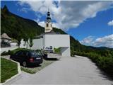
Z avtoceste Ljubljana - Jesenica se usmerimo na izvoz Lesce in cesti sledimo proti Bledu in naprej proti Bohinjski Bistrici. Le malo pred Bohinjska Bistrica, pri naselju Bitnje, nadaljujemo ostro desno v smeri Pokljuke. Po krajšem vzponu se cesta položi in nas hitro pripelje v Zgornjo Bohinjsko dolino. Tu v križišču nadaljujemo levo (desno Pokljuka) in cesti naprej sledimo do Srednje vasi. Tu v drugem delu vasi opazimo oznake za cerkev sv. Martina, ki nas usmerijo desno na ožjo in precej strmo cesto, po kateri nato hitro prispemo do cerkve in osnovne šole. Parkiramo na primernem mestu ob šoli ali cerkvi, urejeno javno parkirišče pa se nahaja približno 15 minut stran ob vznožju smučišča Senožeta. .
Path description:
From the church parking lot, walk a few steps down to the primary school, and from there continue towards the viewpoint on Kresu. The way forward leads us along a narrower asphalt road, which quickly leads to a larger water reservoir, where we see signs for Uskovnica. Continue along cart track, which turns into a forest, and at the right-hand bend, step out of the forest and a beautiful view of Rudnica and part of the Upper Bohinj valley opens up. Continue along cart track, which leads through a slightly narrower passage, then in a cross-climb to a place where you reach the road leading to Uskovnica. The road reaches the beautifully landscaped lookout point at Kres, from which a view opens up towards Srednji vas, the Upper Bohinj valley and the Lower Bohinj mountains in the background. Continue along the road for a short distance, and then at the end of a gentle left-hand bend, signs for Uskovnica direct you right to cart track, which leads you through the forest, lane of bushes, and higher up through the forest again. A few minutes higher, we reach the dirt road again, but this time we stay on it for a longer time and leave the marked trail, which continues along cart track. There is a longer traverse to the left, where we occasionally get some views, but otherwise we mostly climb through the forest. Higher up on the left we can already see the first huts on the mountain pasture Blatka, and we continue climbing along the road for a few minutes, leaving the road to the left, when the road turns slightly to the left, leading to the nearby hut.
From the hut, continue along the lesser cart track, which leads up to the upper part of mountain pasture, where there is another hut. At this hut, go slightly left and climb across the meadow to the edge of the woods, where you will find cart track, which climbs through the woods across to the right. Cart track climbs in a few serpentines and quickly turns into a forest track, which is a little harder to follow higher up due to foliage. The track soon lays down and leads to the south side of the ridge, where in a few 10 steps you reach the Studor airstrip.
From the airstrip, where there are a few benches and a wonderful view, continue slightly left, returning to the forest, and continue walking on the easier trackless path. There are a few short ascents and descents, and we walk until we reach the top marked with a metal pole, which is about 15 minutes from the airstrip. Srednja vas - mountain pasture Blatce 0:55, mountain pasture Blatce - Studor 0:35.
The description refers to the situation in February 2020 and the images are from different periods.

Pictures:
 1
1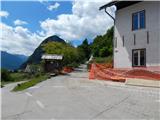 2
2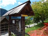 3
3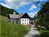 4
4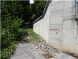 5
5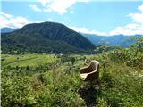 6
6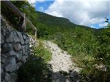 7
7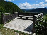 8
8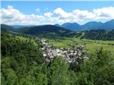 9
9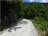 10
10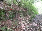 11
11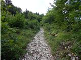 12
12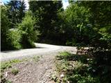 13
13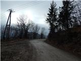 14
14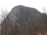 15
15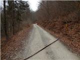 16
16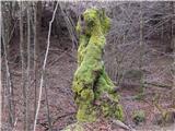 17
17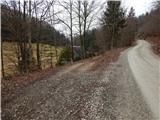 18
18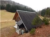 19
19 20
20 21
21 22
22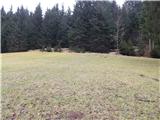 23
23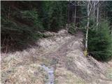 24
24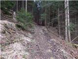 25
25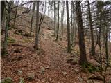 26
26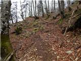 27
27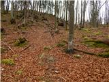 28
28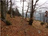 29
29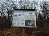 30
30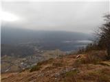 31
31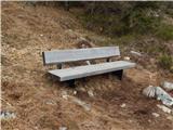 32
32 33
33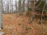 34
34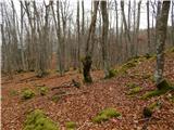 35
35 36
36 37
37 38
38 39
39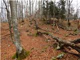 40
40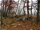 41
41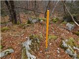 42
42
Discussion about the trail Srednja vas - Studor