Srednja vas - Planina Blatce
Starting point: Srednja vas (583 m)
| Lat/Lon: | 46,2975°N 13,9231°E |
| |
Time of walking: 55 min
Difficulty: easy unmarked way
Altitude difference: 305 m
Altitude difference po putu: 305 m
Map: TNP 1:50.000
Recommended equipment (summer):
Recommended equipment (winter): ice axe, crampons
Views: 618
 | 2 people like this post |
Access to the starting point:
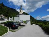
From the motorway Ljubljana - Jesenica take the exit Lesce and follow the road towards Bled and on to Bohinjska Bistrica. Just before Bohinjska Bistrica, at Bitnje, take a sharp right in the direction of Pokljuka. After a short climb, the road flattens out and quickly leads into the Upper Bohinj Valley. Here, at the crossroads, continue left (Pokljuka on the right) and follow the road to Srednja vas. Here, in the second part of the village, you will see signs for St Martin's Church, which direct you to the right onto a narrower and rather steep road, which you will then quickly follow to the church and the primary school. Park in a suitable place next to the school or church, and there is a public parking lot about 15 minutes away at the foot of the Senožeta ski slope.
Path description:
From the church parking lot, walk a few steps down to the primary school, and from there continue towards the viewpoint on Kresu. The way forward leads us along a narrower asphalt road, which quickly leads to a larger water reservoir, where we see signs for Uskovnica. Continue along cart track, which turns into a forest, and at the right-hand bend, step out of the forest and a beautiful view of Rudnica and part of the Upper Bohinj valley opens up. Continue along cart track, which leads through a slightly narrower passage, then in a cross-climb to a place where you reach the road leading to Uskovnica. The road reaches the beautifully landscaped lookout point at Kres, from which a view opens up towards Srednji vas, the Upper Bohinj valley and the Lower Bohinj mountains in the background. Continue along the road for a short distance, and then at the end of a gentle left-hand bend, signs for Uskovnica direct you right to cart track, which leads you through the forest, lane of bushes, and higher up through the forest again. A few minutes higher, we reach the dirt road again, but this time we stay on it for a longer time and leave the marked trail, which continues along cart track. There is a longer traverse to the left, where we occasionally get some views, but otherwise we mostly climb through the forest. Higher up on the left we can already see the first huts on the mountain pasture Blatka, and we continue climbing along the road for a few minutes, leaving the road to the left, when the road turns slightly to the left, leading to the nearby hut.
The description refers to the situation in February 2020 and the pictures are from different periods.

Pictures:
 1
1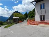 2
2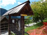 3
3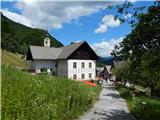 4
4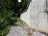 5
5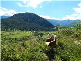 6
6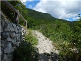 7
7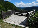 8
8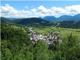 9
9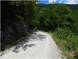 10
10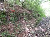 11
11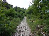 12
12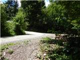 13
13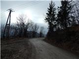 14
14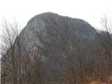 15
15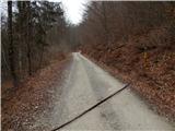 16
16 17
17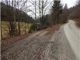 18
18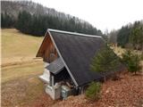 19
19
Discussion about the trail Srednja vas - Planina Blatce