Sopota - Kum (Nežina pot)
Starting point: Sopota (544 m)
| Lat/Lon: | 46,06416°N 15,05664°E |
| |
Name of path: Nežina pot
Time of walking: 2 h
Difficulty: easy marked way
Altitude difference: 676 m
Altitude difference po putu: 687 m
Map: Posavsko hribovje - zahodni del (PZS)
Recommended equipment (summer):
Recommended equipment (winter):
Views: 44.400
 | 4 people like this post |
Access to the starting point:
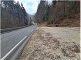
Sopota in the Sopota river valley can be reached via Radeče or via Šmartno pri Litija. From Šmartno, drive in the direction of Mirna and Gabrovka, but pay attention when the road turns left in the direction of Radeče - follow this road to Sopota, where you will soon see a parking lot on the left side of the road, where you can park. The starting point of the route is about 100 m further along the road, where we are directed to the route by the signs Nežina pot and Kum, at the starting point there is also a large sign with a map of the route. From Radeče go straight through the centre towards the paper mill and Sopota, at Sopota you will see the described starting point on the right and continue for another 100 m to the parking lot on the right.
Path description:
At the starting point, you can read the legend of Nežka, Jošto and Jernej on a board with a map, and excerpts from the legend are also written on the boards next to the individual points in the story that you meet along the way. The signposts for Nežka's path (red board) and for Kum (wooden marker), which will show us the way almost to the top, first point us to the right. Shortly before the first house, the signpost points to the left, where the path climbs over a grassy slope and leads into the forest. There we follow the cart track as indicated by the signs, which soon lead us slightly to the left, with cart track on the forest path. This leads to a stream which runs through the forest and is crossed by a wooden bridge. After the bridge, the path leads us steeply to the left and soon leads us to a wooden fence and we are at the first point in the legend, where Nežina's tears still flow from the rocks. The cross at the Tears of St Neza also stands at this point. We continue along the path, which climbs through the forest and after a short time leads us to a grassy slope where we see the first houses of the village of Borovak, which we approach on the right-hand side of the meadow. Just below the first house, a marker directs us to the left under the house, which we pass on the left side, and the path then leads us between a few houses to the next point, the branch church of St Ursula. Above the church, the path joins the road, where we first meet Knafelč's markings, which we follow to the right. The slightly less interesting part of the trail between Borovak and Mali Kum follows the road past the excursion farm in Mali Kum, and then the signs lead you back into the forest. The path starts to climb a little steeper, and after a short climb, which in spring is watered with bluebells and crowns, you reach the rock with the imprints of Neza's knees and the Chapel of St. Neza. Above the chapel, the path turns right and continues to climb, slipping slightly in the wet in some of the steeper parts. The path climbs through the forest to the right, joining the path from Radeče and Zidanega Most at the top. At the crossroads, where you continue left along the forest path, there is also the Chapel of St. Jošta. After a short, not too steep climb through the forest, you will first see the transmitter, and then the mountain lodge and the church of St. Neže on Kum.
The Nežina Trail is well marked throughout, with yellow and white markings in addition to the signposts. There are no problems with orientation. Unlike the trails leading to Kum from Zasavje, this trail is shorter and, as it has a lower altitude difference, less strenuous. The situation described refers to March 2021.

Pictures:
 1
1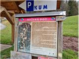 2
2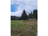 3
3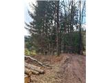 4
4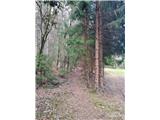 5
5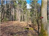 6
6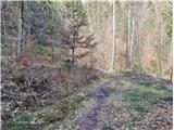 7
7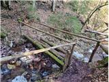 8
8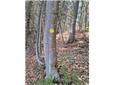 9
9 10
10 11
11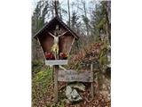 12
12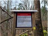 13
13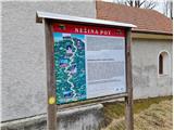 14
14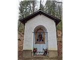 15
15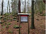 16
16 17
17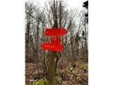 18
18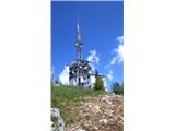 19
19 20
20 21
21
Discussion about the trail Sopota - Kum (Nežina pot)
|
| darkom31. 10. 2021 17:25:59 |
Dne 31/10/21 sem prehodil omenjeno pot.
Pot je zelo dobro označena, brez posebnosti in normalno prehodna.
|
|
|
|
| Savinja112. 10. 2022 19:06:24 |
Danes na tej poti. Pot je natančno opisana, na terenu se vse ujema in je res super označena. Je zanimiva in na vrhu je poplačan ne prehud trud z zares lepimi razgledi in dobrotami v koči. Poldnevni planinski izlet je primeren prav za vse. Manjšim oz. mlajšim otrokom, pa tudi komu drugemu, lahko pohod skrajšamo, če parkiramo na manjših parkiriščih v zaselkih Borovak (pri cerkvi sv. Uršule - 707m) ali v Malem Kumu (levo na začetku zaselka - 812m). Gre za miren in lep podeželski kotiček Slovenije. Pot večinoma poteka po gozdu, po asfaltni cesti le med omenjenima zaselkoma.
|
|
|
|
| Krux1. 11. 2024 17:33:38 |
S kužkom, ki je navajen hoje v hribe, se da lepo prit po tej poti do vrha - ni posebnih nevarnosti, kot prepadi itn. Vmes je vas, kjer imajo ovce, verjetno v sezoni pa tudi na paši krave - takrat privežite obvezno, če pes rad preganja. Pot pa sicer preči tudi ozko dvorišče, kjer imajo kotlo in verigo za psa pripet. Ko smo šli mi mimo, ni bilo psa, kar je še kar sreča, drugače ne vem kako bi obšli to dvorišče.
|
|
|
|
| kofe30. 11. 2025 12:52:17 |
Lepa pot. Z malo snega je še vedno zelo lepo prehodna 30.11. Na MaPZS alikaciji GPX odstopa od markacij po travnatem pobočju in vas vodi skozi domačijo namesto levo. V izogib konfliktu z lokalcem ki si je tam zablokiral cesto je boljša opcija da se držite ceste kot je tu opisano. Smerokaz je tam rahlo skrit.
|
|
|