Skalnica - Vodice (path through trenches)
Starting point: Skalnica (320 m)
| Lat/Lon: | 45,9872°N 13,6619°E |
| |
Name of path: path through trenches
Time of walking: 1 h 45 min
Difficulty: partly demanding marked way
Altitude difference: 331 m
Altitude difference po putu: 520 m
Map: Goriška - izletniška karta 1:50.000
Recommended equipment (summer): helmet, lamp
Recommended equipment (winter): helmet, crampons, lamp
Views: 4.225
 | 1 person likes this post |
Access to the starting point:
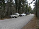
a) Drive to Nova Gorica, then continue to Tolmin and Kobarid. Follow the main road towards Tolmin only as far as Solkan, where at the semaphoreised junction turn right towards Sveta Gora and Grgar. The ascending road continues past the quarry Solkan, then turns sharp right at a slightly higher altitude and leads to the Skalnica Inn, after which continue slightly left in the direction of Sveta Gora. Continue along the narrow asphalt road, parking at a suitable place along the road (preferably before the first cross, which you will notice on the left side of the road).
b) From Tolmin or Most na Soči take the main road towards Nova Gorica, then just before Nova Gorica, more precisely at the traffic lights at Solkan, turn left in the direction of Sveta Gora and Grgar. The ascending road leads us past the quarry Solkan, then a little higher up it turns sharp right and leads us to the Skalnica Inn, after which we continue slightly left in the direction of Svete Gora. Continue along the narrow asphalt road, parking at a suitable place along the road (preferably before the first cross, which you will notice on the left side of the road).
c) From Goriško Brda, drive to Solkan, where at the first crossroads after the new Solkan bridge, continue straight on towards Svete Gora. The ascending road continues past the quarry Solkan, then turns sharp right at a slightly higher elevation and leads to the Skalnica Inn, after which we continue slightly left in the direction of Svatá Gora. Continue along the narrow asphalt road, parking at a suitable place along the road (preferably before the first cross, which you will notice on the left side of the road).
Path description:
From where you parked, first walk to the first cross, and from there continue slightly left on the marked footpath leading to Sveto Gora. After about 50 metres from the cross, you will come to a small crossroads, where you continue to the right along the ditch path (straight ahead Sveta Gora - easy path).
The ditch path splits again just a few metres further on and we continue right into the cavern (a slight left path that bypasses the first and second caverns). A head torch will come in handy further on, as will a helmet due to the low ceiling in places and the risk of falling rocks. On the other side of the first cavern, the path turns slightly left and climbs moderately through the forest. Higher up, you reach the second cavern, which is relatively short. When you come out of it, you return to the path that bypassed the first two caverns, which is a few minutes shorter.
The path becomes steeper, and leads along and around the former military trenches. A little higher up, we reach a beautiful lookout point, which is only a few steps from the path (from the lookout point we have a nice view of the two Solkan bridges, Nova Gorica and Sabotin). Above the lookout point, the path flattens out, and then fully approaches the asphalt road that leads to Sveto Gora (Sveto Mountain).
At the point where the road is fully approached, you will see the entrance to the third cavern, 260 metres long. Here you will put your helmet and torch back on and descend into the cavern, where you will also be guided by a sign above its entrance. The route through the cavern is quite slippery at first and quite steep, as there are not only thick ropes to help us, but also cairns in several places. Higher up, the path or cavern becomes more steep, and all the fixed safety gear end as well. A few minutes' walk later, the path leads out of the cavern, where it joins the path from Grgar.
Here, turn right and continue your ascent along the path that climbs crosswise through the forest. The path continues past a few small caverns and then climbs a little more and leads us to Frančiškov hrib, which offers a beautiful view.
From Frančiškov hrib we continue along a wide ridge path, which in just over 5 minutes of further walking takes us to the cemetery and a few 10 metres further on to the top of Svete Gora. You will mostly pass the church, the pub and other buildings on your right, and then continue down the stairs on your right to the nearby parking lot.
From the parking lot, continue along the road towards Vodice and the Three Shrines Equestrian Trail (signposts are located slightly above the parking lot, specifically at the nearby crossroads), which loses its tarmac surface and descends gently. The road then descends through low forest for the most part, but still occasionally offers a fine view towards Krno and the surrounding mountains. After a descent of about 150 metres, you reach a small pass called Preški vrh, where several forest roads cross.
From the prevala, continue straight along the less ascending road in the direction of Vodice, which you leave only a few 10 steps further on, as the markings lead you to the left on a marked footpath. The path ahead returns to low forest and then continues on a moderate ascent. The path continues past several ditches and a few caverns from the First World War, and then climbs slightly steeper. The steepness quickly subsides and the relatively gentle path leads out of the forest and onto an overgrown meadow, from which you can already see the Vodice peak, on which the mausoleum of General Gonzaga stands and which is reached after a further 10 steps.

Pictures:
 1
1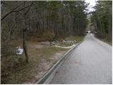 2
2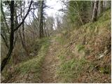 3
3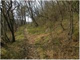 4
4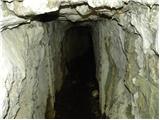 5
5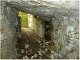 6
6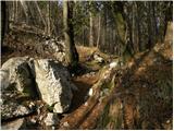 7
7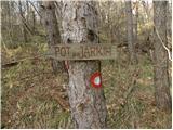 8
8 9
9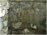 10
10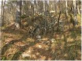 11
11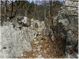 12
12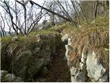 13
13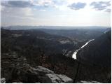 14
14 15
15 16
16 17
17 18
18 19
19 20
20 21
21 22
22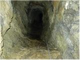 23
23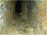 24
24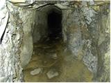 25
25 26
26 27
27 28
28 29
29 30
30 31
31 32
32 33
33 34
34 35
35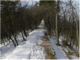 36
36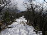 37
37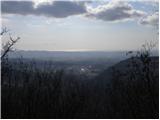 38
38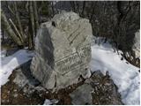 39
39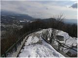 40
40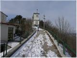 41
41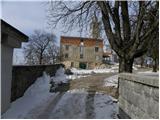 42
42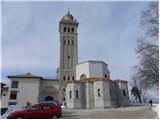 43
43 44
44 45
45 46
46 47
47 48
48 49
49 50
50 51
51 52
52 53
53 54
54 55
55 56
56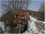 57
57 58
58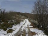 59
59 60
60 61
61 62
62 63
63 64
64 65
65 66
66 67
67 68
68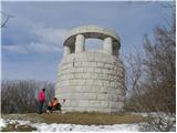 69
69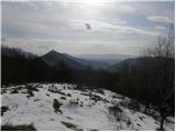 70
70
Discussion about the trail Skalnica - Vodice (path through trenches)