Skadanščina - Slavnik (via Planina Jegno)
Starting point: Skadanščina (550 m)
| Lat/Lon: | 45,54791°N 14,01324°E |
| |
Name of path: via Planina Jegno
Time of walking: 2 h 10 min
Difficulty: easy marked way
Altitude difference: 478 m
Altitude difference po putu: 535 m
Map: Slovenska Istra - Čičarija, Brkini in Kras 1:50.000
Recommended equipment (summer):
Recommended equipment (winter): ice axe, crampons
Views: 15.519
 | 1 person likes this post |
Access to the starting point:
From the Ljubljana - Koper motorway, take the Kozina exit and follow the road towards Rijeka. Just after Materija, you will see signs for Skadanščina, which will direct you to the right onto a narrower and in the last part also ascending road. At a small junction in the middle of Skadanščina, bear slightly right and continue through the village. Follow this road past a small sports field and then park in one of the roadside car parks.
Path description:
From the starting point, continue along the road along which you parked, which quickly leads to a small triangular crossroads. At this junction, continue straight ahead and ascend along a worse macadam road, which quickly leads to a larger turning point. The route continues along the wide cart track, which first descends moderately and then continues without any major changes in elevation. After about half an hour's walk, you reach a large watering place for animals, where you also get onto a dirt road. Follow the road to the left, which soon turns slightly to the right and then climbs steeply westwards. After a few minutes of climbing along the road, you will notice signs on a tree directing you to the left on a footpath (there is also a metal pole at the crossroads, on which there used to be mountain direction signs), and if you continue straight ahead you will arrive at mountain pasture Jegno (it is also possible to climb Slavnik via the above-mentioned mountain pasture).
The trail continues up the footpath and then rejoins the forest road. Follow the road slightly upwards, along which you will see some markings, and walk along it for a few minutes, then the markings will direct you to the left onto a pleasant path. A few minutes of easy walking over partly grassy slopes follows, then cross the slightly wider cart track. Continue along the poorly visible path, along which you can see a number of obliterated markings (a few markings still remain). The way ahead gradually starts to climb steeper, and leads us higher up to a forest road. Follow the road to the right, but walk along it for only a few steps, and then the faint markings direct you left onto the ascending footpath. The path climbs steeply at first, then turns left, where it dips slightly. A few minutes of cross-climbing to the left follows, and then the path leads us out of the forest onto a grassy slope, over which we climb in a few minutes to the road leading to Slavnik. Once on the road, continue to the left, and we can already see the Slavnik peak in front of us, which can be reached either by the aforementioned road, or by a slightly shorter footpath.

Pictures:
 1
1 2
2 3
3 4
4 5
5 6
6 7
7 8
8 9
9 10
10 11
11 12
12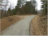 13
13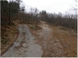 14
14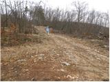 15
15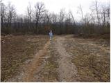 16
16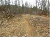 17
17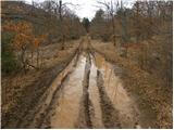 18
18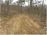 19
19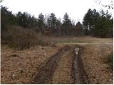 20
20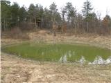 21
21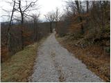 22
22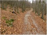 23
23 24
24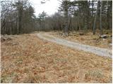 25
25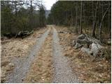 26
26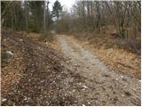 27
27 28
28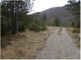 29
29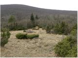 30
30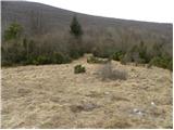 31
31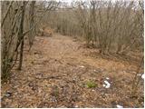 32
32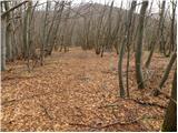 33
33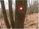 34
34 35
35 36
36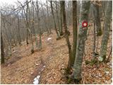 37
37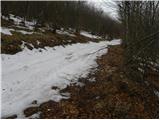 38
38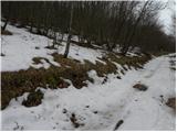 39
39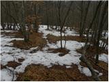 40
40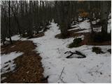 41
41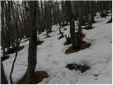 42
42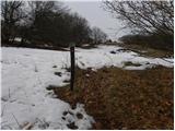 43
43 44
44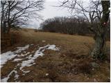 45
45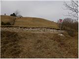 46
46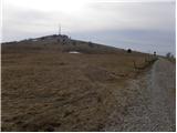 47
47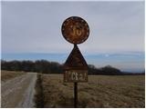 48
48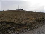 49
49 50
50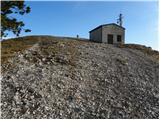 51
51 52
52 53
53
Discussion about the trail Skadanščina - Slavnik (via Planina Jegno)
|
| andi21. 06. 2014 |
Prejšnji mesec sem zgornjo pot opravil iz Markovščine in nato krožno čez planino Jegno. Zelo lepa pot, vendar bi bilo mogoče bolje, če bi se jo postopoma opustilo. Gozdovi pod Slavnikom na to stran so pravi gozdni rezervat, poln divjih živali (srnjad, zajci), na sredi poti pa mi je strah in spoštovanje nagnalo še srdito renčanje (volk?) kakšnih sto metrov od mene iz gozda. Previdno sem se umaknil, počutil sem se kot vsiljivec na nedotaknjenem področju  . Glede na to, da so markacije tako in tako le na vsakih 10 minut hoje, bi se jih morda skupaj s smerno tablo (ki je še vedno na vrhu) lahko odstranilo in pustilo živalim njihov mir, je pa res da je doživetje divjine edinstveno.
|
|
|
|
| Eisheth16. 03. 2017 |
Živjo, je ta pot še slabo označena ali so bile vmes markacije obnovljene? Hvala 
|
|
|
|
| Eisheth10. 07. 2017 |
Pot je dobro vidna, dobro označena. Pride se pa z zmernim tempom v uri in pol.
|
|
|
|
| rasto_r22. 03. 2021 |
Pot je na novo, odlično označena in markirana. Tudi cesta do Skadanščine je na novo asfaltirana. Parkiranje je možno tik pred vasjo, parkirišče na desni strani.
|
|
|