Sežana - Veliki Medvejk / Monte Orsario (via the Karst living museum, Orlek and Fernetiči)
Starting point: Sežana (353 m)
| Lat/Lon: | 45,69894°N 13,87028°E |
| |
Name of path: via the Karst living museum, Orlek and Fernetiči
Time of walking: 2 h 30 min
Difficulty: easy marked way
Altitude difference: 119 m
Altitude difference po putu: 119 m
Map: Poti so zadovoljivo vrisane na OpenStreetMap in v aplikaciji maPZS
Recommended equipment (summer):
Recommended equipment (winter):
Views: 603
 | 1 person likes this post |
Access to the starting point:
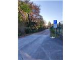
By car: leave the motorway between the Gabrk junction at Divača and the Fernetiči border crossing at exit Sežana-East (the first one after the aforementioned junction). From the exit, turn left, i. e. towards Sežana. Shortly after the exit, there is a semaphore-controlled junction where the regional road from Nova Gorica joins from the right and the local road from Divača joins from the left. Continue straight ahead and just after this junction you will arrive in Sežana. At the next traffic lights, turn left onto Bazoviško cesta (signposted to Lipica), cross the railway line on the overpass, turn right at the roundabout and then go straight ahead at the next roundabout (direction ZGRS Sežana or the Living Museum of Karst). A little further on from the firefighters, where the asphalt ends and a road sign prohibits further traffic for anyone except landowners, you will see a free parking area on the right, where you can park for free. You can also park earlier somewhere in the centre of Sežana, but during the week parking there may be time-limited and/or chargeable.
By train: unfortunately there is no level crossing near Sežana train station, so head east along Kosovelova Street all the way to the end and then turn right onto Bazoviško Street. Cross the railway over the overpass, immediately turn right at the roundabout, and then go straight ahead at the next roundabout (towards ZGRS Sežana or the Living Museum of Karst). A little further on from the firefighters, the asphalt ends, and on the right you will see a parking lot, which serves as the starting point of the route.
Path description:
Warning: the route leads through Italian territory, which is reached via the remote cart track, so be sure to check before you go whether one or other of the countries may have temporarily frozen the implementation of the Schengen regime, where border crossings outside the official border crossing points are not allowed. Make sure you carry a valid identity document (ID card or passport) in case you come across patrols searching for illegal migrants in remote areas.
The Slovenian part of the route coincides with the official Sonja Mašera mountain trail, which leads from Sežana to Trieste, but you will hardly find any PZS markings along the way. However, the Living Karst Museum (ŽMK) has marked the trail all the way to Orlek in a very exemplary way. From the starting parking lot, take the wide macadam road south (ŽMK marked towards Bazovica). Along the way, at numerous forks, ŽMK signs point us towards a number of places of interest a little off the main route, which we can visit if we wish. It should be borne in mind that the attractions are on average about 1 km away from the main route, so that a visit adds quite a bit to the duration of the route. If you are not interested in these sights, stick to the dirt road towards Bazovica. After approx. 2 km, you will reach a fork, where both the ŽMK signs and the red PZS signpost point you to the right towards the Orlek powder magazine and the village of Orlek. Here you turn right onto a slightly narrower forest road. Soon the path leads us between two pillars that remain from the former Orlek gunpowder works from the time between the two World Wars. A little further on, there are two more columns where you leave the gunpowder factory area. From here on, there are several possible routes to Orlek, which are diligently marked with ŽMK signs. If we are not interested in specific points of interest, at each fork where there are several routes to Orlek, we always choose the right-hand version, which is also the shortest. In this case, after approx. 2 km, the route leads past the kala to Orlek, where the ŽMK markings end.
Once you reach the asphalt again in Orlek, there are two possible routes to the NOB memorial at the other end of the village. The official version is to turn right here and then immediately left. If you are interested in the cultural heritage, turn left first at the end of the macadam. However, the asphalt road immediately splits into several paths, and we take the rightmost of them, which soon leads us to the chapel, where we obey the white arrow on the wall and turn right. Crossing the village centre, we soon reach a new crossroads with a stone cross in the middle, turn left here and soon reach a small "square" with the NOB monument on the northern edge.
From the eco-island on this "square", we continue westwards and soon reach a new crossroads. A driveway leads straight ahead to a fenced private plot. The official route goes left along the asphalted road up to the border. If you choose to follow it, turn right just after the border and follow the Italian signs to Fernetice. Personally, I recommend turning right at cart track here, because the route to Fernetice is slightly shorter, and you also get the chance to see the Orleška Draga. If you choose this option, this section is unmarked and it is a good idea to have some guidance at the forks. At cart track, first keep straight ahead until you come to a narrow underpass under the railway line between Sežana and Opčiná. Just after the underpass, there is a fork of several paths. Continue along the rightmost one, where cart track is also the best. From here, walk for approx. 250 m, when a new fork follows. "Straight ahead (or "more right") is the main path towards the border, but if you want to see the karst valley Orleška draga, surrounded by magnificent vertical cliffs, you can turn left here. The cart track "spiral" gently leads to the bottom of the couloir about 60 metres below. The walk to the bottom of the chute and back takes approximately 20 minutes.
From the fork towards Orleška draga, we therefore continue "right"/natural and after approx. 200 metres we reach the national border, which is "invisible" from the Slovenian side, only a few metres after the border line on the Italian side we see a large sign warning people coming from the opposite direction of the proximity of the border. The official route joins us from the left at this sign, if we were to continue along the asphalted road in Orlek and then, already on the Italian side, bypass the Orleška Draga on the western side. From here on, we will be guided by Italian markings, mostly white-red stripes similar to the Polish flag, but occasionally also red-white-red stripes similar to the Austrian flag, with the number of the route. Shortly after the border line, you reach the motorway and cross it via an underpass to reach the first houses in Fernetici. A little further on, you reach the rather busy main road Border crossing Fernetiči - Opčine - Trieste, where you turn right. Here begins the least pleasant part of the route, as there are virtually no pavements along the roads. For the first few metres, walk on the right-hand side of the road, and when there is enough space on the opposite side of the road, cross carefully (there is no marked pedestrian crossing). After another 200 metres, reach a crossroads, where you turn left towards Repentaboro (Italian: Monrupino). First, walk on the left side of the road, as there is a very busy connection to the Italian motorway on the right. After crossing the overpass, cross the truck terminal and continue along the edge of the road (which is fortunately not very busy) towards Repentaboro. About 400 metres from the overpass there is a slight left turn, immediately after which there is a small roadside parking lot on the right, which serves as the starting point for the route to Veliki Medvejk. If you have not done so before, cross the road very carefully here (the bend is not transparent!) and find the path in this "parking area", which starts with a traffic sign for no traffic and its pole is surrounded by Italian red-white-red markings.
Here the flat part of the trail ends and the mountainous part with a moderate ascent begins. If we have become quite accustomed to walking on mostly well-trodden tracks, we are now almost to the top of a mostly narrow and not very well-trodden track, sometimes also on rocks, and at a normal walking pace we will cover about 150 metres of altitude in about 30-45 minutes. However, the official trail is well marked, with "field flags" literally every few metres on rocks or trees, and curved red and white lines at crossroads to show where to turn.
When Route 3 takes us quite high up to about 441 m above sea level, there is a new crossroads and next to it a half-fallen tree with a red-white-red marking and a very ambiguous line underneath it. If you follow the official route to the "left" here, you will soon reach a forest road, where you will turn right and follow route No 43 to the summit. Alternatively, you can take a short cut, turn right at this fork and follow a similar path to the one you have been on (but unmarked) to reach the road a little higher up. Climb the slightly steeper "stairs" to this road and turn right, i. e. upwards. The road immediately makes a sharp left turn and turns a little less than 180°. After only about 100 metres, at a point where the ruins of a house can be seen on the left, there is one last major fork. The signs for route 43 direct you to the right on a fairly steep path over a 'scree slope', which soon leads you, exclusively on Italian territory, directly to a viewing platform. If we are no longer in the mood for this climb, we can continue straight ahead along the forest road, which a few metres later enters unmarked Slovenian territory and leads us to the summit.
If you do not wish to return along the same route, you can return to Sežana via an unmarked shortcut, where it is highly recommended to have a navigation device with a sufficiently detailed map (OpenStreetMap has also been proven to be sufficient). From the summit, follow the aforementioned forest road across Slovenian territory. At two points, two paths branch off to the right (i. e. downhill) and soon merge into a still poorly beaten track. If you do not get lost, after a while you will reach a macadam forest road connecting Sežana and Vrhovlje. Whichever way you go, it's still a bit of a walk to the first signs of "civilisation". Finding a suitable place to cross the motorway near Sežana can be a bit of a challenge.
The description and figures describe the situation as of November 2022.

Pictures:
 1
1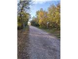 2
2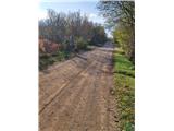 3
3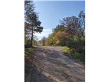 4
4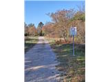 5
5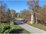 6
6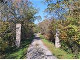 7
7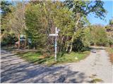 8
8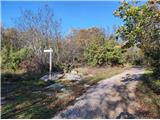 9
9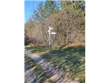 10
10 11
11 12
12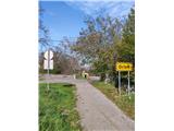 13
13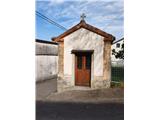 14
14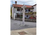 15
15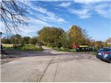 16
16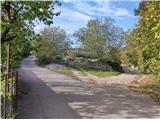 17
17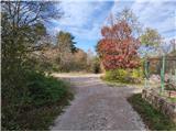 18
18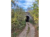 19
19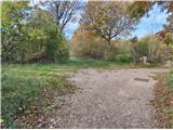 20
20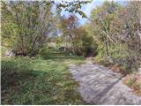 21
21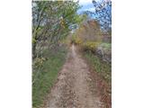 22
22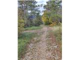 23
23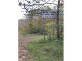 24
24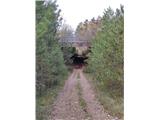 25
25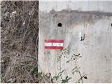 26
26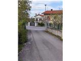 27
27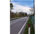 28
28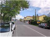 29
29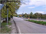 30
30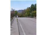 31
31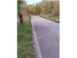 32
32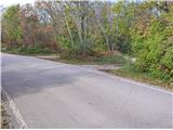 33
33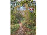 34
34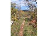 35
35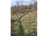 36
36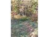 37
37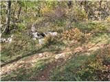 38
38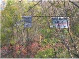 39
39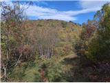 40
40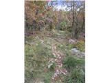 41
41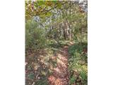 42
42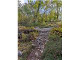 43
43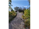 44
44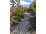 45
45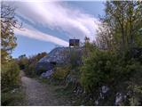 46
46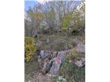 47
47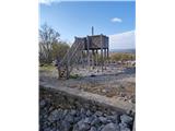 48
48
Discussion about the trail Sežana - Veliki Medvejk / Monte Orsario (via the Karst living museum, Orlek and Fernetiči)