Starting point: Selo (710 m)
| Lat/Lon: | 46,1017°N 14,296°E |
| |
Time of walking: 1 h 10 min
Difficulty: easy marked way
Altitude difference: 204 m
Altitude difference po putu: 270 m
Map: Ljubljana - okolica 1:50.000
Recommended equipment (summer):
Recommended equipment (winter):
Views: 8.406
 | 2 people like this post |
Access to the starting point:
From Horjul or Dobrova, drive to Polhov Gradec, then continue to Črnji vrh. A little above Polhovi Gradec, at the junction at the confluence of the Mala and Velika Bozna, continue straight on towards Sela and Škofja Loka (on the left, Črni Vrh). Continue along the Mala Božna stream, then after a while continue to the right towards the village of Selo (the second turn-off to the right of the town, after leaving the road leading to Črni Vrh). Continue along a fairly steep road, which climbs higher, and then after a short descent leads to Selo. Here, continue to the right (straight on to Sv. Ožbolt) and follow the road for just over 100 m to the parking area next to the chapel.
The starting point can also be reached from Škofja Loka. In this case, take the Puštal at Škofja Loka and then continue towards Sel.
Path description:
From the parking lot at the chapel, take the ascending road in the direction of Sela and Črnega Vrho (if you came to the starting point from Polhov Gradec, this is the road you took to get to the starting point). After a short climb, the road leads us to the first houses, then the road is laid and after a few minutes of further walking it leads us to the open-dor farm Ogrinc, in front of which we see a registration box. We continue a few steps further and the road leads us to a small crossroads where we continue to the left (right Sveti Ožbolt), and we follow the said road only a few steps, as the signs for Črni Vrh direct us to the right to the ascending cart track.
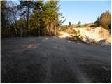
The ascent continues along the well-marked cart track, which initially leads us over a grassy slope with a view, and then continues partly through the wods and partly across grassy hay meadows. After a while the path descends slightly and leads us to a marked crossroads where the path from Sveti Ožbolt joins us from the right. Continue left in the direction of Černý Vrch and follow cart track, which gradually starts to descend more steeply. Lower down, the path splits into two parts and we continue along the road, soon turning right onto cart track or a worse road. cart track is then soon laid and after a few minutes' further walking leads us to a marked crossroads where we continue in the direction of Črnega Vrha via the top of Mlaka (left Črni Vrh past Ostreža). The way forward leads us after a few minutes back to cart track, which we then follow to the top of Mlaka. The summit is reached at the point where cart track starts to descend (the summit is not marked).
The whole route has a few switchbacks, but is well marked everywhere.

Pictures:
 1
1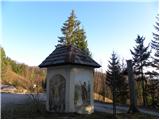 2
2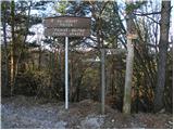 3
3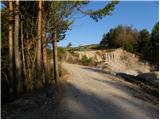 4
4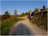 5
5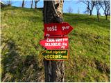 6
6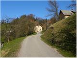 7
7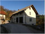 8
8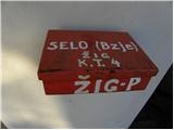 9
9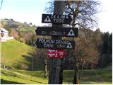 10
10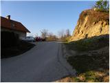 11
11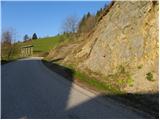 12
12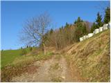 13
13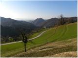 14
14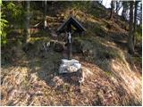 15
15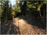 16
16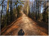 17
17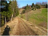 18
18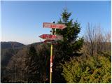 19
19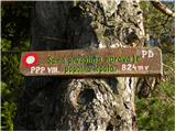 20
20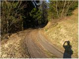 21
21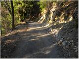 22
22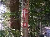 23
23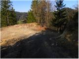 24
24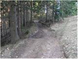 25
25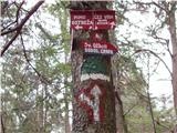 26
26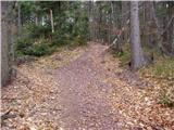 27
27 28
28
Discussion about the trail Selo - Mlaka