Sella Nevea - Monte Robon (via 637)
Starting point: Sella Nevea (1190 m)
| Lat/Lon: | 46,3907°N 13,4839°E |
| |
Name of path: via 637
Time of walking: 2 h 40 min
Difficulty: partly demanding unmarked way
Altitude difference: 790 m
Altitude difference po putu: 850 m
Map: Julijske Alpe - zahodni del 1:50.000
Recommended equipment (summer):
Recommended equipment (winter): ice axe, crampons
Views: 10.143
 | 1 person likes this post |
Access to the starting point:
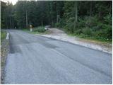
From Kranjska Gora, drive through the Rateče border crossing to Trbiž / Tarvisio. In Trbiz, turn left towards Bovec and follow the road to the crossroads near Lake Rabelj. Here, turn right towards the Nevea Pass / Sella Nevea. Continue along the ascending road, which makes a few serpentines higher up, and then, just 10 m before the road starts to descend, you will notice a minor forest road on your left, which branches off the main road sharply to the left (there is a road sign at the junction and a rock with markings next to it - the start of our route). As there are no suitable parking places at the junction, drive on for another 100 m and then park in a suitable space along the road.
From Bovec, drive to the Predel border crossing, from which you descend to the Italian side. Just after Lake Rabelj, you will reach a crossroads where you turn left towards the Neveje Pass / Sella Nevea. Continue as described above.
Path description:
From the starting point, go back a little and then follow footpath 637, which initially follows a less well-trodden forest road. After a few minutes of easy walking, signs direct you to the right onto the footpath, which begins to climb steeply with the help of a number of small steps. A little higher up, we get a nice view of the surrounding peaks, and the path then lays down and returns to the forest. The path continues on a moderate ascent (with a slight descent a few times in between), crosses the slopes to the left, and then climbs a little steeper for a short time, leading us out of the steep slopes and into the flatter world of the passage. The increasingly scenic route, which follows an old military causeway, then leads through a series of short valleys, crossings and a few short descents. Over time, this path leads to the foot of the steep, smooth and in some places even overhanging western face of Velika Bavha. Just at the foot of the wall, the marked trail turns right and then climbs across a short scree slope. Just a little further on the path turns slightly more to the right, where after a short crossing it leads us to the edge of a torrential ravine. Turn sharp left here and climb along the edge of the torrent to its mouth. Here, through a kind of natural gate, we enter the beautiful high mountain cirque, where the path completely lays down and we, if we keep quiet, can also spot a number of marmots.
Through the above-mentioned cirque, walk slightly to the left and then join the path from the Rifugio Gilberti mountain hut. Follow the path to the left, and it will take you up a few serpentines to the Vrh Laških brežičev lookout saddle (after Sella Robon in Italian), where there is an information board and a table with two benches next to it.
At the saddle, continue left (straight ahead Jerebica for 6 hours) and continue the ascent along a well-traced but unmarked path. The trail then crosses over a rather steep slope, then flattens out and leads to a number of military fortifications. These fortifications are bypassed on the left by a wide artificial ledge, and then there is only a short climb to reach the Modonutti-Savoia cave bivouac.
From the bivouac, continue to the left, following the initially well-traced path, which soon crosses a short exposed ledge, then turns to the right and climbs very steeply through a small notch, where we are helped by stone steps. Higher up, the path lays down and starts to disappear among numerous scrambles and potholes, but as the way ahead is indicated by numerous cairns, orientation is not difficult, at least in fine weather. Higher up, the path begins to turn slightly to the right and leads us on past numerous potholes. Just below the summit we come to a mighty chasm, along the edge of which a short section of the path leads down. Here, instead of crossing the exposed passage through the cracked wood, it is much safer to climb over the solid rock on the right, or to crawl through it at the bottom. Once on the other side of the passage, the path lays down and quickly leads past another exposed but wide ledge to the summit.

Pictures:
 1
1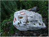 2
2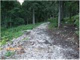 3
3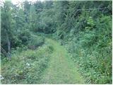 4
4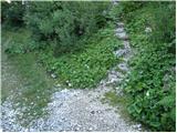 5
5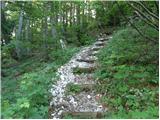 6
6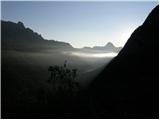 7
7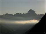 8
8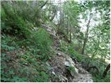 9
9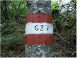 10
10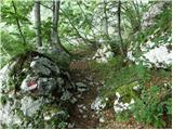 11
11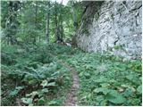 12
12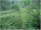 13
13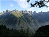 14
14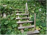 15
15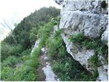 16
16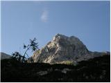 17
17 18
18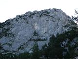 19
19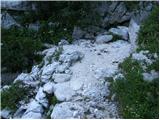 20
20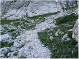 21
21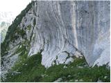 22
22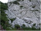 23
23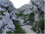 24
24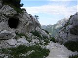 25
25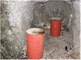 26
26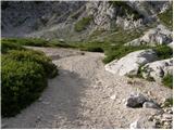 27
27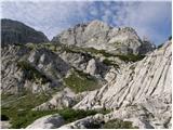 28
28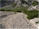 29
29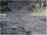 30
30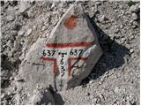 31
31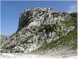 32
32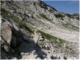 33
33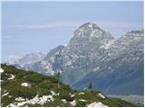 34
34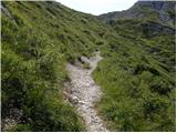 35
35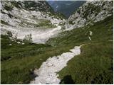 36
36 37
37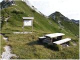 38
38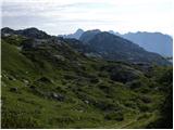 39
39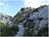 40
40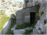 41
41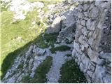 42
42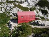 43
43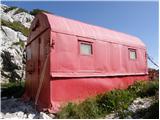 44
44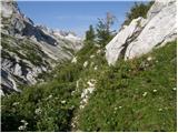 45
45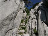 46
46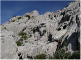 47
47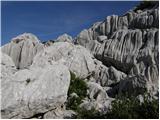 48
48 49
49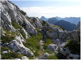 50
50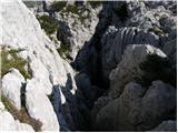 51
51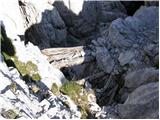 52
52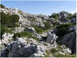 53
53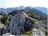 54
54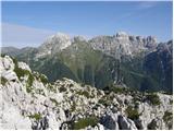 55
55
Discussion about the trail Sella Nevea - Monte Robon (via 637)
|
| damijanp21. 08. 2014 |
V soboto smo opravili krožno pot - gor po poti 637, nazaj po 636. Obe poti sta zanimivi, je pa na prvem delu poti 637 kar precej podrtega drevja, ki pa prevelikih težav ne povzroča. Sicer pa zelo priporočljiv izlet na, kot kaže, ne preveč obiskan vrh. Slike: Velika Bavha
|
|
|
|
| haridautovic6. 07. 2020 |
Danes 5.7.2020 izbereva raziskovalno turo (tura je sicer pisana na kožo ljubiteljem zgodovine in početjem med obema vojnama).Izbrala sva Veliko bavho- Vrh stoji v zaledju Rombona-Velike in male črnelske špice ter hudega vršiča,tukaj je vojna pustila neizbrisiv pečat in veliki madež na celem območju.Sam vrh je sanjski razglednik na katerega vodijo dve poti,najlepše je to da turo lahko opravimo krožno kar je poseben čar.Za vzpon izbereva gorsko cesto cca 500m,pred sella neveom pot 637.,Pot sprva poteka po cesti na kar kmalu zapustiva cesto in se po gozdni poti vzpenjamo pod vznožjem Lopiča.Ko prestopimo naravna vrata vstopimo v čudovito krnico pod Črnelsko špico,kmalu prispeva na sella robon-Vrh laških brežičev,na kar sledi samo vzpon na vrh ob vojaških utrdbah.Sestopila sva po neverjetno lepi mulatjeri proti Prevali in koči Gillberti,vendar omenjeno mulatjero zapustiva pri Monte poviz/Pobič in se spustiva v Sella neveo,300 metrov od izhodišča,,ker se po cesti samo še sprehodiva do avta polna navdušenja,,,,,
|
|
|