Sedlo nad Lohačo - Špilnik (lower path)
Starting point: Sedlo nad Lohačo (829 m)
| Lat/Lon: | 45,83758°N 14,20469°E |
| |
Name of path: lower path
Time of walking: 30 min
Difficulty: easy marked way
Altitude difference: 189 m
Altitude difference po putu: 189 m
Map: Snežnik 1:50 000 PZS
Recommended equipment (summer):
Recommended equipment (winter):
Views: 826
 | 1 person likes this post |
Access to the starting point:
We can drive to the starting point:
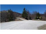
a) From central Slovenia, take the motorway to exit Unec, then turn right towards Mountain pasture. When you arrive in the village, turn left towards Postojna, then pay attention at the end of the village, where direction signs direct you to the right towards Strmca and Predjama. Follow this road straight ahead at the next crossroads and you will soon reach Lohača, where you turn right uphill. The asphalt road turns to macadam and we continue to the saddle where there are mountain signs and a cross. There we park nearby.
b) From Primož, drive to Postojna, where you continue towards Predjama. Pass the village Zagon, then turn right towards Studenec and Strmca. Follow this road to Lohača, where you turn left uphill. The asphalt road turns to macadam and we continue to the saddle where there are mountain signs and a cross. Park nearby.
Path description:
At the starting point turn left in the direction of Sv. Lovrenec. After about a minute's walk, where there is a turn-off for the upper path past Lipovec, we continue slightly left along cart track. Follow this in an easy ascent through the woods, going right uphill (where the path from the Church of Our Lady of the Snows - Strmca - joins). Soon you reach the saddle between Lipovec and Špilnik, where the upper path comes in from the right. Go left and continue straight up for a little while, and then a sign and cairns invite you to the right to the top of Špilnik. Follow the path past the rope fence. With the effects of the ice storm visible, after a few minutes we climb to the summit, then the path heads north and soon reaches the main summit.
Pictures:
 1
1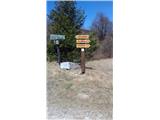 2
2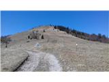 3
3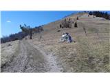 4
4 5
5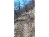 6
6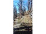 7
7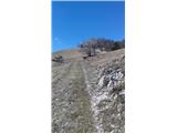 8
8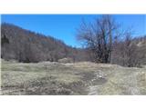 9
9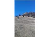 10
10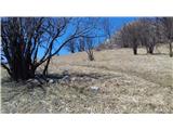 11
11 12
12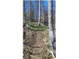 13
13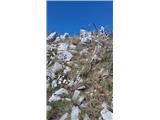 14
14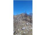 15
15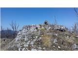 16
16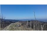 17
17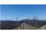 18
18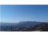 19
19
Discussion about the trail Sedlo nad Lohačo - Špilnik (lower path)