Schiestelscharte - Steinnock (via Klomnock)
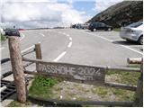
Starting point: Schiestelscharte (2024 m)
| Lat/Lon: | 46,89°N 13,7941°E |
| |
Name of path: via Klomnock
Time of walking: 1 h 30 min
Difficulty: partly demanding marked way, easy pathless terrain
Altitude difference: 173 m
Altitude difference po putu: 350 m
Map:
Recommended equipment (summer):
Recommended equipment (winter): ice axe, crampons
Views: 822
 | 1 person likes this post |
Access to the starting point:
a) Drive through the Karavanke Tunnel into Austria, then continue along the Tur Autobahn, leaving at the Beljaška bypass and continuing on to Feldkirchen. Continue along Lake Ossiach / Ossiacher See to the aforementioned town. In Feldkirchen, turn left towards the Turacher Höhe pass and continue past Himmelberg, Gnesau, Mitterdorf to Wiedweg, where the road from Bad Kleinkircheim joins from the left. From this junction we continue towards the Turacher Höhe pass, following the road for a few kilometres before the signs for the Schiestelscharte or Passhöhe alpine pass direct us left onto the toll road, which we follow to the parking lot at the aforementioned pass.
b) From Styria or Carinthia, first drive to Dravograd and then via Border crossing Vič to Austria, where you follow the signs for Klagenfurt / Klagenfurt. Continue on the so-called Southern Motorway, leaving at Klagenfurt (direction Feldkirchen). Continue along the regional road to reach the aforementioned town. In Feldkirchen, turn right towards the Turacher Höhe pass and continue past Himmelberg, Gnesau and Mitterdorf to Wiedweg, where the road from Bad Kleinkircheim joins from the left. From this junction we continue towards the Turacher Höhe pass, following the road for a few kilometres before the signs for the Schiestelscharte or Passhöhe alpine pass direct us left onto the toll road, which we follow to the parking lot at the aforementioned pass.
Path description:
From the parking lot, follow the footpath towards the Klomnock and Mallnock peaks and the Falkertsee lake. The trail crosses a pasture fence at the very beginning, after which it starts to climb crosswise on the left side of the mountain. The relatively steep path then leads over relatively steep slopes, over which the fixed safety gear are helpful but not strictly necessary. After the first steep part, the path changes to moderately steep grassy slopes, over which it then climbs in a moderate transverse ascent. A little further on, the path becomes steeper again and, with the help of a cable car, leads to a crossroads just below the summit.
Here continue left (right Klomnock 1 minute) in the direction of the Falkert summit and the Falkertsee lake. The path descends along a grassy ridge, then lays down and leads to a place where the path with Mallnock (the path that bypasses Klomnock on the south side) joins us from the right. Just a little further on, we cross a grazing fence and we are already at the next mountain markers.
Continue in the familiar direction towards the top of Falkert, following the path which crosses over to the slopes of Steinnock, from where you have a fine view of the nearby Falkert from the path, with the Julian and Carnic Alps also visible in the distance.
Here, on the slopes of the Steinnock peak, leave the marked path at a suitable point and continue left along the grassy slope. Continue along the easier trackless path, or if you have left the marked path at the most suitable point, along the worse path, from where there is a short climb to the viewpoint.

Pictures:
 1
1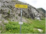 2
2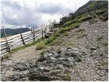 3
3 4
4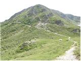 5
5 6
6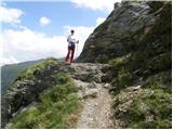 7
7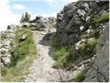 8
8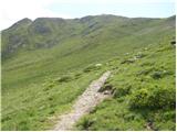 9
9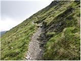 10
10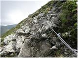 11
11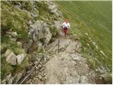 12
12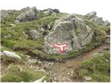 13
13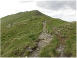 14
14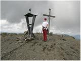 15
15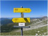 16
16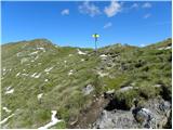 17
17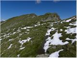 18
18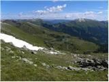 19
19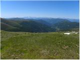 20
20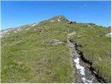 21
21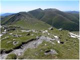 22
22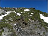 23
23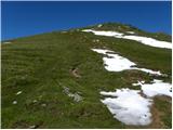 24
24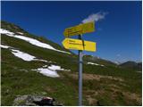 25
25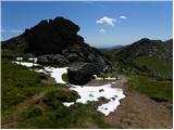 26
26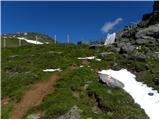 27
27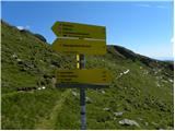 28
28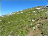 29
29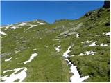 30
30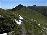 31
31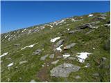 32
32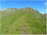 33
33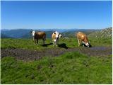 34
34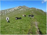 35
35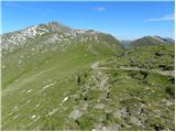 36
36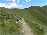 37
37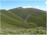 38
38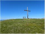 39
39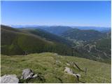 40
40 41
41 42
42
Discussion about the trail Schiestelscharte - Steinnock (via Klomnock)