Starting point: Rudno polje (1347 m)
| Lat/Lon: | 46,3458°N 13,9236°E |
| |
Time of walking: 3 h 50 min
Difficulty: easy unmarked way
Altitude difference: 928 m
Altitude difference po putu: 1020 m
Map: Triglav 1:25.000
Recommended equipment (summer):
Recommended equipment (winter): ice axe, crampons
Views: 21.720
 | 1 person likes this post |
Access to the starting point:
a) Take the Bled, then continue driving towards Pokljuka. After Pokljuka, follow the main road to the large parking lot next to the military barracks at Rudne Polje. There is a charge for parking.
b) Take the Bohinjska Bistrica, then continue to Bled, but only as far as the road to Pokljuka. Continue in the direction of Pokljuka, turn right at Jereka towards Pokljuka and follow the signs for Pokljuka at the following junctions. When you reach Mrzlje studenec, turn left and drive to the large pay parking lot next to the military barracks at Rudne Polje.
Path description:
At the end of the parking lot, a dirt road branches off to the right, with signs for Triglav and Viševnik. Take this road, which climbs gently and after 10 minutes leads to the ski slope Viševnik.
Continue along the road (Viševnik and Blejska koča na Lipanci on the right), which soon turns off to the left onto a marked path towards Triglav. Continue along the above-mentioned path, which in a few minutes of moderate ascent leads to a forest road, which you follow to the left and walk along for only a few metres. The marked path then veers right and climbs steeply for a short time. After ten minutes the steepness subsides and the path slowly switches to steep slopes. After the steep slopes, the path descends gently for the most part and turns increasingly to the right. A little further on, we will see the mountain pasture Horsebox on the left below us, our path then stops descending and passes out of the forest between the dwarf pines. The path that climbs again then leads us under steep rocky cliffs and soon afterwards leads us to a crossroads where we join the path with mountain pasture Konjščica. There is a short climb and the path leads us to a beautiful valley called Jezerce.
Here the path turns left and after a few steps leads us into the narrower area of the TNP. Next, we climb along the small spring towards Studorski Preval. A little higher, cross the torrent and the path heads slightly to the right onto the grassy slopes surrounded by dwarf pines. The path then ascends crosswise to Studorski preval, from which a fine view of the Bohinj side opens up.
From the pass continue straight ahead (left Ablanca, right Veliki Draški vrh and sharp right Srenjski preval) along the path which starts to descend and after a few steps turns to the right. There is a short descent, and then the path continues to cross, first the slopes below Veliki Draški vrh and later Tosc. When you reach the unpaved southern slopes of Tosc, you will come to a small crossroads where an unmarked trail branches off to the right to Tosc (the branch is marked).
Continue on the unmarked but well-traced path, which begins to climb steeply over the grassy slopes of Tosc. The increasingly steep path slowly turns slightly to the right, then turns sharply to the left and almost completely flattens out. A short steep slope is crossed, and then the path leads to less steep slopes, where it gradually begins to disappear. The less visible path then turns slightly to the right and starts to climb slightly steeper. After a few minutes of ascent, we reach the unmarked Little Tosc, which opens up a view of Tosc. A short descent follows and the path leads us past a large sinkhole, which we bypass on the right-hand side, to the summit base of Tosc. The way forward climbs moderately over a pleasant grassy slope and after a few minutes of further walking leads us to the top of Tosc.
Orientation is difficult in fog.
Starting point - Studorski preval 2:20, Studorski preval - Tosc 1:45.

Pictures:
 1
1 2
2 3
3 4
4 5
5 6
6 7
7 8
8 9
9 10
10 11
11 12
12 13
13 14
14 15
15 16
16 17
17 18
18 19
19 20
20 21
21 22
22 23
23 24
24 25
25 26
26 27
27 28
28 29
29 30
30 31
31 32
32 33
33 34
34 35
35 36
36 37
37 38
38 39
39 40
40 41
41 42
42 43
43 44
44 45
45 46
46 47
47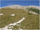 48
48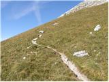 49
49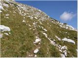 50
50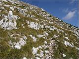 51
51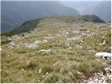 52
52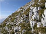 53
53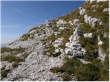 54
54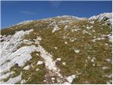 55
55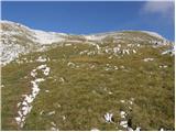 56
56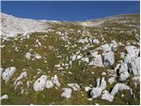 57
57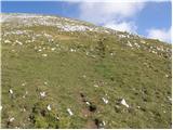 58
58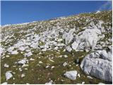 59
59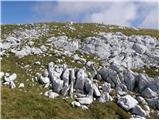 60
60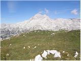 61
61 62
62 63
63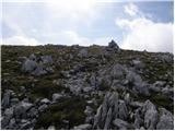 64
64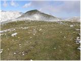 65
65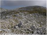 66
66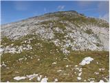 67
67 68
68 69
69 70
70 71
71
Discussion about the trail Rudno polje - Tosc
|
| J.P.14. 03. 2022 16:39:28 |
Snezna podlaga je bila cez vikend odlicna tako kot vreme. Pot brez posebnosti, previdno in z glavo.Eden izmed lepsih vrhov po leti in po zimi le po leti se odpravite iz konca ceste na Pokljuki.Varen korak.Lp
|
|
|
|
| nekdo_nekje10. 10. 2025 18:49:20 |
Ima kdo kaj informacij o tem kakšna je trenutno pot?
|
|
|